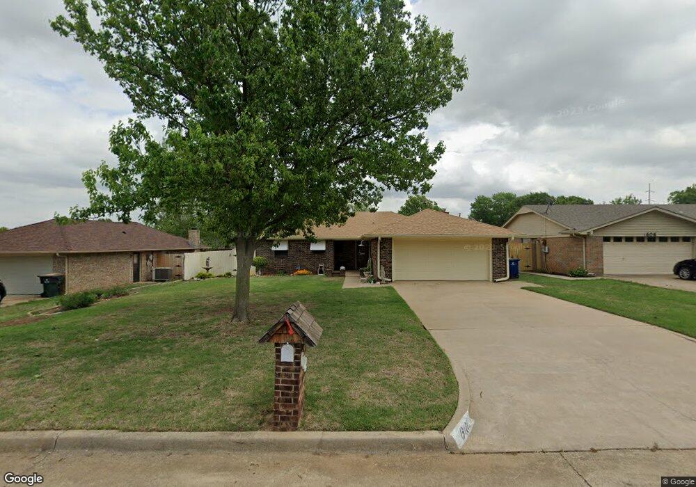
602 Westridge Dr Duncan, OK 73533
Estimated Value: $159,000 - $168,704
3
Beds
2
Baths
1,471
Sq Ft
$112/Sq Ft
Est. Value
About This Home
This home is located at 602 Westridge Dr, Duncan, OK 73533 and is currently estimated at $164,176, approximately $111 per square foot. 602 Westridge Dr is a home located in Stephens County with nearby schools including Mark Twain Elementary School, Duncan Middle School, and Duncan High School.
Ownership History
Date
Name
Owned For
Owner Type
Purchase Details
Closed on
May 24, 2024
Sold by
Neal Clarence L and Revocab Dovie
Bought by
Carreras Catrice and Thibault Linda
Current Estimated Value
Home Financials for this Owner
Home Financials are based on the most recent Mortgage that was taken out on this home.
Original Mortgage
$81,500
Outstanding Balance
$80,357
Interest Rate
6.88%
Mortgage Type
New Conventional
Estimated Equity
$83,819
Purchase Details
Closed on
Aug 1, 2011
Sold by
Watson Ronald L
Bought by
Neal Clarence L
Create a Home Valuation Report for This Property
The Home Valuation Report is an in-depth analysis detailing your home's value as well as a comparison with similar homes in the area
Home Values in the Area
Average Home Value in this Area
Purchase History
| Date | Buyer | Sale Price | Title Company |
|---|---|---|---|
| Carreras Catrice | $155,000 | Stephens County Abstract | |
| Neal Clarence L | $96,500 | None Available |
Source: Public Records
Mortgage History
| Date | Status | Borrower | Loan Amount |
|---|---|---|---|
| Open | Carreras Catrice | $81,500 |
Source: Public Records
Tax History Compared to Growth
Tax History
| Year | Tax Paid | Tax Assessment Tax Assessment Total Assessment is a certain percentage of the fair market value that is determined by local assessors to be the total taxable value of land and additions on the property. | Land | Improvement |
|---|---|---|---|---|
| 2025 | $1,443 | $17,106 | $859 | $16,247 |
| 2024 | $814 | $10,556 | $600 | $9,956 |
| 2023 | $814 | $10,556 | $663 | $9,893 |
| 2022 | $812 | $10,556 | $651 | $9,905 |
| 2021 | $813 | $10,557 | $791 | $9,766 |
| 2020 | $825 | $10,556 | $742 | $9,814 |
| 2019 | $827 | $10,556 | $770 | $9,786 |
| 2018 | $851 | $10,556 | $784 | $9,772 |
| 2017 | $821 | $10,556 | $762 | $9,794 |
| 2016 | $812 | $10,556 | $815 | $9,741 |
| 2015 | $935 | $10,556 | $815 | $9,741 |
| 2014 | $935 | $10,556 | $770 | $9,786 |
Source: Public Records
Map
Nearby Homes
- TBD S 27th St
- 106 Emery Rd
- 2110 W Main St
- 206 N 28th St
- 210 N 31st St
- 201 N 23rd St
- 0 W Beech Ave
- 2006 W Oak Ave
- 209 N 22nd St
- 2011 W Oak Ave
- 174831 N 2844 Rd
- 1223 S 42nd St
- 507 S 13th St
- 1309 W Pecan Ave
- 451 S 11th St
- 711 711 S 12th
- 1244 Carriage Dr
- 123 N Highway 81
- 1109 W Stephens Ave
- 507 N Alice Dr
- 602 W Ridge Dr
- 606 W Ridge Dr
- 510 Westridge Dr
- 601 Fieldcrest Dr
- 610 Westridge Dr
- 506 Westridge Dr
- 605 Fieldcrest Dr
- 605 605 Fieldcrest Dr
- 509 Fieldcrest Dr
- 509 Westridge Dr
- 601 Westridge Dr
- 609 Fieldcrest Dr
- 505 Fieldcrest Dr
- 605 Westridge Dr
- 509 Westridge Dr
- 702 Westridge Dr
- 505 Westridge Dr
- 609 Westridge Dr
- 701 Fieldcrest Dr
- 706 Westridge Dr