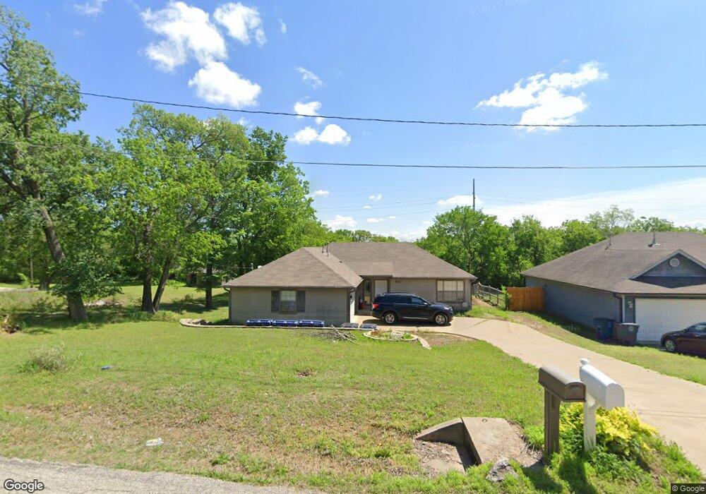
6021 S 30th West Ave Tulsa, OK 74107
Red Fork NeighborhoodEstimated Value: $206,000 - $212,000
--
Bed
2
Baths
1,267
Sq Ft
$164/Sq Ft
Est. Value
About This Home
This home is located at 6021 S 30th West Ave, Tulsa, OK 74107 and is currently estimated at $208,125, approximately $164 per square foot. 6021 S 30th West Ave is a home located in Tulsa County with nearby schools including Clinton West Elementary School, Daniel Webster High School, and Riverfield Country Day School.
Ownership History
Date
Name
Owned For
Owner Type
Purchase Details
Closed on
Nov 13, 2009
Sold by
Darland Amanda J
Bought by
Darland Tommy J
Current Estimated Value
Purchase Details
Closed on
Oct 12, 2006
Sold by
Mcdonald Marvin G and Mcdonald Vicki E
Bought by
Darland Tommy R and Darland Amanda J
Home Financials for this Owner
Home Financials are based on the most recent Mortgage that was taken out on this home.
Original Mortgage
$91,280
Outstanding Balance
$54,127
Interest Rate
6.44%
Mortgage Type
Purchase Money Mortgage
Estimated Equity
$153,998
Purchase Details
Closed on
Jul 1, 2002
Sold by
Mcdonald Marvin G and Mcdonald Vicki E
Bought by
Mcdonald Marvin G and Mcdonald Vicki E
Create a Home Valuation Report for This Property
The Home Valuation Report is an in-depth analysis detailing your home's value as well as a comparison with similar homes in the area
Home Values in the Area
Average Home Value in this Area
Purchase History
| Date | Buyer | Sale Price | Title Company |
|---|---|---|---|
| Darland Tommy J | -- | None Available | |
| Darland Tommy R | $114,500 | None Available | |
| Mcdonald Marvin G | -- | -- |
Source: Public Records
Mortgage History
| Date | Status | Borrower | Loan Amount |
|---|---|---|---|
| Open | Darland Tommy R | $91,280 |
Source: Public Records
Tax History Compared to Growth
Tax History
| Year | Tax Paid | Tax Assessment Tax Assessment Total Assessment is a certain percentage of the fair market value that is determined by local assessors to be the total taxable value of land and additions on the property. | Land | Improvement |
|---|---|---|---|---|
| 2024 | $2,213 | $17,435 | $1,485 | $15,950 |
| 2023 | $2,213 | $17,435 | $1,485 | $15,950 |
| 2022 | $2,324 | $17,435 | $1,485 | $15,950 |
| 2021 | $1,531 | $11,595 | $1,367 | $10,228 |
| 2020 | $1,510 | $11,595 | $1,367 | $10,228 |
| 2019 | $1,589 | $11,595 | $1,367 | $10,228 |
| 2018 | $1,592 | $11,595 | $1,367 | $10,228 |
| 2017 | $1,589 | $12,595 | $1,485 | $11,110 |
| 2016 | $1,557 | $12,595 | $1,485 | $11,110 |
| 2015 | $1,560 | $12,595 | $1,485 | $11,110 |
| 2014 | $1,545 | $12,595 | $1,474 | $11,121 |
Source: Public Records
Map
Nearby Homes
- 5701 S 33rd West Ave
- 2917 W 65th St
- 5353 S 33rd West Ave
- 5921 S 39th West Ave
- 1902 W 62nd St
- 5631 S Vancouver Place
- 6813 S 32nd West Ave
- 4115 W 57th St S
- 6655 Riva Ridge Rd
- 6843 S 30th West Ave
- 4010 W 54th St
- 6234 S 42nd West Ave
- 3026 W 68th Place S
- 3308 W 68th St S
- 5035 S 31st West Ave
- 3121 W 69th Place S
- 5023 S 27th West Ave
- 5017 S 32nd West Ave
- 6947 S 30th West Ave
- 5032 S 36th West Ave
- 6033 S 30th West Ave
- 5921 S 30th West Ave
- 6039 S 30th West Ave
- 5915 S 30th West Ave
- 6049 S 30th West Ave
- 6046 S 30th West Ave
- 6055 S 30th West Ave
- 5911 S 30th West Ave
- 5914 S 30th West Ave
- 6048 S 30th West Ave
- 6059 S 30th Ave W
- 6059 S 30th West Ave
- 6060 S 30th West Ave
- 5842 S 30th West Ave
- 5909 S 31st West Ave
- 5881 S 31st West Ave
- 6052 S 30th West Ave
- 5903 S 31st West Ave
- 5817 S 30th West Ave
- 6033 S 31st West Ave