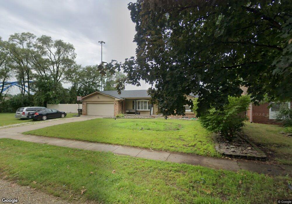
6022 Westpoint St Taylor, MI 48180
Estimated Value: $211,000 - $232,000
3
Beds
3
Baths
1,504
Sq Ft
$145/Sq Ft
Est. Value
About This Home
This home is located at 6022 Westpoint St, Taylor, MI 48180 and is currently estimated at $218,605, approximately $145 per square foot. 6022 Westpoint St is a home located in Wayne County with nearby schools including Taylor Parks Elementary School, Hoover Middle School, and Quest Charter Academy.
Ownership History
Date
Name
Owned For
Owner Type
Purchase Details
Closed on
Mar 24, 2011
Sold by
Fannie Mae
Bought by
Taylor Hutchcraft Hope
Current Estimated Value
Home Financials for this Owner
Home Financials are based on the most recent Mortgage that was taken out on this home.
Original Mortgage
$42,884
Outstanding Balance
$29,742
Interest Rate
4.99%
Mortgage Type
FHA
Estimated Equity
$188,863
Purchase Details
Closed on
May 27, 2010
Sold by
Rbs Citizens Na
Bought by
Federal National Mortgage Association
Purchase Details
Closed on
May 20, 2010
Sold by
Shehan Roger R and Shehan Susan A
Bought by
Rbs Citizens Na
Create a Home Valuation Report for This Property
The Home Valuation Report is an in-depth analysis detailing your home's value as well as a comparison with similar homes in the area
Home Values in the Area
Average Home Value in this Area
Purchase History
| Date | Buyer | Sale Price | Title Company |
|---|---|---|---|
| Taylor Hutchcraft Hope | $44,000 | Attorneys Title Agency Llc | |
| Federal National Mortgage Association | -- | None Available | |
| Rbs Citizens Na | $48,100 | None Available |
Source: Public Records
Mortgage History
| Date | Status | Borrower | Loan Amount |
|---|---|---|---|
| Open | Taylor Hutchcraft Hope | $42,884 |
Source: Public Records
Tax History Compared to Growth
Tax History
| Year | Tax Paid | Tax Assessment Tax Assessment Total Assessment is a certain percentage of the fair market value that is determined by local assessors to be the total taxable value of land and additions on the property. | Land | Improvement |
|---|---|---|---|---|
| 2025 | $2,289 | $86,700 | $0 | $0 |
| 2024 | $2,289 | $86,400 | $0 | $0 |
| 2023 | $2,751 | $81,000 | $0 | $0 |
| 2022 | $2,184 | $66,900 | $0 | $0 |
| 2021 | $2,415 | $61,200 | $0 | $0 |
| 2020 | $2,390 | $55,800 | $0 | $0 |
| 2019 | $238,779 | $54,700 | $0 | $0 |
| 2018 | $1,875 | $44,000 | $0 | $0 |
| 2017 | $1,039 | $43,000 | $0 | $0 |
| 2016 | $2,330 | $41,800 | $0 | $0 |
| 2015 | $4,440 | $46,100 | $0 | $0 |
| 2013 | $4,420 | $45,000 | $0 | $0 |
| 2012 | $1,958 | $44,800 | $17,000 | $27,800 |
Source: Public Records
Map
Nearby Homes
- 5954 Pine St
- 5908 Pine St
- 5689 Cornell St
- 5671 Syracuse St
- 6430 Banner St
- 24035 Currier St
- 6516 Oak St
- 6420 Burr St
- 6456 Birch St
- 6676 Syracuse St
- 23214 S Brookside Dr
- 6733 Cornell St
- 24443 Powers Ave
- 4901 Cornell St
- 24117 Eton Ave
- 24360 Pennie St
- 24339 Eton Ave
- 6832 Cornell St
- 4665 Syracuse St
- 5963 Vivian St
- 6002 Westpoint St
- 6011 Westpoint St
- 6027 Westpoint St Unit Bldg-Unit
- 5942 Westpoint St
- 6003 Westpoint St
- 6035 Westpoint St
- 5951 Westpoint St
- 5935 Westpoint St
- 6018 Cornell St
- 6038 Cornell St
- 5922 Westpoint St
- 6004 Cornell St
- 5906 Westpoint St
- 5911 Westpoint St
- 5926 Cornell St
- 6021 Cooper St
- 6013 Cooper St
- 5906 Cornell St
- 23804 Dolan St
- 6037 Cooper St