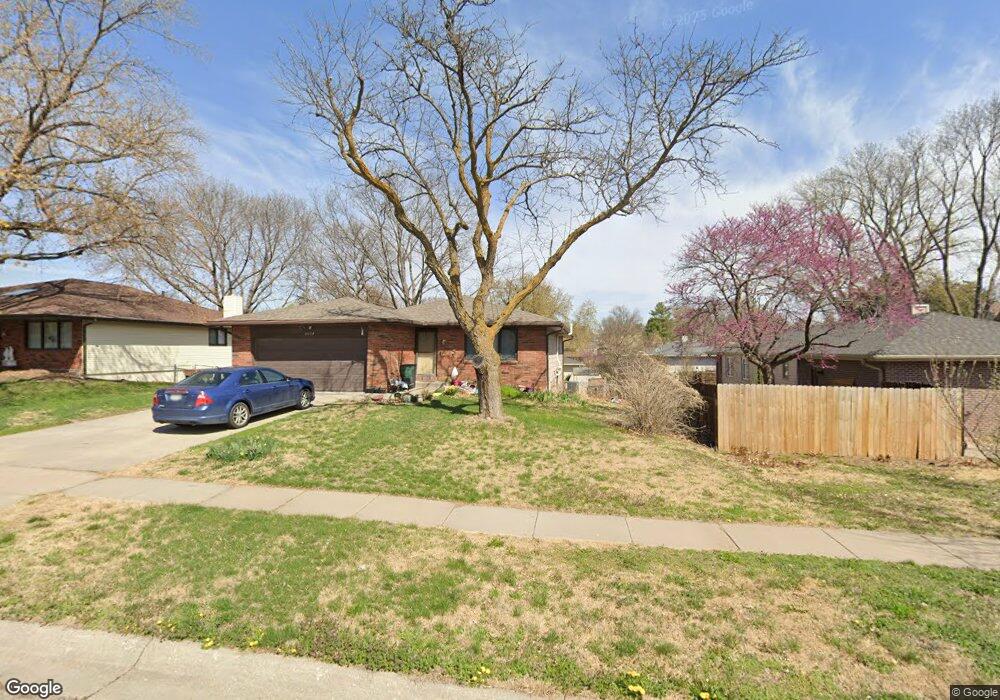
6024 Robin Rd Lincoln, NE 68516
Colonial Hills NeighborhoodEstimated Value: $322,707 - $359,000
4
Beds
3
Baths
2,336
Sq Ft
$144/Sq Ft
Est. Value
About This Home
This home is located at 6024 Robin Rd, Lincoln, NE 68516 and is currently estimated at $336,427, approximately $144 per square foot. 6024 Robin Rd is a home located in Lancaster County with nearby schools including Zeman Elementary School, Lux Middle School, and Lincoln East High School.
Ownership History
Date
Name
Owned For
Owner Type
Purchase Details
Closed on
Aug 26, 2010
Sold by
Barrett Christopher M and Barrett Daisyann M
Bought by
Barrett Christopher M and Barrett Daisyann M
Current Estimated Value
Purchase Details
Closed on
Nov 6, 2008
Sold by
Sutter Harold L and Sutter Gay L
Bought by
Barrett Christopher M and Barrett Daisy Ann M
Home Financials for this Owner
Home Financials are based on the most recent Mortgage that was taken out on this home.
Original Mortgage
$125,000
Outstanding Balance
$82,118
Interest Rate
6.18%
Mortgage Type
VA
Estimated Equity
$254,309
Create a Home Valuation Report for This Property
The Home Valuation Report is an in-depth analysis detailing your home's value as well as a comparison with similar homes in the area
Home Values in the Area
Average Home Value in this Area
Purchase History
| Date | Buyer | Sale Price | Title Company |
|---|---|---|---|
| Barrett Christopher M | -- | None Available | |
| Barrett Christopher M | $175,000 | Ct |
Source: Public Records
Mortgage History
| Date | Status | Borrower | Loan Amount |
|---|---|---|---|
| Open | Barrett Christopher M | $125,000 |
Source: Public Records
Tax History Compared to Growth
Tax History
| Year | Tax Paid | Tax Assessment Tax Assessment Total Assessment is a certain percentage of the fair market value that is determined by local assessors to be the total taxable value of land and additions on the property. | Land | Improvement |
|---|---|---|---|---|
| 2025 | -- | $324,000 | $69,000 | $255,000 |
| 2024 | -- | $312,500 | $69,000 | $243,500 |
| 2023 | -- | $300,500 | $69,000 | $231,500 |
| 2022 | $4,745 | $238,100 | $55,000 | $183,100 |
| 2021 | $4,793 | $238,100 | $55,000 | $183,100 |
| 2020 | $4,025 | $210,400 | $55,000 | $155,400 |
| 2019 | $0 | $210,400 | $55,000 | $155,400 |
| 2018 | $0 | $191,500 | $55,000 | $136,500 |
| 2017 | $0 | $191,500 | $55,000 | $136,500 |
| 2016 | $0 | $183,900 | $45,000 | $138,900 |
| 2015 | -- | $183,900 | $45,000 | $138,900 |
| 2014 | -- | $162,000 | $52,000 | $110,000 |
| 2013 | -- | $162,000 | $52,000 | $110,000 |
Source: Public Records
Map
Nearby Homes
- 5920 Deerwood Dr
- 6001 Fleetwood Dr
- 5638 Dogwood Dr
- 6221 S Richland Cir
- 6121 Fleetwood Dr
- 4711 Lonewood Cir
- 5316 S 65th Street Cir
- 6255 Carveth Dr
- Stella Plan at Charleston Heights
- San Mateo Plan at Charleston Heights
- Kendrick Plan at Charleston Heights
- Katy Lissette Plan at Charleston Heights
- Joslyn Plan at Charleston Heights
- Grace Plan at Charleston Heights
- Ava Nicole 1625 Plan at Charleston Heights
- Ava Nicole 1546 Plan at Charleston Heights
- 5311 S 66th Street Cir
- 6527 Pheasant Run Place
- 5520 Vavak Place
- 4710 S 57th St
- 6016 Robin Rd
- 5217 S 61st St
- 6008 Robin Rd
- 6025 Deerwood Dr
- 6017 Deerwood Dr
- 5201 S 61st St
- 6009 Deerwood Dr
- 5301 S 61st St
- 6017 Robin Rd
- 6000 Robin Rd
- 5216 S 61st St
- 6009 Robin Rd
- 5208 S 61st St
- 6001 Deerwood Dr
- 5224 S 61st St
- S S 61st St
- 5930 Robin Ct Unit 2
- 6109 Deerwood Dr
- 6001 Robin Rd
- 5300 S 61st St