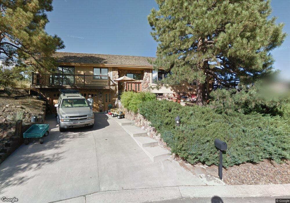
6025 Briarcliff Rd Colorado Springs, CO 80918
Pulpit Rock NeighborhoodEstimated Value: $596,393 - $679,000
3
Beds
4
Baths
2,144
Sq Ft
$293/Sq Ft
Est. Value
About This Home
This home is located at 6025 Briarcliff Rd, Colorado Springs, CO 80918 and is currently estimated at $628,098, approximately $292 per square foot. 6025 Briarcliff Rd is a home located in El Paso County with nearby schools including King Elementary School, Russell Middle School, and Coronado High School.
Ownership History
Date
Name
Owned For
Owner Type
Purchase Details
Closed on
Apr 25, 1995
Sold by
Theis George I and Theis Elaine M
Bought by
Becker Lawrence A and Becker Sherry L
Current Estimated Value
Home Financials for this Owner
Home Financials are based on the most recent Mortgage that was taken out on this home.
Original Mortgage
$168,000
Interest Rate
8.33%
Create a Home Valuation Report for This Property
The Home Valuation Report is an in-depth analysis detailing your home's value as well as a comparison with similar homes in the area
Home Values in the Area
Average Home Value in this Area
Purchase History
| Date | Buyer | Sale Price | Title Company |
|---|---|---|---|
| Becker Lawrence A | -- | -- |
Source: Public Records
Mortgage History
| Date | Status | Borrower | Loan Amount |
|---|---|---|---|
| Closed | Becker Lawrence A | $168,000 |
Source: Public Records
Tax History Compared to Growth
Tax History
| Year | Tax Paid | Tax Assessment Tax Assessment Total Assessment is a certain percentage of the fair market value that is determined by local assessors to be the total taxable value of land and additions on the property. | Land | Improvement |
|---|---|---|---|---|
| 2025 | $2,173 | $44,740 | -- | -- |
| 2024 | $1,684 | $43,570 | $8,760 | $34,810 |
| 2023 | $1,684 | $43,570 | $8,760 | $34,810 |
| 2022 | $1,458 | $33,010 | $6,440 | $26,570 |
| 2021 | $1,582 | $33,960 | $6,620 | $27,340 |
| 2020 | $1,477 | $28,910 | $5,110 | $23,800 |
| 2019 | $1,469 | $28,910 | $5,110 | $23,800 |
| 2018 | $1,481 | $27,390 | $4,680 | $22,710 |
| 2017 | $1,403 | $27,390 | $4,680 | $22,710 |
| 2016 | $1,611 | $27,790 | $4,920 | $22,870 |
| 2015 | $1,605 | $27,790 | $4,920 | $22,870 |
| 2014 | $1,624 | $26,980 | $4,920 | $22,060 |
Source: Public Records
Map
Nearby Homes
- 1725 Applewood Ridge Ct
- 6170 Castlewood Ln
- 6075 Castlewood Ln
- 5933 Rim Ridge Ct
- 1892 Brookdale Dr
- 5950 Ridge Brook Ln
- 5880 Cliffside Terrace
- 5811 Spurwood Ct
- 6107 Pine Hill Dr
- 6320 Lemonwood Dr
- 6119 Pine Hill Dr
- 1850 Brookdale Dr
- 6145 Pine Hill Dr
- 5514 Saxon Ln
- 6438 Village Ln Unit 6438
- 6180 Garlock Way
- 2061 - 2091 Furman Point
- 5925 - 5943 University Village View
- 1860 Erin Loop
- 1858 Erin Loop
- 6035 Briarcliff Rd
- 6126 Applewood Ridge Cir
- 6118 Applewood Ridge Cir
- 6085 Applewood Ridge Cir
- 6115 Applewood Ridge Cir
- 6020 Briarcliff Rd
- 6055 Briarcliff Rd
- 6134 Applewood Ridge Cir
- 6012 Briarcliff Rd
- 6129 Applewood Ridge Cir
- 6140 Applewood Ridge Cir
- 6065 Applewood Ridge Cir
- 1755 Applewood Ridge Ct
- 1745 Applewood Ridge Ct
- 6060 Applewood Ridge Cir
- 6141 Applewood Ridge Cir
- 6115 Briarcliff Rd
- 1645 Fairoak Dr
- 6135 Briarcliff Rd
- 6148 Applewood Ridge Cir