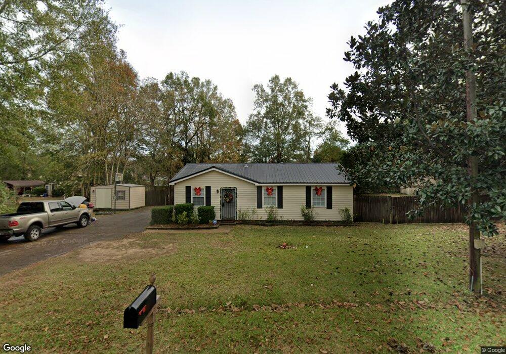
6029 Howells Ferry Rd Unit 3 Mobile, AL 36618
Colonial Heights NeighborhoodEstimated Value: $160,000 - $176,000
3
Beds
2
Baths
1,712
Sq Ft
$99/Sq Ft
Est. Value
About This Home
This home is located at 6029 Howells Ferry Rd Unit 3, Mobile, AL 36618 and is currently estimated at $169,432, approximately $98 per square foot. 6029 Howells Ferry Rd Unit 3 is a home located in Mobile County with nearby schools including Orchard Elementary School, CL Scarborough Middle School, and Mattie T Blount High School.
Ownership History
Date
Name
Owned For
Owner Type
Purchase Details
Closed on
Dec 30, 2010
Sold by
Hall Melvin
Bought by
Smith Dejuan A and Smith Tova
Current Estimated Value
Home Financials for this Owner
Home Financials are based on the most recent Mortgage that was taken out on this home.
Original Mortgage
$108,538
Outstanding Balance
$75,692
Interest Rate
5.5%
Mortgage Type
FHA
Estimated Equity
$93,740
Purchase Details
Closed on
Feb 8, 2010
Sold by
Wells Fargo Bank N A
Bought by
Hall Melvin
Purchase Details
Closed on
Sep 3, 2009
Sold by
Miller Carl Morgan and Miller Amber C
Bought by
Wells Fargo Bank Na
Create a Home Valuation Report for This Property
The Home Valuation Report is an in-depth analysis detailing your home's value as well as a comparison with similar homes in the area
Home Values in the Area
Average Home Value in this Area
Purchase History
| Date | Buyer | Sale Price | Title Company |
|---|---|---|---|
| Smith Dejuan A | $110,000 | Slt | |
| Hall Melvin | $35,000 | None Available | |
| Wells Fargo Bank Na | $55,300 | None Available |
Source: Public Records
Mortgage History
| Date | Status | Borrower | Loan Amount |
|---|---|---|---|
| Open | Smith Dejuan A | $108,538 |
Source: Public Records
Tax History
| Year | Tax Paid | Tax Assessment Tax Assessment Total Assessment is a certain percentage of the fair market value that is determined by local assessors to be the total taxable value of land and additions on the property. | Land | Improvement |
|---|---|---|---|---|
| 2025 | $814 | $13,720 | $2,000 | $11,720 |
| 2024 | $814 | $13,220 | $2,000 | $11,220 |
| 2023 | $610 | $10,490 | $2,000 | $8,490 |
| 2022 | $557 | $9,810 | $2,000 | $7,810 |
| 2021 | $557 | $9,810 | $2,000 | $7,810 |
| 2020 | $572 | $10,050 | $2,000 | $8,050 |
| 2019 | $579 | $10,180 | $0 | $0 |
| 2018 | $562 | $9,900 | $0 | $0 |
| 2017 | $555 | $9,800 | $0 | $0 |
| 2016 | $497 | $8,880 | $0 | $0 |
| 2013 | $565 | $9,020 | $0 | $0 |
Source: Public Records
Map
Nearby Homes
- 0 Hall Rd Unit 7635847
- 1613 Princess Helen Rd W
- 2033 Morganthau Dr
- 4601 Moffett Rd
- 0 Moffett Rd Unit 7717059
- 0 Moffett Rd Unit 7682624
- 0 Moffett Rd Unit 2
- 0 Moffett Rd Unit 7717031
- 0 Moffett Rd Unit 7549673
- 5700 Deerwood Dr N
- 1600 Decatur St
- 6513 Grace St
- 1313 Innsbruck Dr
- 6270 Lausanne Dr N
- 0 Williamstowne Curve Unit 7687107
- 5859 Chalet Dr N
- 5405 Moffett Rd
- 5512 Overlook Rd
- 1951 Highland Forest Dr
- 5462 Racine Ave
- 5928 Heatherwood Ct
- 6025 Howells Ferry Rd
- 5932 Heatherwood Ct
- 6021 Howells Ferry Rd
- 5920 Heatherwood Ct
- 6050 Howells Ferry Rd
- 6012 Howells Ferry Rd
- 6062 Howells Ferry Rd
- 6017 Howells Ferry Rd
- 5916 Heatherwood Ct
- 5927 Heatherwood Ct
- 5925 Heatherwood Ct
- 6074 Howells Ferry Rd
- 6008 Howells Ferry Rd
- 5921 Heatherwood Ct
- 6000 Howells Ferry Rd
- 6013 Howells Ferry Rd
- 5912 Heatherwood Ct
- 5917 Heatherwood Ct
- 0 Hall Rd Unit 216408
Your Personal Tour Guide
Ask me questions while you tour the home.