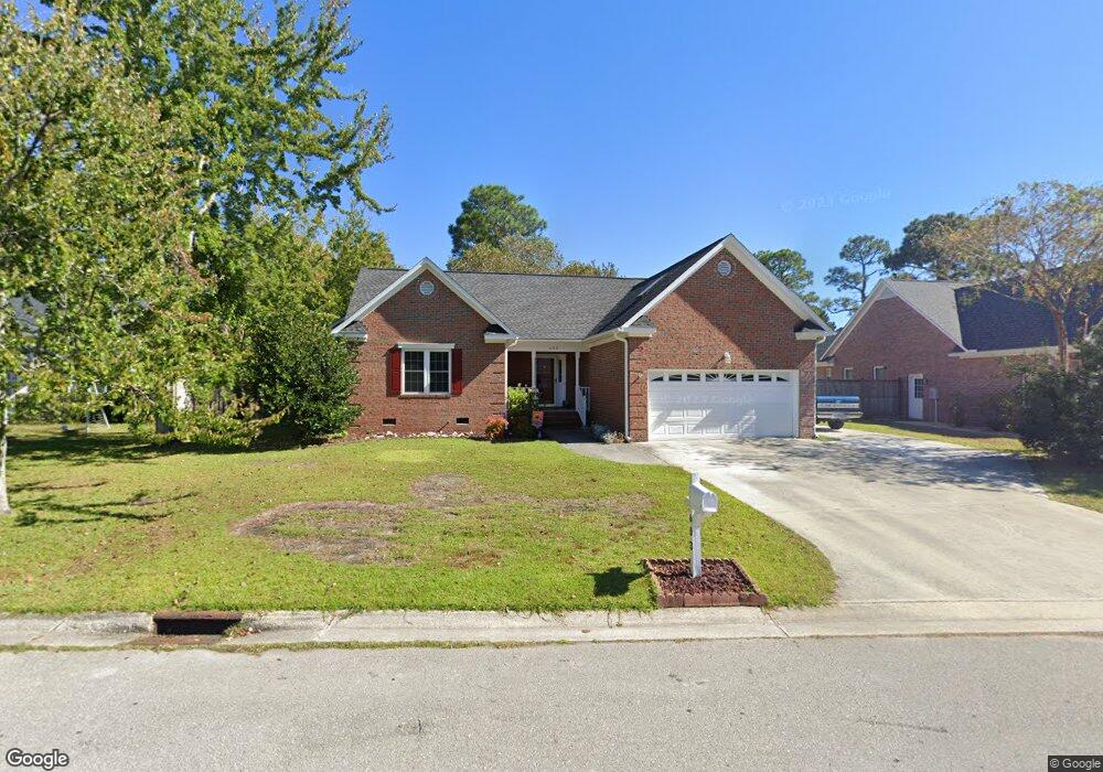
603 Barksdale Rd Wilmington, NC 28409
Lansdowne NeighborhoodEstimated Value: $466,289 - $517,000
3
Beds
2
Baths
1,969
Sq Ft
$246/Sq Ft
Est. Value
About This Home
This home is located at 603 Barksdale Rd, Wilmington, NC 28409 and is currently estimated at $483,572, approximately $245 per square foot. 603 Barksdale Rd is a home located in New Hanover County with nearby schools including Masonboro Elementary School, Myrtle Grove Middle School, and John T. Hoggard High School.
Ownership History
Date
Name
Owned For
Owner Type
Purchase Details
Closed on
Jul 31, 1998
Sold by
Gary Sigmon Construction Co
Bought by
Wallace James R Melissa W
Current Estimated Value
Purchase Details
Closed on
Jan 16, 1997
Sold by
Azalea Coast Developers Inc
Bought by
Gary Sigmon Construction Co
Purchase Details
Closed on
Jan 5, 1996
Sold by
Azalea Coast Developers Inc
Bought by
New Han Cnty Water/Sewer
Purchase Details
Closed on
Apr 15, 1993
Sold by
Sanders Nathan S Judia B
Bought by
Azalea Coast Developers Inc
Create a Home Valuation Report for This Property
The Home Valuation Report is an in-depth analysis detailing your home's value as well as a comparison with similar homes in the area
Home Values in the Area
Average Home Value in this Area
Purchase History
| Date | Buyer | Sale Price | Title Company |
|---|---|---|---|
| Wallace James R Melissa W | $150,000 | -- | |
| Gary Sigmon Construction Co | $25,000 | -- | |
| New Han Cnty Water/Sewer | -- | -- | |
| Azalea Coast Developers Inc | $909,000 | -- |
Source: Public Records
Tax History Compared to Growth
Tax History
| Year | Tax Paid | Tax Assessment Tax Assessment Total Assessment is a certain percentage of the fair market value that is determined by local assessors to be the total taxable value of land and additions on the property. | Land | Improvement |
|---|---|---|---|---|
| 2023 | $2,612 | $300,200 | $73,200 | $227,000 |
| 2022 | $2,552 | $300,200 | $73,200 | $227,000 |
| 2021 | $2,569 | $300,200 | $73,200 | $227,000 |
| 2020 | $2,404 | $228,200 | $52,000 | $176,200 |
| 2019 | $2,404 | $228,200 | $52,000 | $176,200 |
| 2018 | $2,404 | $228,200 | $52,000 | $176,200 |
| 2017 | $2,404 | $228,200 | $52,000 | $176,200 |
| 2016 | $2,386 | $215,300 | $52,000 | $163,300 |
| 2015 | $2,280 | $215,300 | $52,000 | $163,300 |
| 2014 | $2,183 | $215,300 | $52,000 | $163,300 |
Source: Public Records
Map
Nearby Homes
- 623 Barksdale Rd
- 800 Deer Haven Ct
- 531 Commons Way
- 4016 Freedom Rd
- 101 Doughton Dr
- 517 Kelly Rd
- 5029 Monck Ct
- 736 Kelly Rd
- 1008 Sabal Ct
- 125 N Hampton Rd
- 652 Chowning Place
- 3863 Daphine Ct
- 508 Commons Way
- 5008 Monck Ct
- 601 Colony Cir N
- 3556 Iris St
- 106 Brookview Rd
- 716 Benchmark Ct
- 439 Kelly Rd
- 3629 Sutton Dr
- 601 Barksdale Rd
- 605 Barksdale Rd
- 4304 Scotland Ln
- 4302 Scotland Ln
- 607 Barksdale Rd
- 4306 Scotland Ln
- 604 Barksdale Rd
- 908 Deer Spring Ln
- 606 Barksdale Rd
- 910 Deer Spring Ln
- 906 Deer Spring Ln
- 4308 Scotland Ln
- 4300 Scotland Ln
- 609 Barksdale Rd
- 912 Deer Spring Ln
- 904 Deer Spring Ln
- 608 Barksdale Rd
- 4310 Scotland Ln
- 914 Deer Spring Ln
- 611 Barksdale Rd