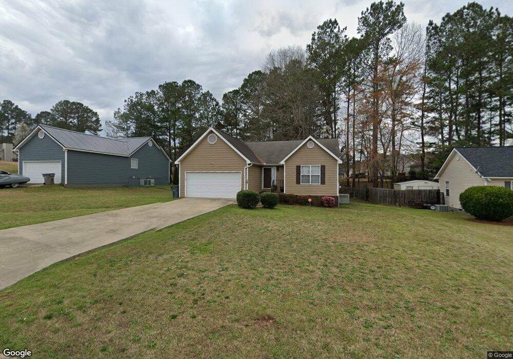
603 Brookstone Dr Lagrange, GA 30241
Estimated Value: $210,000 - $218,000
3
Beds
2
Baths
1,308
Sq Ft
$164/Sq Ft
Est. Value
About This Home
This home is located at 603 Brookstone Dr, Lagrange, GA 30241 and is currently estimated at $215,030, approximately $164 per square foot. 603 Brookstone Dr is a home located in Troup County with nearby schools including Callaway Elementary School, Hogansville Elementary School, and Callaway Middle School.
Ownership History
Date
Name
Owned For
Owner Type
Purchase Details
Closed on
Apr 3, 2009
Sold by
The Bank Of New York Mello
Bought by
Williams Derrick
Current Estimated Value
Home Financials for this Owner
Home Financials are based on the most recent Mortgage that was taken out on this home.
Original Mortgage
$82,478
Outstanding Balance
$52,021
Interest Rate
5.14%
Mortgage Type
FHA
Estimated Equity
$163,009
Purchase Details
Closed on
Mar 27, 2009
Sold by
The Bank Of New York Mello
Bought by
Williams Derrick
Home Financials for this Owner
Home Financials are based on the most recent Mortgage that was taken out on this home.
Original Mortgage
$82,478
Outstanding Balance
$52,021
Interest Rate
5.14%
Mortgage Type
FHA
Estimated Equity
$163,009
Purchase Details
Closed on
Feb 3, 2009
Sold by
Durham Lyra
Bought by
The Bank Of New York Mellon
Home Financials for this Owner
Home Financials are based on the most recent Mortgage that was taken out on this home.
Original Mortgage
$82,478
Outstanding Balance
$52,021
Interest Rate
5.14%
Mortgage Type
FHA
Estimated Equity
$163,009
Purchase Details
Closed on
Dec 5, 2005
Sold by
Brewer Lyra W
Bought by
Durham Lyra W
Home Financials for this Owner
Home Financials are based on the most recent Mortgage that was taken out on this home.
Original Mortgage
$97,600
Interest Rate
8.63%
Mortgage Type
New Conventional
Purchase Details
Closed on
Oct 31, 2003
Sold by
Brewer Larry D
Bought by
Brewer Lyra
Purchase Details
Closed on
Sep 5, 2001
Sold by
Angela Smiley
Bought by
Brewer Larry D
Purchase Details
Closed on
Jun 14, 1999
Sold by
Commercial Bank & Trust Co Tc
Bought by
Angela Smiley
Purchase Details
Closed on
Jun 1, 1999
Sold by
Nce
Bought by
Commercial Bank & Trust Co Tc
Purchase Details
Closed on
Aug 7, 1997
Sold by
Spinks Brown Durand
Bought by
Nce
Purchase Details
Closed on
Aug 12, 1994
Bought by
Spinks Brown Durand
Create a Home Valuation Report for This Property
The Home Valuation Report is an in-depth analysis detailing your home's value as well as a comparison with similar homes in the area
Purchase History
| Date | Buyer | Sale Price | Title Company |
|---|---|---|---|
| Williams Derrick | $84,000 | -- | |
| Williams Derrick | $84,000 | -- | |
| The Bank Of New York Mellon | $35,423 | -- | |
| The Bank Of New York Mellon | $35,423 | -- | |
| Durham Lyra W | -- | -- | |
| Brewer Lyra | -- | -- | |
| Brewer Larry D | $104,900 | -- | |
| Angela Smiley | -- | -- | |
| Commercial Bank & Trust Co Tc | $90,900 | -- | |
| Nce | -- | -- | |
| Spinks Brown Durand | -- | -- |
Source: Public Records
Mortgage History
| Date | Status | Borrower | Loan Amount |
|---|---|---|---|
| Open | Williams Derrick | $82,478 | |
| Closed | The Bank Of New York Mellon | $82,478 | |
| Previous Owner | The Bank Of New York Mellon | $82,478 | |
| Previous Owner | Durham Lyra W | $97,600 | |
| Previous Owner | Durham Lyra W | $24,400 |
Source: Public Records
Tax History
| Year | Tax Paid | Tax Assessment Tax Assessment Total Assessment is a certain percentage of the fair market value that is determined by local assessors to be the total taxable value of land and additions on the property. | Land | Improvement |
|---|---|---|---|---|
| 2025 | $1,799 | $73,800 | $14,000 | $59,800 |
| 2024 | $1,799 | $65,960 | $14,000 | $51,960 |
| 2023 | $1,804 | $66,160 | $14,000 | $52,160 |
| 2022 | $1,546 | $55,400 | $10,000 | $45,400 |
| 2021 | $1,496 | $49,600 | $8,000 | $41,600 |
| 2020 | $1,496 | $49,600 | $8,000 | $41,600 |
| 2019 | $1,348 | $44,680 | $8,000 | $36,680 |
| 2018 | $1,208 | $40,060 | $5,540 | $34,520 |
| 2017 | $1,208 | $40,060 | $5,540 | $34,520 |
| 2016 | $1,189 | $39,438 | $5,540 | $33,898 |
| 2015 | $1,191 | $39,438 | $5,540 | $33,898 |
| 2014 | $1,139 | $37,654 | $5,540 | $32,114 |
| 2013 | -- | $38,078 | $5,540 | $32,538 |
Source: Public Records
Map
Nearby Homes
- 124 Woodridge Cir
- 105 Ridgefield Dr
- 300 Old Pond Rd
- 119 Sir Lancelot St
- 509 Youngs Mill Rd
- 304 Bridgette Blvd
- 101 Sarah Ln
- 227 River Meadow Dr Unit H14
- 227 River Meadow Dr
- 412 Sweetwood Ct Unit A36
- 793 Celebration Blvd
- 104 Sheila St
- 112 Celebration Blvd
- 107 N Barnard Ave
- 305 Lenox Cir
- 0 N Barnard Ave
- 129 Celebration Blvd
- 110 Lenox Cir
- 5 Gulfstream Dr
- 121 Ct
- 601 Brookstone Dr
- 605 Brookstone Dr
- 126 Woodridge Cir
- 102 Woodridge Ct
- 604 Brookstone Dr
- 602 Brookstone Dr Unit 18
- 602 Brookstone Dr
- 103 Woodridge Ct
- 104 Woodridge Ct
- 606 Brookstone Dr
- 600 Brookstone Dr
- 101 Woodridge Ct
- 122 Woodridge Cir
- 506 Brookstone Dr
- 143 Woodridge Cir
- 145 Woodridge Cir
- 141 Woodridge Cir
- 105 Woodridge Ct
- 106 Woodridge Ct
- 120 Woodridge Cir