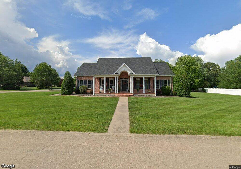
603 Hawthorne Dr Farmington, MO 63640
Estimated Value: $481,000 - $578,000
5
Beds
4
Baths
3,298
Sq Ft
$158/Sq Ft
Est. Value
About This Home
This home is located at 603 Hawthorne Dr, Farmington, MO 63640 and is currently estimated at $520,734, approximately $157 per square foot. 603 Hawthorne Dr is a home located in St. Francois County with nearby schools including Farmington Senior High School, St. Paul Lutheran School, and St. Joseph School.
Ownership History
Date
Name
Owned For
Owner Type
Purchase Details
Closed on
Oct 20, 2021
Sold by
Cleve Albert L
Bought by
Jones Adam and Jones Kristen Jones
Current Estimated Value
Home Financials for this Owner
Home Financials are based on the most recent Mortgage that was taken out on this home.
Original Mortgage
$301,200
Outstanding Balance
$263,398
Interest Rate
0.3%
Mortgage Type
Construction
Estimated Equity
$257,336
Purchase Details
Closed on
Jul 14, 1998
Sold by
Weible Raymond L and Weible Maggie M
Bought by
Johnson Wayne E Te and Johnson Dorothy M Te
Create a Home Valuation Report for This Property
The Home Valuation Report is an in-depth analysis detailing your home's value as well as a comparison with similar homes in the area
Home Values in the Area
Average Home Value in this Area
Purchase History
| Date | Buyer | Sale Price | Title Company |
|---|---|---|---|
| Jones Adam | $376,500 | Preferred Land Title | |
| Johnson Wayne E Te | -- | -- |
Source: Public Records
Mortgage History
| Date | Status | Borrower | Loan Amount |
|---|---|---|---|
| Open | Jones Adam | $301,200 |
Source: Public Records
Tax History Compared to Growth
Tax History
| Year | Tax Paid | Tax Assessment Tax Assessment Total Assessment is a certain percentage of the fair market value that is determined by local assessors to be the total taxable value of land and additions on the property. | Land | Improvement |
|---|---|---|---|---|
| 2024 | $3,048 | $60,510 | $9,700 | $50,810 |
| 2023 | $3,048 | $60,510 | $9,700 | $50,810 |
| 2022 | $3,057 | $60,510 | $9,700 | $50,810 |
| 2021 | $3,022 | $59,990 | $9,700 | $50,290 |
| 2020 | $3,042 | $59,990 | $9,700 | $50,290 |
| 2019 | $3,042 | $59,990 | $9,700 | $50,290 |
| 2018 | -- | $50,030 | $4,750 | $45,280 |
| 2017 | $2,622 | $50,030 | $4,750 | $45,280 |
| 2016 | $2,611 | $50,030 | $0 | $0 |
| 2015 | -- | $50,030 | $0 | $0 |
| 2014 | -- | $50,030 | $0 | $0 |
| 2013 | -- | $50,030 | $0 | $0 |
Source: Public Records
Map
Nearby Homes
- 501 Hawthorne Dr
- 847 Valley Brook Dr
- 209 Hawthorne Dr Unit FGT
- 200 Lisa Dr
- 610 Walter St
- 1155 E Karsch Blvd
- 601 Edward St
- 17 Airline Dr
- 620 Braning Dr
- 404 Helber Dr
- 549 N Haven Dr
- 4 Mileva Ct
- 1145 Bell Mountain Dr
- 42 Park St
- 1141 Bell Mountain Dr
- 1006 Stone Creek Rd
- 5808 & 5802 Highway F
- 5810 Highway F
- 113 Shepherd Mountain Rd
- 105 Shepherd Mountain Rd
- 1208 Springbrook Park Dr
- 605 Hawthorne Dr
- 505 Hawthorne Dr
- 606 Hawthorne Dr
- 1209 Springbrook Park Dr
- 602 Hawthorne Dr
- 1207 Cherry Hill Dr
- 514 Hawthorne Dr
- 610 Hawthorne Dr
- 1205 Springbrook Park Dr
- 860 Valley Brook Dr
- 1109 Cherry Hill Dr
- 702 Willow Brook Dr
- 1212 Cherry Hill Dr
- 1208 Chestnut Ct
- 502 Hawthorne Dr
- 1176 Springbrook Park Dr
- 23 Springbrook Park Dr
- 0Lot 82 Springbrook Park Dr
- 0Lot 80 Springbrook Park Dr