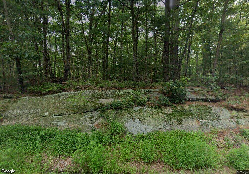
603 Hazel St Uxbridge, MA 01569
Estimated Value: $178,537 - $683,000
--
Bed
--
Bath
--
Sq Ft
4.64
Acres
About This Home
This home is located at 603 Hazel St, Uxbridge, MA 01569 and is currently estimated at $381,512. 603 Hazel St is a home located in Worcester County with nearby schools including Uxbridge High School and Our Lady of the Valley Regional School.
Ownership History
Date
Name
Owned For
Owner Type
Purchase Details
Closed on
Apr 9, 2010
Sold by
Blaine Deborah and Blaine Debra
Bought by
Gately Edward
Current Estimated Value
Purchase Details
Closed on
Dec 2, 2009
Sold by
Fortier Gary A
Bought by
Gately Edward
Purchase Details
Closed on
Feb 12, 2009
Sold by
Fortier Pearl D and Morrissette Pearl D
Bought by
Gately Edward
Purchase Details
Closed on
Dec 9, 2008
Sold by
Gately Edward
Bought by
Bainbridge Rlty Inc
Purchase Details
Closed on
Aug 26, 2008
Sold by
Enman Doris
Bought by
Gately Edward
Create a Home Valuation Report for This Property
The Home Valuation Report is an in-depth analysis detailing your home's value as well as a comparison with similar homes in the area
Home Values in the Area
Average Home Value in this Area
Purchase History
| Date | Buyer | Sale Price | Title Company |
|---|---|---|---|
| Gately Edward | $1,500 | -- | |
| Gately Edward | $1,500 | -- | |
| Gately Edward | $500 | -- | |
| Gately Edward | $500 | -- | |
| Gately Edward | $500 | -- | |
| Bainbridge Rlty Inc | -- | -- | |
| Bainbridge Rlty Inc | -- | -- | |
| Gately Edward | $500 | -- |
Source: Public Records
Tax History Compared to Growth
Tax History
| Year | Tax Paid | Tax Assessment Tax Assessment Total Assessment is a certain percentage of the fair market value that is determined by local assessors to be the total taxable value of land and additions on the property. | Land | Improvement |
|---|---|---|---|---|
| 2025 | $22 | $169,300 | $169,300 | $0 |
| 2024 | $2,018 | $156,200 | $156,200 | $0 |
| 2023 | $1,963 | $140,700 | $140,700 | $0 |
| 2022 | $1,948 | $128,500 | $128,500 | $0 |
| 2021 | $1,951 | $123,300 | $123,300 | $0 |
| 2020 | $2,136 | $127,600 | $127,600 | $0 |
| 2019 | $2,063 | $118,900 | $118,900 | $0 |
| 2018 | $2,042 | $118,900 | $118,900 | $0 |
| 2017 | $1,803 | $106,300 | $106,300 | $0 |
| 2016 | $1,978 | $112,600 | $112,600 | $0 |
| 2015 | $1,959 | $112,600 | $112,600 | $0 |
Source: Public Records
Map
Nearby Homes
- 103 Uxbridge St
- 138 Mantell Rd
- 145 Mantell Rd
- 169 Mantell Rd
- 137 Mantell Rd
- 33 Summerfield Dr Unit 33
- 60 Tyler Dr
- 153 Davis St
- 7 Jefferson Ct Unit 7
- 405 West St
- Layla Plan at Pine Ridge
- Ashley Plan at Pine Ridge
- Lily Plan at Pine Ridge
- Brooklyn Plan at Pine Ridge
- Tucker Plan at Pine Ridge
- Everleigh Plan at Pine Ridge
- 395 High St
- 100 Spring Hill Dr Unit 100
- 68 Lackey Dam Rd
- 2 C St
- 575 Hazel St
- 643 Hazel St
- 555 Hazel St
- 38 West St
- 582 W Hartford Ave
- 588 Hartford Ave W
- 588 Hartford Ave W Unit 2nd flr
- 0 Hazel St
- 66 Uxbridge St
- 591 Hartford Ave W
- 573 Hartford Ave W
- 35 West St
- 74 Uxbridge St
- 119 Uxbridge St
- 43 N Uxbridge St
- 65 Uxbridge St
- 75 Uxbridge St
- 86 Uxbridge St
- 519 Hazel St
- 55 Uxbridge St
