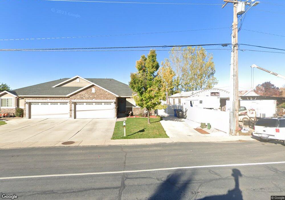
603 N 300 W Spanish Fork, UT 84660
Estimated Value: $350,000 - $518,000
3
Beds
2
Baths
2,769
Sq Ft
$158/Sq Ft
Est. Value
About This Home
This home is located at 603 N 300 W, Spanish Fork, UT 84660 and is currently estimated at $438,034, approximately $158 per square foot. 603 N 300 W is a home located in Utah County with nearby schools including Brockbank Elementary School, Spanish Fork Jr High School, and Spanish Fork High School.
Ownership History
Date
Name
Owned For
Owner Type
Purchase Details
Closed on
Jul 14, 2021
Sold by
Davis Spencer Ross and Davis William Clinton
Bought by
Msr Investments Llc
Current Estimated Value
Purchase Details
Closed on
Sep 29, 2020
Sold by
Kindell Brigham and Kindell Daurie
Bought by
Davis Spencer Ross and Davis William Clinton
Home Financials for this Owner
Home Financials are based on the most recent Mortgage that was taken out on this home.
Original Mortgage
$327,750
Interest Rate
2.9%
Mortgage Type
New Conventional
Purchase Details
Closed on
Aug 23, 2013
Sold by
Hughes Natan T
Bought by
Daniels Richard V and Daniels Diane M
Purchase Details
Closed on
Feb 3, 2010
Sold by
Federal Home Loan Mortgage Corporation
Bought by
Clark Clifford and Clark Clara Lee
Purchase Details
Closed on
Oct 8, 2009
Sold by
Dahlen James H and Dahlen Marie
Bought by
Federal Home Loan Mortgage Corporation
Purchase Details
Closed on
Jan 2, 2008
Sold by
Raines Donald
Bought by
Dahlen James H and Dahlen Marie C
Home Financials for this Owner
Home Financials are based on the most recent Mortgage that was taken out on this home.
Original Mortgage
$207,000
Interest Rate
6.05%
Mortgage Type
Purchase Money Mortgage
Purchase Details
Closed on
Sep 12, 2007
Sold by
English Matthew A
Bought by
Raines Donald
Home Financials for this Owner
Home Financials are based on the most recent Mortgage that was taken out on this home.
Original Mortgage
$45,000
Interest Rate
6.61%
Mortgage Type
Purchase Money Mortgage
Purchase Details
Closed on
Jun 15, 2007
Sold by
Grant Joseph Clay and Grant Jan M
Bought by
English Adam C
Home Financials for this Owner
Home Financials are based on the most recent Mortgage that was taken out on this home.
Original Mortgage
$166,250
Interest Rate
6.16%
Mortgage Type
Commercial
Create a Home Valuation Report for This Property
The Home Valuation Report is an in-depth analysis detailing your home's value as well as a comparison with similar homes in the area
Home Values in the Area
Average Home Value in this Area
Purchase History
| Date | Buyer | Sale Price | Title Company |
|---|---|---|---|
| Msr Investments Llc | -- | Pro Title And Escrow Inc | |
| Davis Spencer Ross | -- | Pro Title & Escrow Inc | |
| Daniels Richard V | -- | Barlett Title Insurance Age | |
| Clark Clifford | -- | First American Union Heig | |
| Federal Home Loan Mortgage Corporation | $227,429 | Etitle Insurance Agency | |
| Dahlen James H | -- | Equity Title Orem Blvd | |
| Raines Donald | -- | Security Title & Abstract | |
| Raines Donald | -- | Security Title & Abstract | |
| English Adam C | -- | Investors Title Insurance A |
Source: Public Records
Mortgage History
| Date | Status | Borrower | Loan Amount |
|---|---|---|---|
| Previous Owner | Davis Spencer Ross | $327,750 | |
| Previous Owner | Dahlen James H | $207,000 | |
| Previous Owner | Raines Donald | $45,000 | |
| Previous Owner | English Adam C | $166,250 |
Source: Public Records
Tax History Compared to Growth
Tax History
| Year | Tax Paid | Tax Assessment Tax Assessment Total Assessment is a certain percentage of the fair market value that is determined by local assessors to be the total taxable value of land and additions on the property. | Land | Improvement |
|---|---|---|---|---|
| 2025 | $2,388 | $242,990 | $77,400 | $364,400 |
| 2024 | $2,388 | $246,180 | $0 | $0 |
| 2023 | $2,387 | $246,345 | $0 | $0 |
| 2022 | $2,205 | $223,135 | $0 | $0 |
| 2021 | $1,950 | $315,700 | $65,500 | $250,200 |
| 2020 | $1,685 | $289,600 | $65,500 | $224,100 |
| 2019 | $1,685 | $279,000 | $65,500 | $213,500 |
| 2018 | $1,386 | $221,800 | $65,500 | $156,300 |
| 2017 | $1,397 | $120,230 | $0 | $0 |
| 2016 | $1,199 | $101,805 | $0 | $0 |
| 2015 | $1,115 | $93,500 | $0 | $0 |
| 2014 | $1,013 | $85,250 | $0 | $0 |
Source: Public Records
Map
Nearby Homes
- 393 N 400 W
- 559 N Mitchell Dr
- 433 N 100 W
- 40 W 400 N Unit 1-6
- 294 W 200 N
- 55 E 700 N
- 555 N 100 E
- 134 N 300 W
- 1841 N 630 St W Unit 71
- 1788 N 630 St W Unit 47
- 1826 N 630 St W Unit 101
- 136 E 900 N
- 440 N 200 E
- 143 E 200 N
- 833 W 250 N
- 288 E 800 N Unit 144
- 235 E 900 N
- 226 N 860 W Unit 156
- 13 N 710 W
- 385 E 700 N