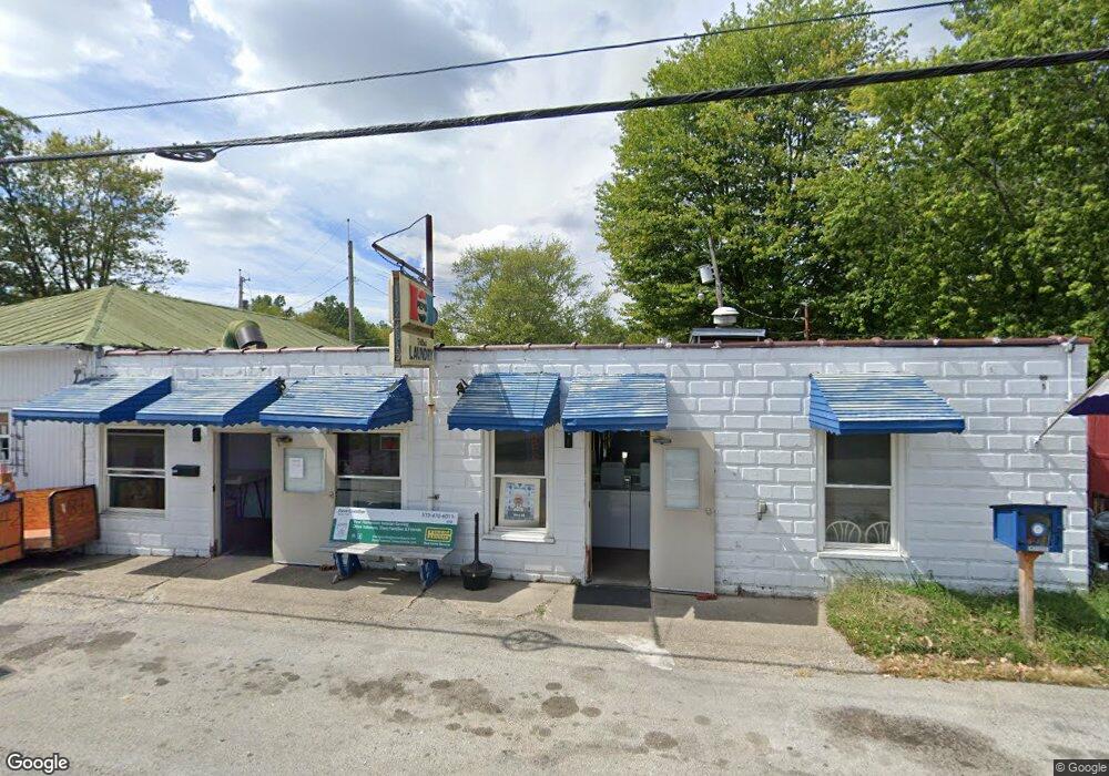
603 N Apple St Georgetown, OH 45121
--
Bed
1
Bath
--
Sq Ft
--
Built
About This Home
This home is located at 603 N Apple St, Georgetown, OH 45121. 603 N Apple St is a home located in Brown County with nearby schools including Georgetown Elementary School and Georgetown Jr/Sr High School.
Ownership History
Date
Name
Owned For
Owner Type
Purchase Details
Closed on
Nov 10, 2021
Sold by
Village Laudromat Llc
Bought by
Guenther David M and Guenther Melca
Home Financials for this Owner
Home Financials are based on the most recent Mortgage that was taken out on this home.
Original Mortgage
$92,000
Outstanding Balance
$78,418
Interest Rate
3.05%
Mortgage Type
Commercial
Purchase Details
Closed on
Aug 6, 2019
Sold by
Kattine Jo Ann
Bought by
Village Laundromat Llc
Home Financials for this Owner
Home Financials are based on the most recent Mortgage that was taken out on this home.
Original Mortgage
$78,750
Interest Rate
3.7%
Mortgage Type
Commercial
Create a Home Valuation Report for This Property
The Home Valuation Report is an in-depth analysis detailing your home's value as well as a comparison with similar homes in the area
Home Values in the Area
Average Home Value in this Area
Purchase History
| Date | Buyer | Sale Price | Title Company |
|---|---|---|---|
| Guenther David M | $115,000 | Stewart Title Company | |
| Village Laundromat Llc | $105,000 | Stewart Title Company |
Source: Public Records
Mortgage History
| Date | Status | Borrower | Loan Amount |
|---|---|---|---|
| Open | Guenther David M | $92,000 | |
| Previous Owner | Village Laundromat Llc | $78,750 |
Source: Public Records
Tax History Compared to Growth
Tax History
| Year | Tax Paid | Tax Assessment Tax Assessment Total Assessment is a certain percentage of the fair market value that is determined by local assessors to be the total taxable value of land and additions on the property. | Land | Improvement |
|---|---|---|---|---|
| 2024 | $331 | $7,190 | $1,650 | $5,540 |
| 2023 | $331 | $6,670 | $1,470 | $5,200 |
| 2022 | $332 | $6,670 | $1,470 | $5,200 |
| 2021 | $325 | $6,670 | $1,470 | $5,200 |
| 2020 | $328 | $6,670 | $1,470 | $5,200 |
| 2019 | $326 | $6,670 | $1,470 | $5,200 |
| 2018 | $324 | $6,670 | $1,470 | $5,200 |
| 2017 | $290 | $6,670 | $1,470 | $5,200 |
| 2016 | $273 | $6,670 | $1,470 | $5,200 |
| 2015 | $276 | $6,670 | $1,470 | $5,200 |
| 2014 | $276 | $6,670 | $1,470 | $5,200 |
| 2013 | $273 | $6,670 | $1,470 | $5,200 |
Source: Public Records
Map
Nearby Homes
- 508 Mount Orab Pike
- 331 Spring Grove Dr
- 405 N Main St
- 403 Elmwood Ct
- 401 Elmwood Ct
- 427 Kenwood Ave
- 874 Mount Orab Pike
- 60 New St
- 406 E North St
- 102 Bill Dee Dr
- 104 Elm St
- 306 W 2nd St
- 402 S Pleasant St
- 505 S Water St
- 666 E State St
- 418 Home St
- 708 E State St
- 143 Hamer Rd
- 25 Douglas Ln
- 0 St Rt 221 & Footbridge Unit 1826509
- 519 Mount Orab Pike
- 523 Mount Orab Pike
- 516 N Apple St
- 524 N Main St
- 515 Mount Orab Pike
- 525 S Mt Orab Pike
- 521 N Main St
- 104 Illinois St Unit 106
- 510 N Apple St
- 509 Mount Orab Pike
- 523 N Main St
- 207 Blair Ave
- 509 N Main St
- 601 N Apple St
- 204 Blair Ave
- 527 N Main St
- 506 N Apple St
- 605 N Apple St
- 600 N Main St
- 301 Blair Ave