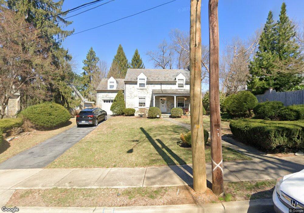
603 N Brobst St Reading, PA 19607
Estimated Value: $354,000 - $440,000
3
Beds
3
Baths
2,402
Sq Ft
$162/Sq Ft
Est. Value
About This Home
This home is located at 603 N Brobst St, Reading, PA 19607 and is currently estimated at $389,587, approximately $162 per square foot. 603 N Brobst St is a home located in Berks County with nearby schools including Cumru Elementary School, Governor Mifflin Intermediate School, and Governor Mifflin Middle School.
Ownership History
Date
Name
Owned For
Owner Type
Purchase Details
Closed on
May 31, 2006
Sold by
Oulds Howard R and Oulds Nancy R
Bought by
Olinger David D and Olinger Nancy C
Current Estimated Value
Home Financials for this Owner
Home Financials are based on the most recent Mortgage that was taken out on this home.
Original Mortgage
$122,500
Outstanding Balance
$70,722
Interest Rate
6.25%
Mortgage Type
Adjustable Rate Mortgage/ARM
Estimated Equity
$318,865
Create a Home Valuation Report for This Property
The Home Valuation Report is an in-depth analysis detailing your home's value as well as a comparison with similar homes in the area
Home Values in the Area
Average Home Value in this Area
Purchase History
| Date | Buyer | Sale Price | Title Company |
|---|---|---|---|
| Olinger David D | $222,500 | None Available |
Source: Public Records
Mortgage History
| Date | Status | Borrower | Loan Amount |
|---|---|---|---|
| Open | Olinger David D | $122,500 |
Source: Public Records
Tax History Compared to Growth
Tax History
| Year | Tax Paid | Tax Assessment Tax Assessment Total Assessment is a certain percentage of the fair market value that is determined by local assessors to be the total taxable value of land and additions on the property. | Land | Improvement |
|---|---|---|---|---|
| 2025 | $2,719 | $168,300 | $63,000 | $105,300 |
| 2024 | $7,672 | $168,300 | $63,000 | $105,300 |
| 2023 | $7,472 | $168,300 | $63,000 | $105,300 |
| 2022 | $7,388 | $168,300 | $63,000 | $105,300 |
| 2021 | $7,304 | $168,300 | $63,000 | $105,300 |
| 2020 | $7,304 | $168,300 | $63,000 | $105,300 |
| 2019 | $7,220 | $168,300 | $63,000 | $105,300 |
| 2018 | $7,135 | $168,300 | $63,000 | $105,300 |
| 2017 | $7,003 | $168,300 | $63,000 | $105,300 |
| 2016 | $2,394 | $168,300 | $63,000 | $105,300 |
| 2015 | $2,394 | $168,300 | $63,000 | $105,300 |
| 2014 | $2,187 | $168,300 | $63,000 | $105,300 |
Source: Public Records
Map
Nearby Homes
- 33 Pennsylvania Ave
- 27 Pennsylvania Ave
- 305 W Elm St
- 405 State St
- 137 E Elm St
- 136 E Elm St
- 31 S Wyomissing Ave
- 31 S Sterley St Unit 401
- 31 S Sterley St Unit 101
- 429 Devon Terrace
- 1 Vireo Dr
- 1964 Meadow Ln
- 1907 Meadow Ln
- 24 Philadelphia Ave
- 1913 Meadow Ln
- 2018 Meadow Glen
- 120 S Miller St
- 15 Bare Ave
- 1801 Cambridge Ave Unit B4
- 1617 Meadowlark Rd