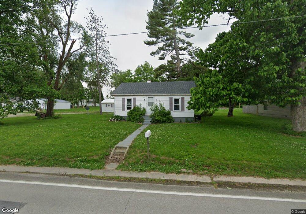
603 N Walnut St Oakland, IL 61943
Estimated Value: $64,000 - $89,000
2
Beds
1
Bath
960
Sq Ft
$76/Sq Ft
Est. Value
About This Home
This home is located at 603 N Walnut St, Oakland, IL 61943 and is currently estimated at $72,610, approximately $75 per square foot. 603 N Walnut St is a home located in Coles County with nearby schools including Lake Crest Elementary School and Oakland High School.
Ownership History
Date
Name
Owned For
Owner Type
Purchase Details
Closed on
Jan 30, 2023
Sold by
Mays Louie F
Bought by
Mays Louie F and Desimone Kathy
Current Estimated Value
Purchase Details
Closed on
May 21, 2015
Sold by
Anthony Renee
Bought by
Habitat For Humanity
Purchase Details
Closed on
May 1, 2012
Sold by
Coles County Habitat For Humanity
Bought by
Anthony Renee
Purchase Details
Closed on
Jan 31, 2012
Sold by
Eaton Donna J
Bought by
Jasper Holdings Llc
Purchase Details
Closed on
Nov 11, 2008
Sold by
Beta Gamma Chapter Sigma Pi Fraternity
Bought by
Brooklyn Heights Apartments Llc
Purchase Details
Closed on
Aug 7, 2008
Sold by
Phillips Chad and Phillips Hadley
Bought by
Brooklyn Heights Apartments Llc
Purchase Details
Closed on
Oct 23, 2007
Sold by
Duncan Robert M
Bought by
Eaton Tony M and Eaton Donna J
Create a Home Valuation Report for This Property
The Home Valuation Report is an in-depth analysis detailing your home's value as well as a comparison with similar homes in the area
Home Values in the Area
Average Home Value in this Area
Purchase History
| Date | Buyer | Sale Price | Title Company |
|---|---|---|---|
| Mays Louie F | $45,500 | None Listed On Document | |
| Habitat For Humanity | -- | -- | |
| Anthony Renee | -- | None Available | |
| Jasper Holdings Llc | $3,000 | None Available | |
| Brooklyn Heights Apartments Llc | -- | None Available | |
| Brooklyn Heights Apartments Llc | -- | None Available | |
| Eaton Tony M | -- | None Available |
Source: Public Records
Tax History Compared to Growth
Tax History
| Year | Tax Paid | Tax Assessment Tax Assessment Total Assessment is a certain percentage of the fair market value that is determined by local assessors to be the total taxable value of land and additions on the property. | Land | Improvement |
|---|---|---|---|---|
| 2024 | $2,188 | $25,337 | $3,871 | $21,466 |
| 2023 | $2,183 | $25,337 | $3,871 | $21,466 |
| 2022 | -- | $8,487 | $4,283 | $4,204 |
| 2021 | -- | $7,670 | $3,871 | $3,799 |
| 2020 | $0 | $7,947 | $4,011 | $3,936 |
| 2019 | $0 | $7,670 | $6,670 | $1,000 |
| 2018 | $0 | $7,670 | $6,670 | $1,000 |
| 2017 | $0 | $7,670 | $6,670 | $1,000 |
| 2016 | $824 | $7,670 | $6,670 | $1,000 |
| 2015 | $1,332 | $7,670 | $6,670 | $1,000 |
| 2014 | $1,332 | $17,944 | $8,170 | $9,774 |
| 2013 | $1,332 | $17,944 | $8,170 | $9,774 |
Source: Public Records
Map
Nearby Homes
- 512 Norton Dr
- 100 N Reel St
- 215 Silver St
- 312 Ashmore Rd
- 509 Lakeshore Dr
- 22518 State Highway 133
- 0 E Co Road 1550 N
- Moody Rd Unit Lot WP001
- County Road 1550 N
- 0 County Road 2300 Rd E Unit 24630606
- 0 County Road 2300 Rd E Unit RMAPA1260552
- 212 Michigan St
- 206 S Boyer Ave
- 18428 E Co Road 1500 N
- 20315 Airtight Rd
- 2445 E County Road 875 N
- 210 Buena Vista St
- 12 E Walnut St
- 6 S Oakland Rd
- 137 E Buena Vista St
- 509 N Walnut St
- 606 N Walnut St
- 505 N Walnut St
- 610 N Walnut St
- 125 W Lincoln St
- 600 N Walnut St
- 611 N Walnut St
- 629 N Walnut St
- 501 N Walnut St
- 612 N Walnut St
- 3 Moore St
- 618 Burtner Dr
- 410 N Walnut St
- 621 Burtner Dr
- 111 W Lincoln St
- 616 N Walnut St
- 109 W Lincoln St
- 409 N Pike St
- 625 N Walnut St
- 115 W Lincoln St