Estimated Value: $545,604 - $616,000
Studio
--
Bath
2,382
Sq Ft
$246/Sq Ft
Est. Value
About This Home
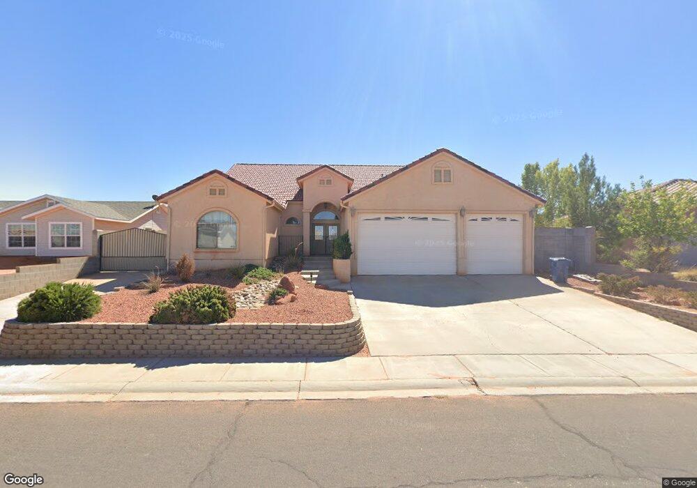
This home is located at 603 Pinto Rd, Page, AZ 86040 and is currently estimated at $586,151, approximately $246 per square foot. 603 Pinto Rd is a home with nearby schools including Desert View Elementary Intermediate School, Lake View Elementary Primary School, and Page Middle School.
Ownership History
Date
Name
Owned For
Owner Type
Purchase Details
Closed on
Apr 8, 2022
Sold by
Eu Bank Susan E
Bought by
Moon Dong Hwan and Lee Hong Seon
Current Estimated Value
Home Financials for this Owner
Home Financials are based on the most recent Mortgage that was taken out on this home.
Original Mortgage
$15,354
Outstanding Balance
$14,214
Interest Rate
3.76%
Estimated Equity
$571,937
Purchase Details
Closed on
May 22, 2014
Sold by
Fonner Christopher J
Bought by
Eubanks Susan E and Eubanks Alan R
Home Financials for this Owner
Home Financials are based on the most recent Mortgage that was taken out on this home.
Original Mortgage
$296,650
Interest Rate
4.07%
Mortgage Type
New Conventional
Purchase Details
Closed on
Feb 3, 2005
Sold by
Sheppard Michael R and Sheppard Margie R
Bought by
Fonner Christopher J
Home Financials for this Owner
Home Financials are based on the most recent Mortgage that was taken out on this home.
Original Mortgage
$200,000
Interest Rate
5.66%
Mortgage Type
New Conventional
Purchase Details
Closed on
May 14, 2003
Sold by
Slavens J Dean and Slavens Judy L
Bought by
Sheppard Michael R and Sheppard Margie R
Create a Home Valuation Report for This Property
The Home Valuation Report is an in-depth analysis detailing your home's value as well as a comparison with similar homes in the area
Home Values in the Area
Average Home Value in this Area
Purchase History
| Date | Buyer | Sale Price | Title Company |
|---|---|---|---|
| Moon Dong Hwan | $530,000 | Pioneer Title | |
| Eubanks Susan E | $349,000 | Pioneer Title Agency Inc | |
| Fonner Christopher J | $300,000 | First American Title Ins Co | |
| Sheppard Michael R | $44,900 | First American Title Ins Co |
Source: Public Records
Mortgage History
| Date | Status | Borrower | Loan Amount |
|---|---|---|---|
| Open | Moon Dong Hwan | $15,354 | |
| Open | Moon Dong Hwan | $511,807 | |
| Previous Owner | Eubanks Susan E | $296,650 | |
| Previous Owner | Fonner Christopher J | $200,000 |
Source: Public Records
Tax History
| Year | Tax Paid | Tax Assessment Tax Assessment Total Assessment is a certain percentage of the fair market value that is determined by local assessors to be the total taxable value of land and additions on the property. | Land | Improvement |
|---|---|---|---|---|
| 2025 | $1,976 | $43,191 | -- | -- |
| 2024 | $1,976 | $44,171 | -- | -- |
| 2023 | $2,680 | $40,702 | $0 | $0 |
| 2022 | $1,762 | $34,048 | $0 | $0 |
| 2021 | $2,059 | $31,139 | $0 | $0 |
| 2020 | $1,572 | $28,018 | $0 | $0 |
| 2019 | $1,538 | $27,510 | $0 | $0 |
| 2018 | $1,528 | $26,460 | $0 | $0 |
| 2017 | $1,435 | $25,519 | $0 | $0 |
| 2016 | $1,307 | $23,421 | $0 | $0 |
| 2015 | $1,365 | $23,845 | $0 | $0 |
Source: Public Records
Map
Nearby Homes
- 22 Sunset St Unit 22
- 41 W Jerome St
- 425 Cedar St
- 801 Oak St Unit 133
- 801 Oak St Unit 70
- 801 Oak St Unit 62
- 134 Calle Hermosa
- 314 Clubhouse Dr Unit 16
- 57 Aero Ave
- 1531 Rim View Dr
- 8.35 Acres S Parcel Rainbow Dr
- 112 Schoppman Ln Unit 60
- 451 Ticaboo Canyon Dr Unit 33
- 461 Ticaboo Canyon Dr Unit 34
- 112 Bryce Canyon Dr
- 122 Bryce Canyon Dr
- 12 Sumner Cove
- 132 Bryce Canyon Dr
- 30 Tek Ct
- 130 Tek Ct Unit 95
Your Personal Tour Guide
Ask me questions while you tour the home.