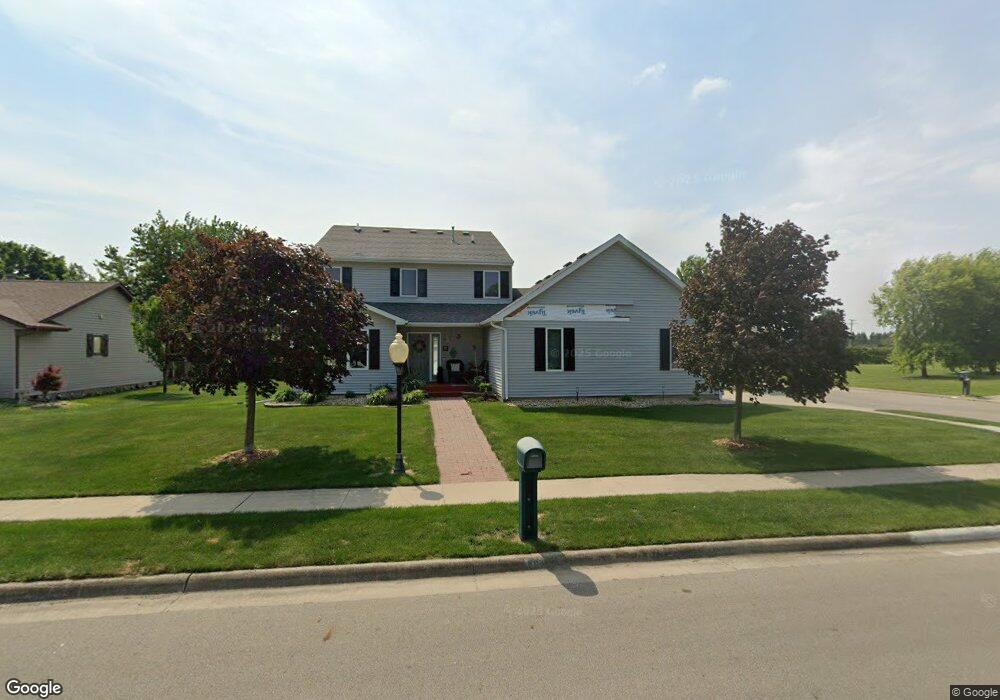
603 S Franklin Way Pontiac, IL 61764
Estimated Value: $195,643 - $236,000
3
Beds
2
Baths
1,742
Sq Ft
$122/Sq Ft
Est. Value
About This Home
This home is located at 603 S Franklin Way, Pontiac, IL 61764 and is currently estimated at $211,661, approximately $121 per square foot. 603 S Franklin Way is a home located in Livingston County with nearby schools including Central Elementary School, Lincoln Elementary School, and Washington Elementary School.
Ownership History
Date
Name
Owned For
Owner Type
Purchase Details
Closed on
Jan 29, 2021
Sold by
Brownlee John R
Bought by
Rodrick Roy and Rodrick Alicia
Current Estimated Value
Home Financials for this Owner
Home Financials are based on the most recent Mortgage that was taken out on this home.
Original Mortgage
$149,380
Outstanding Balance
$133,535
Interest Rate
2.67%
Mortgage Type
New Conventional
Estimated Equity
$78,126
Create a Home Valuation Report for This Property
The Home Valuation Report is an in-depth analysis detailing your home's value as well as a comparison with similar homes in the area
Home Values in the Area
Average Home Value in this Area
Purchase History
| Date | Buyer | Sale Price | Title Company |
|---|---|---|---|
| Rodrick Roy | $154,000 | None Available |
Source: Public Records
Mortgage History
| Date | Status | Borrower | Loan Amount |
|---|---|---|---|
| Open | Rodrick Roy | $149,380 |
Source: Public Records
Tax History Compared to Growth
Tax History
| Year | Tax Paid | Tax Assessment Tax Assessment Total Assessment is a certain percentage of the fair market value that is determined by local assessors to be the total taxable value of land and additions on the property. | Land | Improvement |
|---|---|---|---|---|
| 2024 | $5,298 | $57,301 | $8,919 | $48,382 |
| 2023 | $5,161 | $53,602 | $8,343 | $45,259 |
| 2022 | $5,137 | $51,082 | $8,343 | $42,739 |
| 2021 | $4,996 | $49,117 | $8,022 | $41,095 |
| 2020 | $4,952 | $47,640 | $7,781 | $39,859 |
| 2019 | $4,841 | $45,553 | $7,440 | $38,113 |
| 2018 | $4,874 | $46,200 | $7,515 | $38,685 |
| 2017 | $4,856 | $46,153 | $7,507 | $38,646 |
| 2016 | $4,877 | $46,713 | $7,598 | $39,115 |
| 2015 | $4,820 | $45,708 | $7,598 | $38,110 |
| 2013 | $3,532 | $35,230 | $8,143 | $27,087 |
Source: Public Records
Map
Nearby Homes
- 1304 W Reynolds St
- 1204 W Reynolds St
- 406 Carol Ct Unit B2
- 105 Carol Ct Unit C-1
- 2 W Edgewood Dr
- 1635 Mockingbird Ln
- 1620 Meadowlark Dr
- 811 W South St
- 1810 Cardinal Ct
- 721 W South St
- 734 W Henry St
- 615 W South St
- 606 N Ladd St
- 319 W Moulton St
- 409 W Water St
- 503 W Livingston St
- 618 W Sherman Ave
- Lot 3 W Cleary St
- 219 W Bennett St
- 304 S Mill St
- 605 S Franklin Way
- 707 S Franklin Way
- 706 S Franklin Way
- 705 S Franklin Way
- 1501 Bethany Ln
- 701 S Franklin Way
- 602 S Franklin Way
- 604 S Franklin Way
- 801 S Franklin Way
- 800 S Franklin Way
- 805 S Franklin Way
- 805 S Franklin Way
- 703 S Franklin Way
- 700 S Franklin Way
- 702 S Franklin Way
- 1410 Bethany Ln
- 605 S Lawrence Way
- 1413 W Reynolds St
- 701 S Lawrence Way
- 1409 Bethany Ln