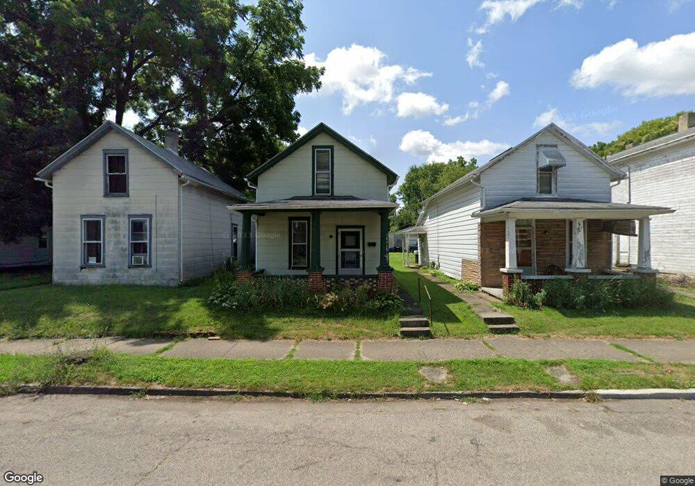
603 Sherman Ave Springfield, OH 45503
Estimated Value: $50,000 - $94,000
2
Beds
1
Bath
904
Sq Ft
$73/Sq Ft
Est. Value
About This Home
This home is located at 603 Sherman Ave, Springfield, OH 45503 and is currently estimated at $66,329, approximately $73 per square foot. 603 Sherman Ave is a home located in Clark County with nearby schools including Lagonda Elementary School, Roosevelt Middle School, and Springfield High School.
Ownership History
Date
Name
Owned For
Owner Type
Purchase Details
Closed on
Jun 17, 2020
Sold by
Hampton Louis N
Bought by
Future Sights Llc
Current Estimated Value
Purchase Details
Closed on
Jun 4, 2020
Sold by
Reed Hattie E
Bought by
Hampton Louis N
Purchase Details
Closed on
Jan 8, 2019
Sold by
Hampton Louis N and Hampton Luvenia
Bought by
Hampton Luis N
Purchase Details
Closed on
Nov 2, 1992
Sold by
Reed Ivan W and Reed Hattie E
Bought by
Hampton Louis N and Hampton Louis N
Purchase Details
Closed on
Jan 1, 1981
Create a Home Valuation Report for This Property
The Home Valuation Report is an in-depth analysis detailing your home's value as well as a comparison with similar homes in the area
Home Values in the Area
Average Home Value in this Area
Purchase History
| Date | Buyer | Sale Price | Title Company |
|---|---|---|---|
| Future Sights Llc | $21,000 | Team Ttl & Closing Svcs Llc | |
| Hampton Louis N | -- | Team Ttl & Closing Svcs Llc | |
| Hampton Luis N | -- | None Available | |
| Hampton Louis N | $6,000 | -- | |
| -- | $4,500 | -- |
Source: Public Records
Tax History
| Year | Tax Paid | Tax Assessment Tax Assessment Total Assessment is a certain percentage of the fair market value that is determined by local assessors to be the total taxable value of land and additions on the property. | Land | Improvement |
|---|---|---|---|---|
| 2025 | $596 | $14,480 | $2,260 | $12,220 |
| 2024 | $581 | $11,770 | $2,180 | $9,590 |
| 2023 | $581 | $11,770 | $2,180 | $9,590 |
| 2022 | $596 | $11,770 | $2,180 | $9,590 |
| 2021 | $479 | $8,710 | $1,610 | $7,100 |
| 2020 | $480 | $8,710 | $1,610 | $7,100 |
| 2019 | $481 | $8,710 | $1,610 | $7,100 |
| 2018 | $452 | $7,860 | $1,610 | $6,250 |
| 2017 | $452 | $7,862 | $1,614 | $6,248 |
| 2016 | $452 | $7,862 | $1,614 | $6,248 |
| 2015 | $447 | $7,620 | $1,614 | $6,006 |
| 2014 | $445 | $7,620 | $1,614 | $6,006 |
| 2013 | $441 | $7,620 | $1,614 | $6,006 |
Source: Public Records
Map
Nearby Homes
- 726 E Madison Ave
- 412 E Madison Ave
- 242 Chestnut Ave
- 802 Warder St
- 368 E Madison Ave
- 825-827 Elm St
- 836-838 Rodgers Dr
- 469 E Cecil St Unit 471
- 469-471 E Cecil St
- 0 Mitchell Blvd
- 1015 Rodgers Dr
- 1009 Elm St
- 114-116 E Ward St
- 736 E Northern Ave
- 307 E Northern Ave
- 33-35 E Ward St
- 29 E Ward St
- 1105 Farlow St
- 825 E McCreight Ave
- 1007 N Limestone St
- 601 Sherman Ave
- 605 Sherman Ave
- 611 Sherman Ave
- 617 Sherman Ave
- 531 N Murray St Unit 533
- 527 N Murray St
- 555 Sherman Ave
- 523 N Murray St
- 618 Sherman Ave Unit 620
- 602 Sherman Ave
- 608 Sherman Ave Unit 610
- 570 Sherman Ave
- 564 Chestnut Ave
- 564 Sherman Ave
- 564 Sherman Ave
- 538 N Murray St
- 542 N Murray St
- 556 Chestnut Ave
- 534 N Murray St
- 560 Sherman Ave
Your Personal Tour Guide
Ask me questions while you tour the home.