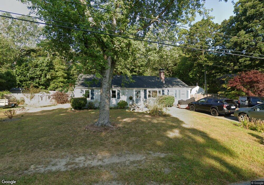
603 Skunknet Rd Centerville, MA 02632
Centerville NeighborhoodEstimated Value: $627,940 - $656,000
3
Beds
2
Baths
1,501
Sq Ft
$425/Sq Ft
Est. Value
About This Home
This home is located at 603 Skunknet Rd, Centerville, MA 02632 and is currently estimated at $638,235, approximately $425 per square foot. 603 Skunknet Rd is a home located in Barnstable County with nearby schools including West Villages Elementary School, Barnstable United Elementary School, and Barnstable Intermediate School.
Ownership History
Date
Name
Owned For
Owner Type
Purchase Details
Closed on
Aug 17, 2004
Sold by
Beatty Joanne A and Beatty Wilbert C
Bought by
Hopper Julie A
Current Estimated Value
Home Financials for this Owner
Home Financials are based on the most recent Mortgage that was taken out on this home.
Original Mortgage
$245,000
Outstanding Balance
$119,298
Interest Rate
6.16%
Mortgage Type
Purchase Money Mortgage
Estimated Equity
$518,937
Purchase Details
Closed on
Mar 1, 2000
Sold by
Marino John E and Marino Paige M
Bought by
Beatty Joanne A
Home Financials for this Owner
Home Financials are based on the most recent Mortgage that was taken out on this home.
Original Mortgage
$110,000
Interest Rate
8.21%
Mortgage Type
Purchase Money Mortgage
Purchase Details
Closed on
Jun 1, 1995
Sold by
Emerald Rt
Bought by
Marino John E
Create a Home Valuation Report for This Property
The Home Valuation Report is an in-depth analysis detailing your home's value as well as a comparison with similar homes in the area
Home Values in the Area
Average Home Value in this Area
Purchase History
| Date | Buyer | Sale Price | Title Company |
|---|---|---|---|
| Hopper Julie A | $337,500 | -- | |
| Beatty Joanne A | $150,000 | -- | |
| Marino John E | $90,000 | -- |
Source: Public Records
Mortgage History
| Date | Status | Borrower | Loan Amount |
|---|---|---|---|
| Open | Hopper Julie A | $245,000 | |
| Previous Owner | Marino John E | $55,700 | |
| Previous Owner | Marino John E | $110,000 |
Source: Public Records
Tax History
| Year | Tax Paid | Tax Assessment Tax Assessment Total Assessment is a certain percentage of the fair market value that is determined by local assessors to be the total taxable value of land and additions on the property. | Land | Improvement |
|---|---|---|---|---|
| 2025 | $4,425 | $547,000 | $151,900 | $395,100 |
| 2024 | $4,243 | $543,300 | $151,900 | $391,400 |
| 2023 | $3,991 | $478,500 | $138,100 | $340,400 |
| 2022 | $3,816 | $395,800 | $102,300 | $293,500 |
| 2021 | $3,570 | $340,300 | $102,300 | $238,000 |
| 2020 | $3,669 | $334,800 | $102,300 | $232,500 |
| 2019 | $3,474 | $308,000 | $102,300 | $205,700 |
| 2018 | $3,116 | $277,700 | $107,700 | $170,000 |
| 2017 | $2,896 | $269,100 | $107,700 | $161,400 |
| 2016 | $2,942 | $269,900 | $108,500 | $161,400 |
| 2015 | $2,864 | $264,000 | $105,100 | $158,900 |
Source: Public Records
Map
Nearby Homes
- 51 Larch Ln
- 200 Lumbert Mill Rd
- 53 Meadow Farm Rd
- 52 Meadow Farm Rd
- 103 Pine Tree Dr
- 315 Prince Hinckley Rd
- 296 Buckskin Path
- 7 Ebenezer
- 82 Yacht Club Rd
- 19 Marrick Ct
- 351 Swift Ave
- 900 Old Stage Rd
- 87 Foxglove Rd
- 369 Bumps River Rd
- 12 S Cedar Rd
- 156 S Main St
- 40 Sachem Dr
- 818 S Main St
- 89 Swift Ave
- 1028 Old Falmouth Rd
- 611 Skunknet Rd
- 589 Skunknet Rd
- 602 Skunknet Rd
- 621 Skunknet Rd
- 613 Skunknet Rd
- 592 Skunknet Rd
- 28 Manni Cir
- 42 Natka Dr
- 618 Skunknet Rd
- 579 Skunknet Rd
- 31 Manni Cir
- 608 Skunknet Rd
- 32 Natka Dr
- 628 Skunknet Rd
- 578 Skunknet Rd
- 610 Skunknet Rd
- 635 Skunknet Rd
- 569 Skunknet Rd
- 586 Skunknet Rd
- 33 Manni Cir
Your Personal Tour Guide
Ask me questions while you tour the home.