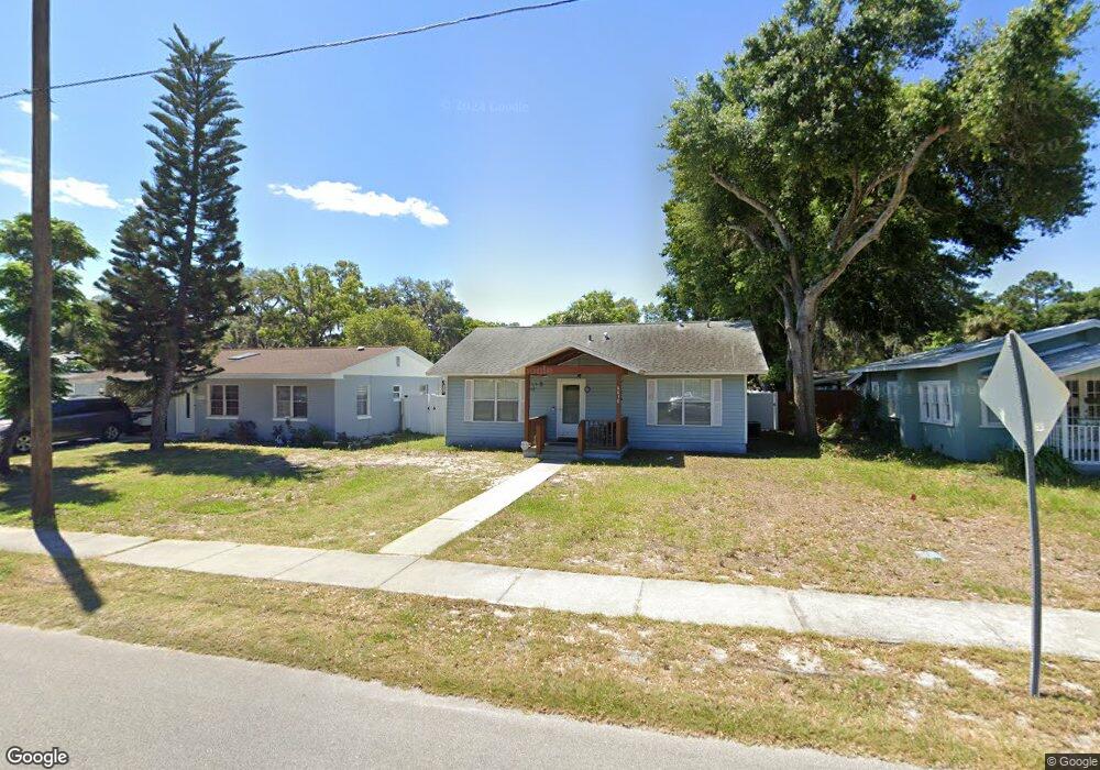
6030 Illinois Ave New Port Richey, FL 34653
Downtown New Port Richey NeighborhoodEstimated Value: $210,000 - $287,000
--
Bed
2
Baths
1,256
Sq Ft
$201/Sq Ft
Est. Value
About This Home
This home is located at 6030 Illinois Ave, New Port Richey, FL 34653 and is currently estimated at $252,975, approximately $201 per square foot. 6030 Illinois Ave is a home located in Pasco County with nearby schools including Richey Elementary School, Gulf Middle School, and Gulf High School.
Ownership History
Date
Name
Owned For
Owner Type
Purchase Details
Closed on
Jun 29, 1998
Sold by
Mcmasters Lori M
Bought by
Howard Jean A
Current Estimated Value
Home Financials for this Owner
Home Financials are based on the most recent Mortgage that was taken out on this home.
Original Mortgage
$56,950
Outstanding Balance
$11,552
Interest Rate
7.21%
Mortgage Type
FHA
Estimated Equity
$241,423
Purchase Details
Closed on
Mar 17, 1994
Sold by
Mallett Walter J
Bought by
Mcmaster Lori M
Purchase Details
Closed on
Jul 2, 1993
Sold by
Heritage Trail Const Inc
Bought by
Mallett Walter J
Create a Home Valuation Report for This Property
The Home Valuation Report is an in-depth analysis detailing your home's value as well as a comparison with similar homes in the area
Home Values in the Area
Average Home Value in this Area
Purchase History
| Date | Buyer | Sale Price | Title Company |
|---|---|---|---|
| Howard Jean A | $57,000 | -- | |
| Mcmaster Lori M | $8,000 | -- | |
| Mallett Walter J | -- | -- |
Source: Public Records
Mortgage History
| Date | Status | Borrower | Loan Amount |
|---|---|---|---|
| Open | Howard Jean A | $56,950 |
Source: Public Records
Tax History Compared to Growth
Tax History
| Year | Tax Paid | Tax Assessment Tax Assessment Total Assessment is a certain percentage of the fair market value that is determined by local assessors to be the total taxable value of land and additions on the property. | Land | Improvement |
|---|---|---|---|---|
| 2025 | $1,028 | $75,780 | -- | -- |
| 2024 | $1,028 | $73,650 | -- | -- |
| 2023 | $1,021 | $71,510 | $0 | $0 |
| 2022 | $956 | $68,340 | $0 | $0 |
| 2021 | $951 | $66,350 | $23,000 | $43,350 |
| 2020 | $947 | $65,440 | $14,000 | $51,440 |
| 2019 | $938 | $63,970 | $0 | $0 |
| 2018 | $931 | $62,777 | $0 | $0 |
| 2017 | $937 | $62,777 | $0 | $0 |
| 2016 | $844 | $59,809 | $0 | $0 |
| 2015 | $856 | $59,393 | $0 | $0 |
| 2014 | $854 | $60,977 | $10,520 | $50,457 |
Source: Public Records
Map
Nearby Homes
- 6033 Illinois Ave
- 10840 State Road 52
- 6110 Missouri Ave
- 5800 Madison St
- 6170 Nebraska Ave
- 6220 Missouri Ave
- 6105 & 6107 Adams St
- 6201 Main St
- 6339 Delaware Ave
- 5853 Harrison St
- 6316 Alaska Ave
- 5750 Georgia Ave
- 6108 Oak Ridge Ave
- 6340 Harrison St
- 5640 Ferguson Ct Unit 2203
- 5922 Pennsylvania Ave
- 6345 Old Main St
- 5627 Ferguson Ct Unit 1303
- 5728 Colonial Dr
- 5736 Colonial Dr
- 6024 Illinois Ave
- 6036 Illinois Ave
- 6040 Illinois Ave
- 6020 Illinois Ave
- 5931 Monroe St
- 6029 Wyoming Ave
- 6027 Wyoming Ave
- 6050 Illinois Ave
- 6041 Illinois Ave
- 6004 Illinois Ave
- 6027 Illinois Ave
- 5940 Monroe St
- 5921 Monroe St
- 6102 Illinois Ave
- 6021 Illinois Ave
- 5930 Madison St
- 6015 Wyoming Ave
- 5922, 5926, 5930 Monroe St
- 6015 Monroe St
- 6051 Illinois Ave