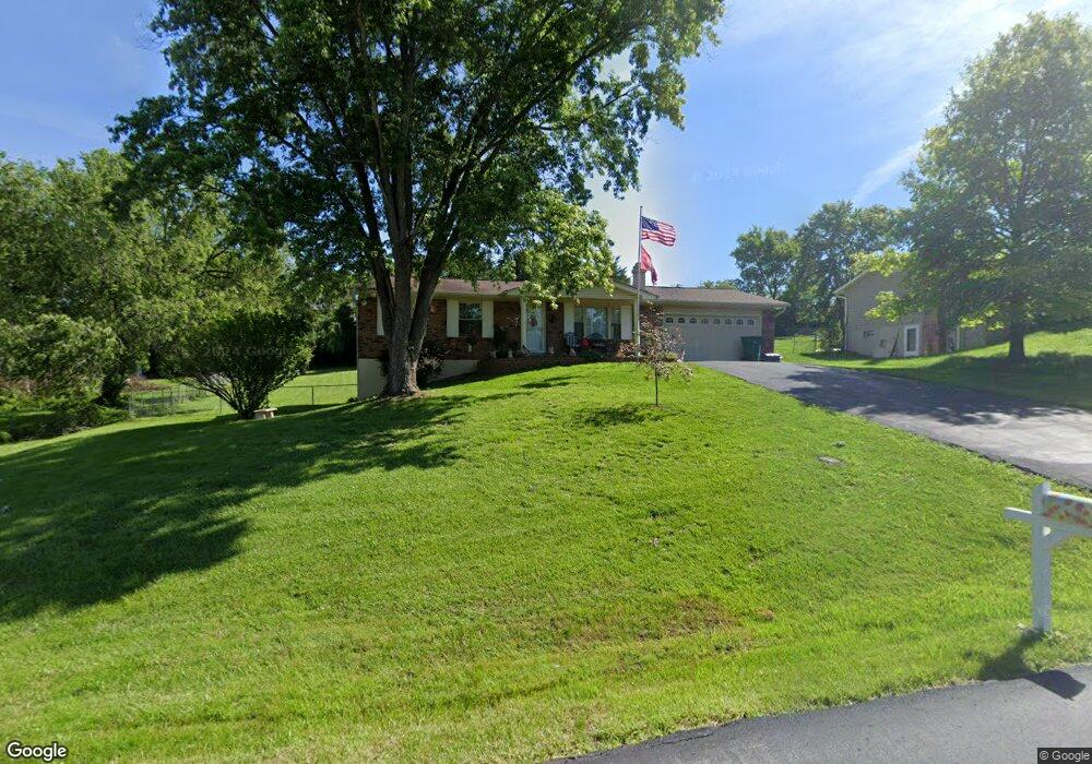
6031 Carol St House Springs, MO 63051
Estimated Value: $207,000 - $241,000
--
Bed
1
Bath
1,120
Sq Ft
$202/Sq Ft
Est. Value
About This Home
This home is located at 6031 Carol St, House Springs, MO 63051 and is currently estimated at $226,005, approximately $201 per square foot. 6031 Carol St is a home located in Jefferson County with nearby schools including Northwest High School and St. Anthony School.
Ownership History
Date
Name
Owned For
Owner Type
Purchase Details
Closed on
Apr 12, 2022
Sold by
Mensio Daniel J and Mensio Karen E
Bought by
Daniel J Mensio And Karen E Mensio Revocable
Current Estimated Value
Purchase Details
Closed on
May 16, 2003
Sold by
Stroder Kenneth G and Stroder Connie J
Bought by
Mensio Daniel J and Mensio Karen E
Home Financials for this Owner
Home Financials are based on the most recent Mortgage that was taken out on this home.
Original Mortgage
$107,120
Interest Rate
5.84%
Mortgage Type
Purchase Money Mortgage
Create a Home Valuation Report for This Property
The Home Valuation Report is an in-depth analysis detailing your home's value as well as a comparison with similar homes in the area
Home Values in the Area
Average Home Value in this Area
Purchase History
| Date | Buyer | Sale Price | Title Company |
|---|---|---|---|
| Daniel J Mensio And Karen E Mensio Revocable | -- | None Listed On Document | |
| Mensio Daniel J | -- | -- |
Source: Public Records
Mortgage History
| Date | Status | Borrower | Loan Amount |
|---|---|---|---|
| Previous Owner | Mensio Daniel J | $107,120 |
Source: Public Records
Tax History Compared to Growth
Tax History
| Year | Tax Paid | Tax Assessment Tax Assessment Total Assessment is a certain percentage of the fair market value that is determined by local assessors to be the total taxable value of land and additions on the property. | Land | Improvement |
|---|---|---|---|---|
| 2025 | $1,285 | $19,300 | $1,900 | $17,400 |
| 2024 | $1,285 | $17,800 | $1,900 | $15,900 |
| 2023 | $1,285 | $17,800 | $1,900 | $15,900 |
| 2022 | $1,279 | $17,800 | $1,900 | $15,900 |
| 2021 | $1,229 | $17,200 | $1,900 | $15,300 |
| 2020 | $1,156 | $15,800 | $1,600 | $14,200 |
| 2019 | $1,155 | $15,800 | $1,600 | $14,200 |
| 2018 | $1,170 | $15,800 | $1,600 | $14,200 |
| 2017 | $1,069 | $15,800 | $1,600 | $14,200 |
| 2016 | $983 | $14,400 | $1,800 | $12,600 |
| 2015 | $1,010 | $14,400 | $1,800 | $12,600 |
| 2013 | -- | $14,200 | $1,800 | $12,400 |
Source: Public Records
Map
Nearby Homes
- 6042 Carol St
- 172 Cardinal Ln Unit 172
- 173 Cardinal Ln Unit 173
- 74 Mockingbird Hill Unit 74
- 185 Bobwhite Ln Unit 185
- 65 Mockingbird Hill Unit 65
- 0 Manor Crest Dr Unit MIS25054810
- 192 Bobwhite Ln Unit 192
- 5899 Midridge Dr
- 6144 Misty Meadow Dr
- 5916 Roger Rd
- 4138 Elizabeth Dr
- 3833 Dorchester Ct
- 5814 Mayfair Ct
- 5919 Brookside Place
- 5916 Brookside Place
- 3734 Carol Park Rd
- 6302 Upper Byrnes Mill Rd
- 0 Old Gravois Rd
- 0 Lots 6 Cedar Dr
- 6025 Carol St
- 6043 Carol St
- 6036 Carol St
- 6024 Carol St
- 6019 Carol St
- 112 Brooks Farm Ct
- 108 Brooks Farm Ct
- 6049 Carol St
- 6018 Carol St
- 116 Brooks Farm Ct
- 6013 Carol St
- 6055 Carol St
- 6048 Carol St
- 104 Brooks Farm Ct
- 120 Brooks Farm Ct
- 6012 Carol St
- 6054 Carol St
- 6061 Carol St
- 109 Brooks Farm Ct
- 6006 Carol St