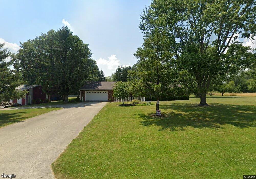
6032 County Road 139 Findlay, OH 45840
Estimated Value: $367,147 - $554,000
3
Beds
2
Baths
1,663
Sq Ft
$266/Sq Ft
Est. Value
About This Home
This home is located at 6032 County Road 139, Findlay, OH 45840 and is currently estimated at $441,787, approximately $265 per square foot. 6032 County Road 139 is a home located in Hancock County with nearby schools including Liberty-Benton Elementary School, Liberty-Benton Middle School, and Liberty-Benton High School.
Ownership History
Date
Name
Owned For
Owner Type
Purchase Details
Closed on
Mar 3, 2023
Sold by
Fisher Jeannine R
Bought by
Zeiter Brent R
Current Estimated Value
Purchase Details
Closed on
Aug 28, 2017
Sold by
Corbin Larry L and Corbin Mary A
Bought by
Fisher Jeannine R and Zeiter Brent R
Home Financials for this Owner
Home Financials are based on the most recent Mortgage that was taken out on this home.
Original Mortgage
$233,974
Interest Rate
3.87%
Mortgage Type
FHA
Purchase Details
Closed on
Jun 17, 1991
Bought by
Corbin Larry and Corbin Mary A
Purchase Details
Closed on
Aug 11, 1987
Bought by
Zeltner Ervin H and Ruth Ann
Create a Home Valuation Report for This Property
The Home Valuation Report is an in-depth analysis detailing your home's value as well as a comparison with similar homes in the area
Home Values in the Area
Average Home Value in this Area
Purchase History
| Date | Buyer | Sale Price | Title Company |
|---|---|---|---|
| Zeiter Brent R | $25,000 | -- | |
| Fisher Jeannine R | $255,500 | Am Title | |
| Corbin Larry | $145,000 | -- | |
| Zeltner Ervin H | -- | -- |
Source: Public Records
Mortgage History
| Date | Status | Borrower | Loan Amount |
|---|---|---|---|
| Previous Owner | Fisher Jeannine R | $233,974 |
Source: Public Records
Tax History Compared to Growth
Tax History
| Year | Tax Paid | Tax Assessment Tax Assessment Total Assessment is a certain percentage of the fair market value that is determined by local assessors to be the total taxable value of land and additions on the property. | Land | Improvement |
|---|---|---|---|---|
| 2024 | $3,407 | $91,440 | $16,860 | $74,580 |
| 2023 | $3,327 | $91,440 | $16,860 | $74,580 |
| 2022 | $3,295 | $91,440 | $16,860 | $74,580 |
| 2021 | $2,830 | $69,310 | $15,490 | $53,820 |
| 2020 | $2,854 | $69,310 | $15,490 | $53,820 |
| 2019 | $2,739 | $69,310 | $15,490 | $53,820 |
| 2018 | $2,222 | $62,040 | $12,910 | $49,130 |
| 2017 | $2,292 | $62,040 | $12,910 | $49,130 |
| 2016 | $1,918 | $62,040 | $12,910 | $49,130 |
| 2015 | $2,026 | $63,830 | $12,910 | $50,920 |
| 2014 | $2,044 | $63,830 | $12,910 | $50,920 |
| 2012 | $1,941 | $58,780 | $12,910 | $45,870 |
Source: Public Records
Map
Nearby Homes
- 8922 Township Road 94
- 0 County Road 95 Unit 6097574
- 0 County Road 140
- 0 Rock Candy Rd Unit Lot 159
- 0 Rock Candy Rd Unit Lot 170
- 0 Rock Candy Rd Unit Lot 172 206819
- 0 Rock Candy Rd Unit Lot 162
- 0 Rock Candy Rd Unit Lot 171
- 0 Rock Candy Rd Unit Lot 168
- 0 Rock Candy Rd Or Bushwillow Dr Unit Lot 173
- 0 Bearcat Way Or Rock Candy Rd Unit Lot 167
- 0 Bushwillow Dr Or Rock Candy Rd Unit Lot 157
- 6535 Silver Lake Dr
- 9960 W Us Route 224
- 1405 Cypress Lake
- 3106 Saddlebrook
- 3018 Gleneagle Dr
- 0 County Road 223
- 933 Laurel Ln
- 1310 Muirfield Dr
- 6263 County Road 139
- 6243 County Road 139
- 6404 County Road 139
- 6408 County Road 139
- 6155 County Road 139
- 9038 Township Road 95
- 9038 Trail 95
- 9051 Township Road 95
- 8760 Township Road 95
- 8833 Township Road 95
- 9180 Township Road 95
- 9089 Township Road 95
- 9157 Township Road 95
- 8765 Township Road 95
- 5925 County Road 139
- 8676 Township Road 95
- 8727 Township Road 95
- 9199 Township Road 95
- 6671 County Road 139
- 8622 Township Road 95