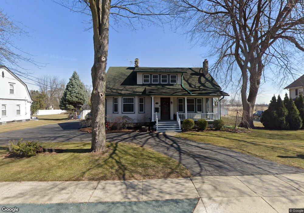
6035 Chicago Rd Warren, MI 48092
Northwest Warren NeighborhoodEstimated Value: $285,000 - $407,000
3
Beds
3
Baths
2,385
Sq Ft
$137/Sq Ft
Est. Value
About This Home
This home is located at 6035 Chicago Rd, Warren, MI 48092 and is currently estimated at $325,745, approximately $136 per square foot. 6035 Chicago Rd is a home located in Macomb County with nearby schools including Green Acres Elementary School, Beer Middle School, and Warren Mott High School.
Ownership History
Date
Name
Owned For
Owner Type
Purchase Details
Closed on
Sep 9, 2003
Sold by
Ashford Sandra and Ashford Clifton
Bought by
Scensny Renee A and Frontera Walter B
Current Estimated Value
Home Financials for this Owner
Home Financials are based on the most recent Mortgage that was taken out on this home.
Original Mortgage
$175,000
Interest Rate
5.12%
Mortgage Type
Purchase Money Mortgage
Purchase Details
Closed on
Jun 18, 1997
Sold by
Kujawa C and Kujawa J
Bought by
Ashford C and Ashford S
Create a Home Valuation Report for This Property
The Home Valuation Report is an in-depth analysis detailing your home's value as well as a comparison with similar homes in the area
Home Values in the Area
Average Home Value in this Area
Purchase History
| Date | Buyer | Sale Price | Title Company |
|---|---|---|---|
| Scensny Renee A | $230,000 | Blue Moon Title | |
| Ashford C | $137,500 | -- |
Source: Public Records
Mortgage History
| Date | Status | Borrower | Loan Amount |
|---|---|---|---|
| Previous Owner | Scensny Renee A | $175,000 |
Source: Public Records
Tax History
| Year | Tax Paid | Tax Assessment Tax Assessment Total Assessment is a certain percentage of the fair market value that is determined by local assessors to be the total taxable value of land and additions on the property. | Land | Improvement |
|---|---|---|---|---|
| 2025 | $3,676 | $166,580 | $0 | $0 |
| 2024 | $36 | $153,200 | $0 | $0 |
| 2023 | $3,410 | $143,810 | $0 | $0 |
| 2022 | $3,294 | $131,880 | $0 | $0 |
| 2021 | $3,352 | $127,610 | $0 | $0 |
| 2020 | $3,232 | $107,510 | $0 | $0 |
| 2019 | $3,116 | $101,280 | $0 | $0 |
| 2018 | $2,975 | $73,160 | $0 | $0 |
| 2017 | $3,125 | $71,750 | $17,140 | $54,610 |
| 2016 | $3,121 | $71,750 | $0 | $0 |
| 2015 | -- | $67,130 | $0 | $0 |
| 2012 | -- | $56,290 | $0 | $0 |
Source: Public Records
Map
Nearby Homes
- 32075 Saint Annes Dr
- 32076 Saint Annes Dr
- 32436 Saint Annes Dr
- 31778 Cloverly Ct
- 5612 Streefkerk Dr
- 5441 Arden Ave
- 6222 Peck Ave
- 5010 Kelly Dr
- 4896 Chicago Rd
- 5211 Streefkerk Dr
- 5664 Murphy Ct
- 31030 Cousino Dr
- 4812 Berwyn Dr
- 32416 Exeter Dr
- 33121 Defour Dr
- 32838 Grinsell Dr
- 4702 Arden Ave
- 4780 S Tuxedo Dr
- 30295 Berghway Trail
- 5552 Southlawn Dr
- 6051 Chicago Rd
- 6017 Chicago Rd
- 6003 Chicago Rd
- 6061 Chicago Rd
- 6048 Chicago Rd
- 5981 Chicago Rd
- 6115 Chicago Rd
- 31761 Flynn Ave
- 6070 Chicago Rd
- 5972 Chicago Rd Unit Suite A / Suite B
- 5972 Chicago Rd Unit A and B
- 5972 Chicago Rd Unit A
- 31751 Flynn Ave
- 5957 Chicago Rd
- 5966 Chicago Rd
- 31741 Flynn Ave
- 31670 Flynn Ave
- 31730 Mound Rd
- 31687 Flynn Ave
- 6106 Chicago Rd
Your Personal Tour Guide
Ask me questions while you tour the home.