Estimated Value: $279,064 - $373,000
3
Beds
1
Bath
1,440
Sq Ft
$217/Sq Ft
Est. Value
About This Home
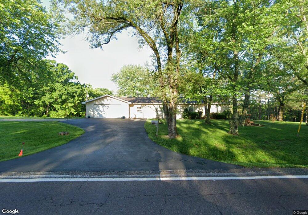
This home is located at 6035 Highway V, Union, MO 63084 and is currently estimated at $313,021, approximately $217 per square foot. 6035 Highway V is a home located in Franklin County with nearby schools including Union High School, Immaculate Conception School, and St. John The Baptist School.
Ownership History
Date
Name
Owned For
Owner Type
Purchase Details
Closed on
Apr 22, 2020
Sold by
Dueker Trust
Bought by
Kluesner Teresa J and Kluesner Dennis L
Current Estimated Value
Home Financials for this Owner
Home Financials are based on the most recent Mortgage that was taken out on this home.
Original Mortgage
$171,000
Outstanding Balance
$151,445
Interest Rate
3.5%
Mortgage Type
New Conventional
Estimated Equity
$161,576
Purchase Details
Closed on
Jun 22, 2010
Sold by
Dueker Fred J and Dueker Geraldine Straatmann
Bought by
Dueker Geraldine R and Geraldine Dueker Trust
Create a Home Valuation Report for This Property
The Home Valuation Report is an in-depth analysis detailing your home's value as well as a comparison with similar homes in the area
Home Values in the Area
Average Home Value in this Area
Purchase History
| Date | Buyer | Sale Price | Title Company |
|---|---|---|---|
| Kluesner Teresa J | -- | None Available | |
| Dueker Geraldine R | -- | None Available |
Source: Public Records
Mortgage History
| Date | Status | Borrower | Loan Amount |
|---|---|---|---|
| Open | Kluesner Teresa J | $171,000 |
Source: Public Records
Tax History Compared to Growth
Tax History
| Year | Tax Paid | Tax Assessment Tax Assessment Total Assessment is a certain percentage of the fair market value that is determined by local assessors to be the total taxable value of land and additions on the property. | Land | Improvement |
|---|---|---|---|---|
| 2025 | $1,598 | $32,866 | $0 | $0 |
| 2024 | $1,598 | $30,116 | $0 | $0 |
| 2023 | $1,607 | $30,116 | $0 | $0 |
| 2022 | $1,496 | $27,964 | $0 | $0 |
| 2021 | $1,499 | $27,964 | $0 | $0 |
| 2020 | $1,364 | $25,076 | $0 | $0 |
| 2019 | $1,360 | $25,076 | $0 | $0 |
| 2018 | $1,132 | $22,128 | $0 | $0 |
| 2017 | $1,137 | $22,128 | $0 | $0 |
| 2016 | $1,077 | $20,431 | $0 | $0 |
| 2015 | $1,058 | $20,431 | $0 | $0 |
| 2014 | $1,065 | $20,469 | $0 | $0 |
Source: Public Records
Map
Nearby Homes
- 5950 Highway V
- 000 Mo-V
- 0 Highway V
- 408 Godsey Dr
- 1122 Old County Farm Rd
- 105 E Roosevelt Ave
- 323 Park Hill Dr
- 1017 Delmar Ave
- 510 N Oak St
- Lot 2 E State Highway 47
- Lot 1 E State Highway 47
- 435 Water Tower Dr
- 614 E State St
- 204 Wally Ave
- 300 Bourbeuse Rd
- 695 Clearview Heights Dr
- 613 W State St
- 507 S Oak St
- 21 Forest Ln
- 23 Forest Ln
- 6019 Highway V
- 5992 Highway V
- 5802 21 Acres 5802 Hwy V
- 6068 Highway V
- 0 Hwy V Lot #2 Plsnt View Acs Unit 10018730
- 0 27 5 Acres Hwy V Unit 14026506
- 6020 Highway V
- 6081 Highway V
- 5975 Highway V
- 6083 Highway V
- 117 Platt Rd
- 121 Platt Rd
- 6018 Highway V
- 6123 Highway V
- 129 Platt Rd
- 144 Platt Rd
- 5956 Highway V
- 881 Winters Rd Unit 893
- 1782 Big Valley Dr
- 5951 Highway V