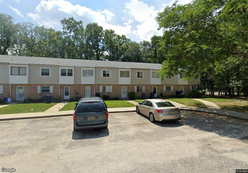
6036 Hoover Dr Mays Landing, NJ 08330
Estimated Value: $111,796 - $160,000
--
Bed
--
Bath
1,292
Sq Ft
$111/Sq Ft
Est. Value
About This Home
This home is located at 6036 Hoover Dr, Mays Landing, NJ 08330 and is currently estimated at $143,949, approximately $111 per square foot. 6036 Hoover Dr is a home located in Atlantic County with nearby schools including Joseph Shaner School, George L. Hess Educational Complex, and William Davies Middle School.
Ownership History
Date
Name
Owned For
Owner Type
Purchase Details
Closed on
Aug 17, 2022
Sold by
Brandywood Sales Associates Inc
Bought by
Jersey South Investors Llc
Current Estimated Value
Purchase Details
Closed on
Feb 23, 2016
Sold by
Loia Karen D and Brandywood Comdominium Associa
Bought by
Bandywood Sales Associates Inc
Purchase Details
Closed on
Jul 16, 2001
Sold by
Loia Joan M
Bought by
Loia Karen D
Purchase Details
Closed on
Mar 31, 1992
Sold by
Lee Jeong Hee
Bought by
Loia Peter C and Loia Joan M
Create a Home Valuation Report for This Property
The Home Valuation Report is an in-depth analysis detailing your home's value as well as a comparison with similar homes in the area
Home Values in the Area
Average Home Value in this Area
Purchase History
| Date | Buyer | Sale Price | Title Company |
|---|---|---|---|
| Jersey South Investors Llc | $28,000 | Stewart Title Guaranty Company | |
| Jersey South Investors Llc | $18,000 | -- | |
| Bandywood Sales Associates Inc | $18,000 | Madison Title Agency Llc | |
| Loia Karen D | -- | -- | |
| Loia Peter C | $55,000 | -- |
Source: Public Records
Tax History Compared to Growth
Tax History
| Year | Tax Paid | Tax Assessment Tax Assessment Total Assessment is a certain percentage of the fair market value that is determined by local assessors to be the total taxable value of land and additions on the property. | Land | Improvement |
|---|---|---|---|---|
| 2025 | $1,451 | $63,200 | $20,000 | $43,200 |
| 2024 | $1,451 | $42,300 | $4,500 | $37,800 |
| 2023 | $1,365 | $42,300 | $4,500 | $37,800 |
| 2022 | $1,365 | $42,300 | $4,500 | $37,800 |
| 2021 | $1,140 | $35,400 | $3,000 | $32,400 |
| 2020 | $1,140 | $35,400 | $3,000 | $32,400 |
| 2019 | $1,142 | $35,400 | $3,000 | $32,400 |
| 2018 | $1,102 | $35,400 | $3,000 | $32,400 |
| 2017 | $1,085 | $35,400 | $3,000 | $32,400 |
| 2016 | $1,195 | $40,100 | $5,000 | $35,100 |
| 2015 | $1,154 | $40,100 | $5,000 | $35,100 |
| 2014 | $1,476 | $56,200 | $5,000 | $51,200 |
Source: Public Records
Map
Nearby Homes
- 37 Delancy Ct
- 6310 Phillips Ave
- 6301 Knight Ave
- 6314 Lance Ave
- 87 Devon Rd
- 6202 Lance Ave
- 0 Harding Hwy Unit 597638
- 0 Harding Hwy Unit NJAC2019438
- 6206 Roberts Ave
- 6140 Robin Dr
- 16 Holly Ct
- 24 Holly Ct
- 0 Wheeling Ave Unit NJAC2018470
- 1 Walnut Ct
- 11 Maple Ct
- 13 Hickory Ln
- 14 Hickory Ln
- 39 Dogwood Ln Unit OAKS OF WEYMOUTH
- 39 Dogwood Ln
- 10 Locust Ct
- 6037 Hoover Dr Unit 3D
- 6035 Hoover Dr
- 6034 Hoover Dr Unit 3D
- 6038 Hoover Dr Unit 314
- 6033 Hoover Dr
- 6032 Hoover Dr
- 6031 Hoover Dr
- 6028 Hoover Dr Unit 2H
- 6025 Hoover Dr
- 6026 Hoover Dr
- 6024 Hoover Dr Unit 2D
- 6088 Hoover Dr Unit 8H
- 6023 Hoover Dr
- 6022 Hoover Dr
- 6021 Hoover Dr
- 6087 Hoover Dr
- 6086 Hoover Dr Unit 8F
- 6047 Hoover Dr
- 6048 Hoover Dr
- 6044 Hoover Dr