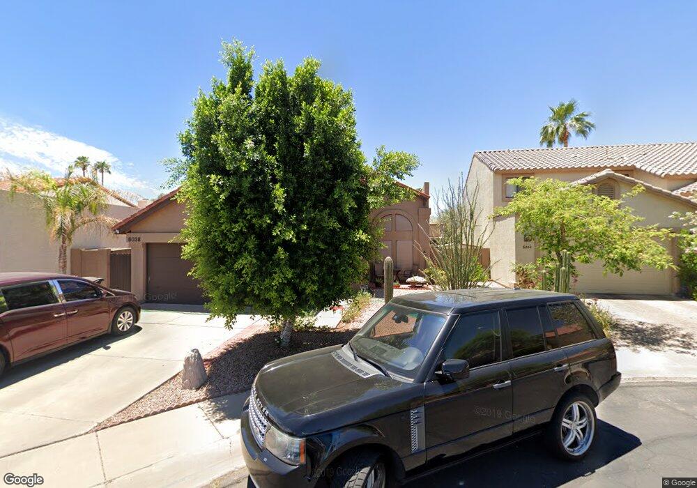
6038 N 81st St Scottsdale, AZ 85250
Indian Bend NeighborhoodEstimated Value: $686,000 - $913,000
--
Bed
4
Baths
2,075
Sq Ft
$374/Sq Ft
Est. Value
About This Home
This home is located at 6038 N 81st St, Scottsdale, AZ 85250 and is currently estimated at $775,969, approximately $373 per square foot. 6038 N 81st St is a home located in Maricopa County with nearby schools including Pueblo Elementary School, Navajo Elementary School, and Mohave Middle School.
Ownership History
Date
Name
Owned For
Owner Type
Purchase Details
Closed on
Nov 23, 2022
Sold by
May Richard J and May Pamela A
Bought by
Pamela Dehnert And Richard May Family Trust
Current Estimated Value
Purchase Details
Closed on
Oct 10, 2017
Sold by
Dehnert Pamela A and Ashby Pamela D
Bought by
May Richard J and Dehnert Pamela A
Home Financials for this Owner
Home Financials are based on the most recent Mortgage that was taken out on this home.
Original Mortgage
$205,000
Interest Rate
3.78%
Mortgage Type
VA
Purchase Details
Closed on
Jan 3, 1997
Sold by
Ashby Ralph Ruddell
Bought by
Ashby Pamela Ann Dehnert
Purchase Details
Closed on
Aug 3, 1995
Sold by
Ashby Ralph R
Bought by
Ashby Pamela D
Create a Home Valuation Report for This Property
The Home Valuation Report is an in-depth analysis detailing your home's value as well as a comparison with similar homes in the area
Home Values in the Area
Average Home Value in this Area
Purchase History
| Date | Buyer | Sale Price | Title Company |
|---|---|---|---|
| Pamela Dehnert And Richard May Family Trust | -- | -- | |
| May Richard J | -- | Old Republic Title Agency | |
| Ashby Pamela Ann Dehnert | -- | -- | |
| Ashby Pamela D | -- | United Title Agency | |
| Ashby Pamela D | $152,000 | United Title Agency |
Source: Public Records
Mortgage History
| Date | Status | Borrower | Loan Amount |
|---|---|---|---|
| Previous Owner | May Richard J | $205,000 |
Source: Public Records
Tax History Compared to Growth
Tax History
| Year | Tax Paid | Tax Assessment Tax Assessment Total Assessment is a certain percentage of the fair market value that is determined by local assessors to be the total taxable value of land and additions on the property. | Land | Improvement |
|---|---|---|---|---|
| 2025 | $2,004 | $33,225 | -- | -- |
| 2024 | $1,879 | $31,643 | -- | -- |
| 2023 | $1,879 | $54,970 | $10,990 | $43,980 |
| 2022 | $1,787 | $42,330 | $8,460 | $33,870 |
| 2021 | $1,936 | $37,010 | $7,400 | $29,610 |
| 2020 | $1,919 | $35,030 | $7,000 | $28,030 |
| 2019 | $1,861 | $33,330 | $6,660 | $26,670 |
| 2018 | $1,821 | $31,050 | $6,210 | $24,840 |
| 2017 | $1,718 | $29,130 | $5,820 | $23,310 |
| 2016 | $1,673 | $27,500 | $5,500 | $22,000 |
| 2015 | $1,620 | $27,120 | $5,420 | $21,700 |
Source: Public Records
Map
Nearby Homes
- 5942 N 83rd St
- 8238 E Keim Dr
- 8340 E McDonald Dr Unit 1003
- 5941 N 83rd St
- 5995 N 78th St Unit 2020
- 5995 N 78th St Unit 1024
- 5995 N 78th St Unit 1100
- 5995 N 78th St Unit 1037
- 5995 N 78th St Unit 2082
- 5995 N 78th St Unit 1113
- 5995 N 78th St Unit 1108
- 7844 E Rovey Ave Unit 361
- 7950 E Starlight Way Unit 132
- 7950 E Starlight Way Unit 131
- 7950 E Starlight Way Unit 153
- 6480 N 82nd St Unit 1107
- 6480 N 82nd St Unit 1116
- 5818 N Granite Reef Rd
- 7967 E Solano Dr
- 6249 N 78th St Unit 65
- 6032 N 81st St
- 6044 N 81st St
- 6037 N 80th Way
- 6043 N 80th Way
- 6031 N 80th Way
- 6026 N 81st St
- 6050 N 81st St
- 6025 N 80th Way
- 6037 N 81st St
- 6055 N 81st St
- 6031 N 81st St
- 6049 N 80th Way
- 6020 N 81st St
- 6043 N 81st St
- 6025 N 81st St
- 6019 N 80th Way
- 6049 N 81st St
- 6019 N 81st St
- 6014 N 81st St
- 6056 N 80th Way