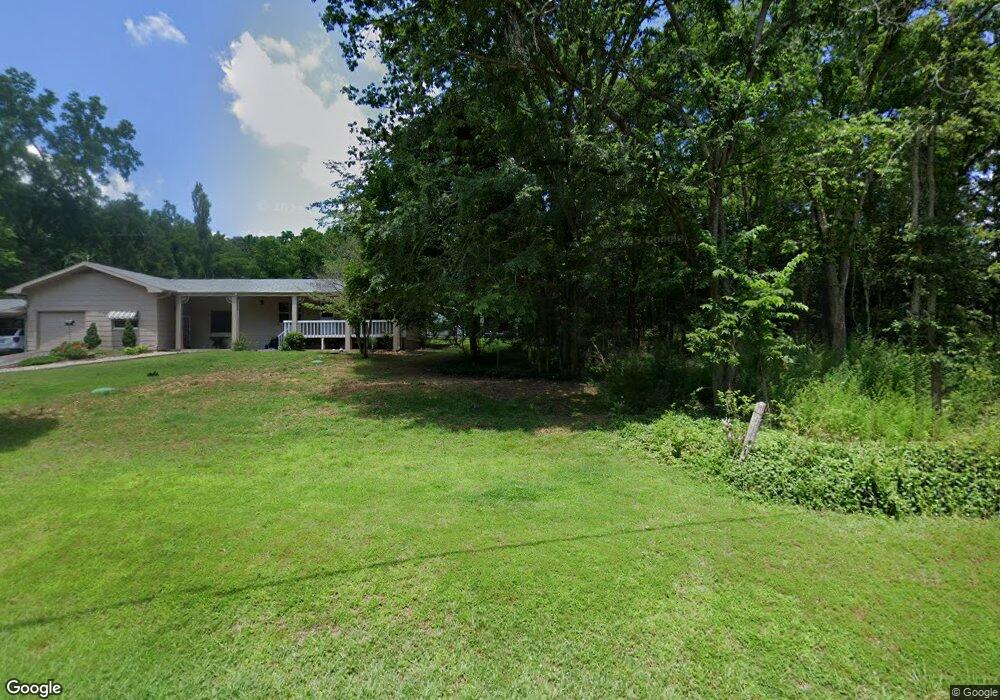
6039 State Highway T Branson, MO 65616
Estimated Value: $207,000 - $384,000
3
Beds
1
Bath
1,447
Sq Ft
$189/Sq Ft
Est. Value
About This Home
This home is located at 6039 State Highway T, Branson, MO 65616 and is currently estimated at $272,774, approximately $188 per square foot. 6039 State Highway T is a home located in Taney County with nearby schools including Cedar Ridge Primary, Cedar Ridge Intermediate School, and Cedar Ridge Elementary School.
Ownership History
Date
Name
Owned For
Owner Type
Purchase Details
Closed on
Nov 8, 2022
Sold by
Harshbarger Family Revocable Living Trus
Bought by
Harshbarger Fred R and Harshbarger Vickie
Current Estimated Value
Home Financials for this Owner
Home Financials are based on the most recent Mortgage that was taken out on this home.
Original Mortgage
$80,000
Outstanding Balance
$77,515
Interest Rate
6.94%
Mortgage Type
Seller Take Back
Estimated Equity
$195,259
Purchase Details
Closed on
Feb 11, 2020
Sold by
Harshbarger Fred and Harshbarger Janet
Bought by
Harshbarger Fred R and Harshbarger Janet A
Create a Home Valuation Report for This Property
The Home Valuation Report is an in-depth analysis detailing your home's value as well as a comparison with similar homes in the area
Purchase History
| Date | Buyer | Sale Price | Title Company |
|---|---|---|---|
| Harshbarger Fred R | -- | -- | |
| Harshbarger Fred R | -- | None Available |
Source: Public Records
Mortgage History
| Date | Status | Borrower | Loan Amount |
|---|---|---|---|
| Open | Harshbarger Fred R | $80,000 |
Source: Public Records
Tax History
| Year | Tax Paid | Tax Assessment Tax Assessment Total Assessment is a certain percentage of the fair market value that is determined by local assessors to be the total taxable value of land and additions on the property. | Land | Improvement |
|---|---|---|---|---|
| 2025 | $646 | $12,810 | -- | -- |
| 2023 | $646 | $12,460 | $0 | $0 |
| 2022 | $628 | $12,460 | $0 | $0 |
| 2021 | $625 | $12,460 | $0 | $0 |
| 2019 | $541 | $10,520 | $0 | $0 |
| 2018 | $542 | $10,520 | $0 | $0 |
| 2017 | $537 | $10,520 | $0 | $0 |
| 2016 | $525 | $10,300 | $0 | $0 |
| 2015 | $520 | $10,300 | $0 | $0 |
| 2014 | $477 | $9,880 | $0 | $0 |
Source: Public Records
Map
Nearby Homes
- 138 Cathy St
- 5557 State Highway T
- 360 Cathy St
- 000 Hwy 176
- 150 Persimmon
- 261 Cedar Point Rd
- 227 Cedar Point Rd
- 2529 Missouri 176 Unit A-7
- 260 Hobart Dr
- 155 Deer Run Dr
- 311 S Hickory St
- 2529 State Highway 176 Unit A9
- 2529 State Highway 176 Unit C2
- 280 Mach Ln
- Lot 11 Mach Ln
- 485 State Highway Ee
- 000 Missouri 176
- 14228 U S 160
- 250 Vin Villa
- 000 Vin Villa
- 6125 State Highway T
- 6100 State Highway T
- 6128 State Highway T
- 3 Earnhardt Dr
- 6147 State Highway T
- 5844 State Highway T
- 0 Earnhardt Dr Unit 11101257
- 0 Earnhardt Dr
- 146 Kyle Way
- 5955 State Highway T
- 178 Kyle Way
- 6009 State Highway T
- 5810 State Highway T
- 5831 T Hwy
- 5831 State Highway T
- 6312 State Highway T
- 306 Earnhardt Dr
- 5318 State Highway T
- 259 Thomas Trail
- 189 Sarah Ln
Your Personal Tour Guide
Ask me questions while you tour the home.