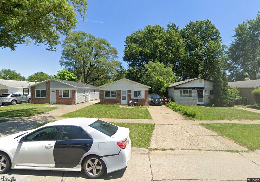
6039 Sylvia St Taylor, MI 48180
Estimated Value: $133,000 - $153,000
3
Beds
1
Bath
1,012
Sq Ft
$143/Sq Ft
Est. Value
About This Home
This home is located at 6039 Sylvia St, Taylor, MI 48180 and is currently estimated at $144,446, approximately $142 per square foot. 6039 Sylvia St is a home located in Wayne County with nearby schools including Holland Elementary School, Hoover Middle School, and Taylor High School.
Ownership History
Date
Name
Owned For
Owner Type
Purchase Details
Closed on
Oct 29, 2008
Sold by
Federal National Mortgage Association
Bought by
Bridges Sally
Current Estimated Value
Purchase Details
Closed on
Jul 17, 2008
Sold by
Citimortgage Inc
Bought by
Federal National Mortgage Association
Purchase Details
Closed on
Nov 5, 2003
Sold by
Harvell Wayne P and Harvell Tracy L
Bought by
Rosado Fredy
Purchase Details
Closed on
Nov 6, 1998
Sold by
Harvell Brian
Bought by
Lharvell Tracy
Create a Home Valuation Report for This Property
The Home Valuation Report is an in-depth analysis detailing your home's value as well as a comparison with similar homes in the area
Home Values in the Area
Average Home Value in this Area
Purchase History
| Date | Buyer | Sale Price | Title Company |
|---|---|---|---|
| Bridges Sally | $17,500 | Warranty Title Agency Llc | |
| Federal National Mortgage Association | -- | None Available | |
| Citimortgage Inc | $75,483 | None Available | |
| Rosado Fredy | $81,000 | Multiple | |
| Lharvell Tracy | $65,000 | -- |
Source: Public Records
Tax History Compared to Growth
Tax History
| Year | Tax Paid | Tax Assessment Tax Assessment Total Assessment is a certain percentage of the fair market value that is determined by local assessors to be the total taxable value of land and additions on the property. | Land | Improvement |
|---|---|---|---|---|
| 2025 | $1,511 | $54,800 | $0 | $0 |
| 2024 | $1,511 | $47,600 | $0 | $0 |
| 2023 | $2,334 | $43,200 | $0 | $0 |
| 2022 | $1,421 | $35,900 | $0 | $0 |
| 2021 | $2,353 | $33,500 | $0 | $0 |
| 2020 | $1,565 | $32,200 | $0 | $0 |
| 2019 | $173,714 | $27,900 | $0 | $0 |
| 2018 | $1,248 | $24,300 | $0 | $0 |
| 2017 | $626 | $24,200 | $0 | $0 |
| 2016 | $2,767 | $23,500 | $0 | $0 |
| 2015 | $1,980 | $19,800 | $0 | $0 |
| 2013 | $2,170 | $22,500 | $0 | $0 |
| 2012 | $1,431 | $21,900 | $6,100 | $15,800 |
Source: Public Records
Map
Nearby Homes
- 6368 Hazel St
- 6211 Inkster Rd
- 6107 John Daly St
- 5970 John Daly St
- 6221 Inkster Rd
- 5993 John Daly St
- 6370 Hampden St
- 5526 Sylvia St
- 6075 Duncan St
- 6319 Duncan St
- 26215 Beverly Rd
- 6179 Fellrath St
- 6338 Marvin St
- 26532 Powers Ave
- 5961 Marvin St
- 27523 Powers St
- 4863 Glenis St
- 27620 Newcastle St
- 6363 Mcguire St
- 0 Ecorse Service Rd
- 6045 Sylvia St
- 6035 Sylvia St
- 6051 Sylvia St
- 6025 Sylvia St
- 6017 Sylvia St
- 6034 Hazel St
- 6030 Hazel St
- 6009 Sylvia St
- 27008 Jeannette Ct
- 6024 Hazel St
- 6024 Hazel St Unit 6024 HAZEL
- 27008 Jeannette St
- 27008 Jeanette St
- 6038 Hazel St
- 6044 Hazel St
- 27007 Avalon St
- 6010 Hazel St
- 6067 Sylvia St
- 6058 Hazel St
- 27017 Avalon St