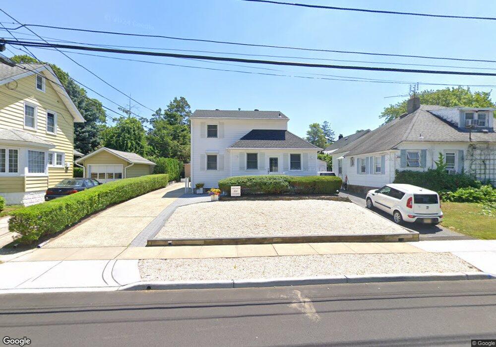
604 5th Ave Spring Lake, NJ 07762
Estimated Value: $1,419,000 - $1,945,188
3
Beds
3
Baths
1,304
Sq Ft
$1,267/Sq Ft
Est. Value
About This Home
This home is located at 604 5th Ave, Spring Lake, NJ 07762 and is currently estimated at $1,652,047, approximately $1,266 per square foot. 604 5th Ave is a home located in Monmouth County with nearby schools including St. Catharine School.
Ownership History
Date
Name
Owned For
Owner Type
Purchase Details
Closed on
Jun 10, 2013
Sold by
Beach Locker Llc
Bought by
Pietrucha Dorothy
Current Estimated Value
Purchase Details
Closed on
Mar 29, 2005
Sold by
Crosta Donald
Bought by
Crosta Donald and Crosta Helen
Purchase Details
Closed on
Mar 15, 1994
Sold by
Detufo Nicholas
Bought by
Crosta Donald and Crosta Helen
Home Financials for this Owner
Home Financials are based on the most recent Mortgage that was taken out on this home.
Original Mortgage
$137,000
Interest Rate
7.07%
Create a Home Valuation Report for This Property
The Home Valuation Report is an in-depth analysis detailing your home's value as well as a comparison with similar homes in the area
Home Values in the Area
Average Home Value in this Area
Purchase History
| Date | Buyer | Sale Price | Title Company |
|---|---|---|---|
| Pietrucha Dorothy | -- | First American Title Insuran | |
| Crosta Donald | -- | -- | |
| Crosta Donald | $187,500 | -- |
Source: Public Records
Mortgage History
| Date | Status | Borrower | Loan Amount |
|---|---|---|---|
| Previous Owner | Crosta Donald | $137,000 |
Source: Public Records
Tax History
| Year | Tax Paid | Tax Assessment Tax Assessment Total Assessment is a certain percentage of the fair market value that is determined by local assessors to be the total taxable value of land and additions on the property. | Land | Improvement |
|---|---|---|---|---|
| 2025 | $6,610 | $1,465,200 | $1,210,600 | $254,600 |
| 2024 | $6,471 | $1,351,800 | $1,114,900 | $236,900 |
| 2023 | $6,471 | $1,286,400 | $1,055,000 | $231,400 |
| 2022 | $5,918 | $1,179,900 | $959,600 | $220,300 |
| 2021 | $5,765 | $986,300 | $787,000 | $199,300 |
| 2020 | $5,828 | $943,000 | $751,500 | $191,500 |
| 2019 | $5,765 | $915,000 | $729,000 | $186,000 |
| 2018 | $5,719 | $910,600 | $729,000 | $181,600 |
| 2017 | $5,638 | $900,600 | $729,000 | $171,600 |
| 2016 | $5,443 | $796,900 | $672,000 | $124,900 |
| 2015 | $5,432 | $771,300 | $653,300 | $118,000 |
| 2014 | $5,148 | $750,400 | $632,400 | $118,000 |
Source: Public Records
Map
Nearby Homes
- 513 Mercer Ave
- 604 Monmouth Ave
- 200 Monmouth Ave Unit 19
- 200 Monmouth Ave Unit 27
- 200 Monmouth Ave Unit 21
- 200 Monmouth Ave Unit 5
- 208 Salem Ave
- 570 Central Ave
- 118 Warren Ave
- 607 Central Ave
- 574 Central Ave
- 16 Cherry Ct
- 117 Madison Ave
- 23 Locust Way
- 510 Beacon Blvd
- 909 Jersey Ave
- 206 Brighton Ave
- 815 Woodcrest Dr
- 13 Beacon Blvd
- 420 Ludlow Ave
Your Personal Tour Guide
Ask me questions while you tour the home.