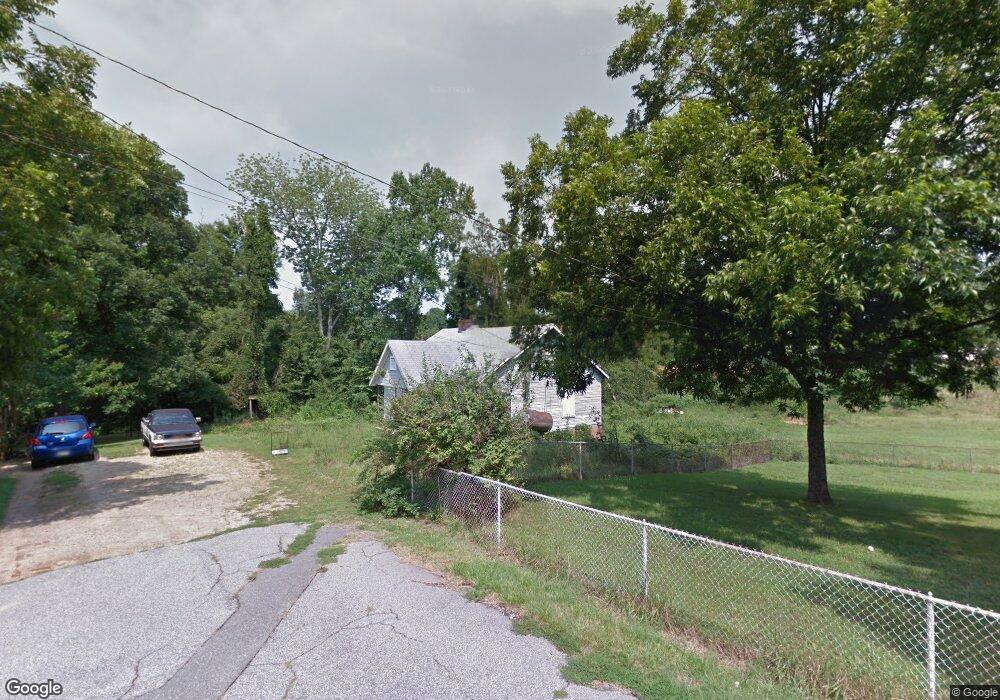
604 Doby St Kannapolis, NC 28081
Estimated Value: $55,000 - $194,000
2
Beds
1
Bath
812
Sq Ft
$177/Sq Ft
Est. Value
About This Home
This home is located at 604 Doby St, Kannapolis, NC 28081 and is currently estimated at $144,000, approximately $177 per square foot. 604 Doby St is a home located in Cabarrus County with nearby schools including Winecoff Elementary School, Northwest Cabarrus Middle School, and Northwest Cabarrus High.
Ownership History
Date
Name
Owned For
Owner Type
Purchase Details
Closed on
Jan 7, 2010
Sold by
Federal Home Loan Mortgage Corporation
Bought by
Morris John
Current Estimated Value
Purchase Details
Closed on
Dec 14, 2009
Sold by
Jung Karen D and Jung Newmoon N
Bought by
Federal Home Loan Mortgage Corp
Purchase Details
Closed on
Aug 16, 2001
Sold by
Perkins Shirley Y
Bought by
Perkins Derrell R
Purchase Details
Closed on
May 1, 1987
Bought by
Jung Newmoon N
Purchase Details
Closed on
Mar 1, 1984
Create a Home Valuation Report for This Property
The Home Valuation Report is an in-depth analysis detailing your home's value as well as a comparison with similar homes in the area
Home Values in the Area
Average Home Value in this Area
Purchase History
| Date | Buyer | Sale Price | Title Company |
|---|---|---|---|
| Morris John | -- | None Available | |
| Federal Home Loan Mortgage Corp | $31,500 | None Available | |
| Perkins Derrell R | -- | -- | |
| Jung Newmoon N | $18,000 | -- | |
| -- | $22,000 | -- |
Source: Public Records
Tax History Compared to Growth
Tax History
| Year | Tax Paid | Tax Assessment Tax Assessment Total Assessment is a certain percentage of the fair market value that is determined by local assessors to be the total taxable value of land and additions on the property. | Land | Improvement |
|---|---|---|---|---|
| 2025 | -- | $69,600 | $69,600 | $0 |
| 2024 | $790 | $69,600 | $69,600 | $0 |
| 2023 | $460 | $33,600 | $33,600 | $0 |
| 2022 | $460 | $33,600 | $33,600 | $0 |
| 2021 | $460 | $33,600 | $33,600 | $0 |
| 2020 | $460 | $33,600 | $33,600 | $0 |
| 2019 | $345 | $25,200 | $25,200 | $0 |
| 2018 | $340 | $25,200 | $25,200 | $0 |
| 2017 | $335 | $25,200 | $25,200 | $0 |
| 2016 | $335 | $38,620 | $27,600 | $11,020 |
| 2015 | $487 | $38,620 | $27,600 | $11,020 |
| 2014 | $487 | $38,620 | $27,600 | $11,020 |
Source: Public Records
Map
Nearby Homes
- 1309 Red Birch Place
- 1417 Azalea Ave
- 1589 Matthew Allen Cir
- 1418 Oakwood Ave
- 1693 Azalea Ave
- 1003 Robinhood Ln
- 1410 Oakwood Ave
- 00 Sapp Rd
- 1700 Azalea Ave
- 1408 Nottingham Rd
- 1441 Sherwood Dr
- 915 Sprucewood St
- 1500 S Ridge Ave
- 307 Meadowood Cir
- 210 Cliffside Dr
- 806 Walker St
- 808 Walker St
- 301 Briarcliff Dr
- 103 Crescent St
- 325 Briarcliff Dr
- 1500 Dennis Ave
- 602 Doby St
- 597 Black Maple Dr
- 597 Black Maple Dr Unit 25
- 1502 Dennis Ave
- 613 Black Maple Dr
- 603 Doby St
- 581 Black Maple Dr
- 601 Doby St
- 612 Black Maple Dr
- 565 Black Maple Dr
- 1410 Cooper Ave
- 1412 Cooper Ave
- 1413 Wildwood Dr
- 1500 Cooper Ave
- 1501 Wildwood Dr
- 1502 Cooper Ave
- 549 Black Maple Dr
- 1388 Red Birch Place
- 1505 Wildwood Dr