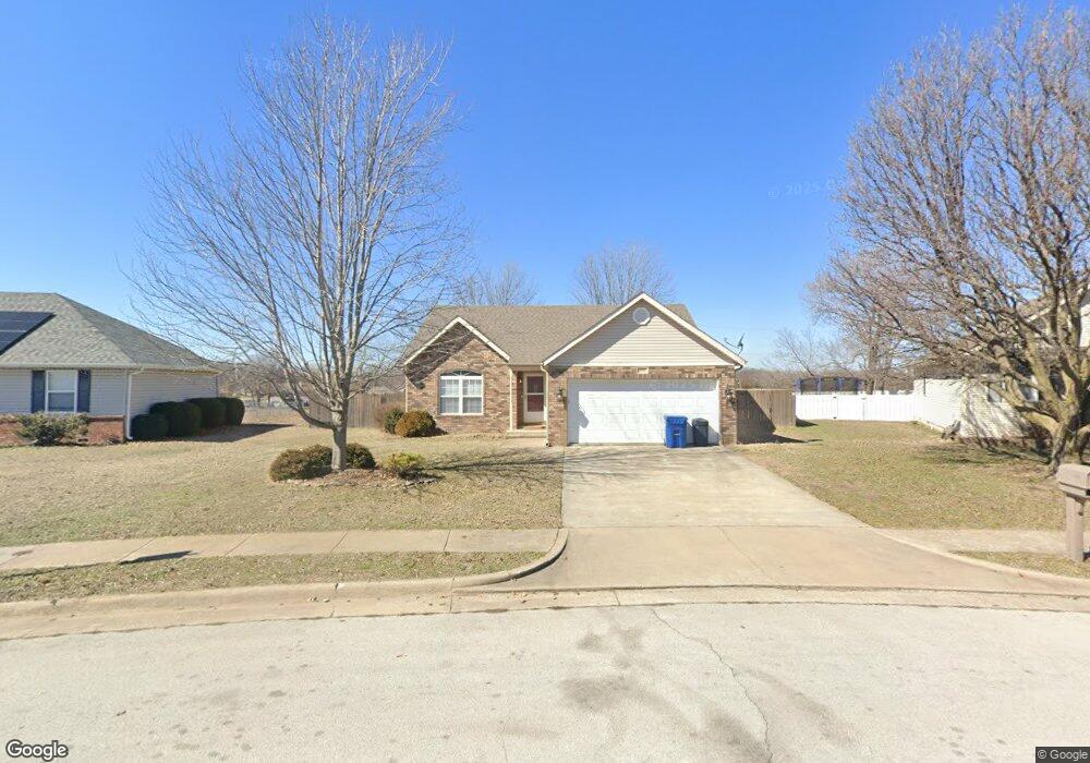
604 Hayes Ave Carl Junction, MO 64834
Estimated Value: $205,000 - $228,543
3
Beds
2
Baths
1,480
Sq Ft
$146/Sq Ft
Est. Value
About This Home
This home is located at 604 Hayes Ave, Carl Junction, MO 64834 and is currently estimated at $216,386, approximately $146 per square foot. 604 Hayes Ave is a home located in Jasper County with nearby schools including Carl Junction Primary School (K-1), Carl Junction Intermediate School, and Carl Junction Primary School (2-3).
Ownership History
Date
Name
Owned For
Owner Type
Purchase Details
Closed on
Jun 20, 2024
Sold by
Boles Paul J
Bought by
Smith Jacob A and Brown Lauren E
Current Estimated Value
Home Financials for this Owner
Home Financials are based on the most recent Mortgage that was taken out on this home.
Original Mortgage
$159,200
Outstanding Balance
$157,055
Interest Rate
7.09%
Mortgage Type
New Conventional
Estimated Equity
$59,331
Purchase Details
Closed on
Mar 25, 2011
Sold by
Lopez William T and Lopez Jennifer R
Bought by
Boles Paul J
Purchase Details
Closed on
Jan 11, 2006
Sold by
Boyes Justin W and Boyes Shanna
Bought by
Lopez William T and Wilson Jennifer R
Home Financials for this Owner
Home Financials are based on the most recent Mortgage that was taken out on this home.
Original Mortgage
$111,900
Interest Rate
5.37%
Mortgage Type
Purchase Money Mortgage
Create a Home Valuation Report for This Property
The Home Valuation Report is an in-depth analysis detailing your home's value as well as a comparison with similar homes in the area
Home Values in the Area
Average Home Value in this Area
Purchase History
| Date | Buyer | Sale Price | Title Company |
|---|---|---|---|
| Smith Jacob A | -- | None Listed On Document | |
| Boles Paul J | -- | Fatco | |
| Lopez William T | -- | None Available |
Source: Public Records
Mortgage History
| Date | Status | Borrower | Loan Amount |
|---|---|---|---|
| Open | Smith Jacob A | $159,200 | |
| Previous Owner | Lopez William T | $111,900 |
Source: Public Records
Tax History Compared to Growth
Tax History
| Year | Tax Paid | Tax Assessment Tax Assessment Total Assessment is a certain percentage of the fair market value that is determined by local assessors to be the total taxable value of land and additions on the property. | Land | Improvement |
|---|---|---|---|---|
| 2025 | $1,064 | $20,520 | $2,220 | $18,300 |
| 2024 | $1,071 | $18,190 | $2,220 | $15,970 |
| 2023 | $1,071 | $18,190 | $2,220 | $15,970 |
| 2022 | $1,135 | $19,230 | $2,220 | $17,010 |
| 2021 | $974 | $19,230 | $2,220 | $17,010 |
| 2020 | $913 | $17,710 | $2,220 | $15,490 |
| 2019 | $866 | $17,710 | $2,220 | $15,490 |
| 2018 | $910 | $18,650 | $0 | $0 |
| 2017 | $912 | $18,650 | $0 | $0 |
| 2016 | $922 | $19,030 | $0 | $0 |
| 2015 | $903 | $19,030 | $0 | $0 |
| 2014 | $903 | $19,030 | $0 | $0 |
Source: Public Records
Map
Nearby Homes
- 505 W Walton Ave
- 409 W Gault St
- 409 Gault St
- 408 W Walton Ave
- 802 Aberdeen Ave
- TBD S Roney St
- 311 S Roney St
- 114 W Walton Ave
- 106 S Roney St
- 819 Delaney Dr
- 815 Delaney Dr
- Tract 3 Prairie Ln
- Tract 2 Prairie Ln
- Tract 1 Prairie Ln
- Tract 4 Prairie Ln
- 711 Prairie Ln
- 205 Allen St
- 907 Aberdeen Ave
- 503 Valley View
- 105 Summit St