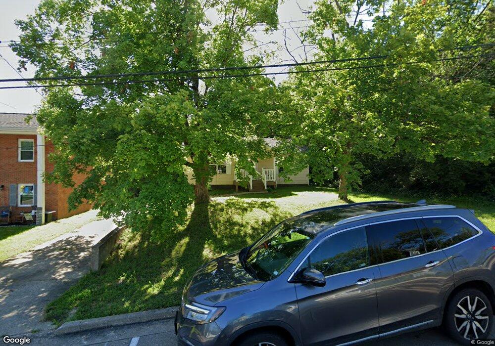
604 Maple St Hillsboro, MO 63050
Estimated Value: $169,993 - $193,000
Studio
--
Bath
884
Sq Ft
$202/Sq Ft
Est. Value
About This Home
This home is located at 604 Maple St, Hillsboro, MO 63050 and is currently estimated at $178,498, approximately $201 per square foot. 604 Maple St is a home with nearby schools including Hillsboro Elementary School, Hillsboro Primary School, and Hillsboro Middle Elementary School.
Ownership History
Date
Name
Owned For
Owner Type
Purchase Details
Closed on
Apr 17, 2019
Sold by
Queen Joyce D
Bought by
Prince Robert and Prince Christine
Current Estimated Value
Home Financials for this Owner
Home Financials are based on the most recent Mortgage that was taken out on this home.
Original Mortgage
$185,000
Outstanding Balance
$162,975
Interest Rate
4.4%
Mortgage Type
Commercial
Estimated Equity
$15,523
Purchase Details
Closed on
Feb 1, 2019
Sold by
Highland Diversified Inc
Bought by
Queen Joyce D and Sampson Andrea L
Purchase Details
Closed on
Dec 15, 1998
Sold by
Queen Daniel J and Queen Joyce D
Bought by
Queen Joyce D
Purchase Details
Closed on
Nov 2, 1998
Sold by
Raymond Queen and Raymond Rita A
Bought by
Highland Diversified Inc
Create a Home Valuation Report for This Property
The Home Valuation Report is an in-depth analysis detailing your home's value as well as a comparison with similar homes in the area
Home Values in the Area
Average Home Value in this Area
Purchase History
| Date | Buyer | Sale Price | Title Company |
|---|---|---|---|
| Prince Robert | -- | Hillsborough Title | |
| Queen Joyce D | -- | None Available | |
| Queen Joyce D | -- | -- | |
| Highland Diversified Inc | -- | Hillsboro Title Co | |
| Highland Diversified Inc | -- | Hillsboro Title Co | |
| Queen Daniel J | -- | Hillsboro Title Co |
Source: Public Records
Mortgage History
| Date | Status | Borrower | Loan Amount |
|---|---|---|---|
| Open | Prince Robert | $185,000 |
Source: Public Records
Tax History
| Year | Tax Paid | Tax Assessment Tax Assessment Total Assessment is a certain percentage of the fair market value that is determined by local assessors to be the total taxable value of land and additions on the property. | Land | Improvement |
|---|---|---|---|---|
| 2025 | $797 | $14,000 | $1,500 | $12,500 |
| 2024 | $797 | $12,900 | $1,500 | $11,400 |
| 2023 | $797 | $12,900 | $1,500 | $11,400 |
| 2022 | $799 | $12,900 | $1,500 | $11,400 |
| 2021 | $857 | $12,900 | $1,500 | $11,400 |
| 2020 | $807 | $11,800 | $1,200 | $10,600 |
| 2019 | $806 | $11,800 | $1,200 | $10,600 |
| 2018 | $810 | $11,800 | $1,200 | $10,600 |
| 2017 | $812 | $11,800 | $1,200 | $10,600 |
| 2016 | $767 | $10,600 | $1,300 | $9,300 |
| 2015 | $763 | $10,600 | $1,300 | $9,300 |
| 2013 | -- | $10,500 | $1,300 | $9,200 |
Source: Public Records
Map
Nearby Homes
- 612 Ray Henry Way
- 714 Camelot Estates Dr
- 9 Ridgewood Dr
- 0 Lot 62 01 Acres Unit 23042037
- 10865 Business 21
- 10430 Business 21
- 841 Vreeland Rd
- 4671 Cedar Dr
- 6005 Elm
- 4625 Cedar Dr
- 4654 Cedar Dr
- 5640 Hawks Landing Dr
- 5641 Hawks Landing Dr
- 5522 Hillsboro Hematite Rd
- 6360 State Road B
- LOT 7A Blk-H S Lake Dr
- 726 Blake Dr
- Lot 11 Hawk Ridge Estates
- 0 Hawk Ridge Estates Augusta Model Unit MIS25075139
- 733 Blake Dr
- 0 Lot 28 Brookside Dr Unit 11057447
- 0 Lot 26 Brookside Dr Unit 11057444
- 0 Lot 4 Brookside Dr Unit 11057441
- 0 Lot 6 Brookside Dr Unit 11057439
- 0 Lot 10 Brookside Dr Unit 11057437
- 0 Lot 12 Brookside Dr Unit 11057435
- 0 Lot 14 Brookside Dr Unit 11057433
- 0 Lot 18 Brookside Dr Unit 11057429
- 0 Lot 20 Brookside Dr Unit 11057426
- 0 Lot 22 Brookside Dr Unit 11057424
- 0 Lot 8 Brookside Dr Unit 11057438
- 0 Lot 16 Brookside Dr Unit 11057431
- 0 Brookside Parc Lot 26 Unit 14061084
- 612 Maple St
- 616 Maple St
- 0 Lot 27 Brookside Dr Unit 11057446
- 0 Lot 25 Brookside Dr Unit 11057443
- 0 Lot 13 Brookside Dr Unit 11057434
- 0 Lot 15 Brookside Dr Unit 11057432
- 0 Lot 17 Brookside Dr Unit 11057430
Your Personal Tour Guide
Ask me questions while you tour the home.