Estimated Value: $360,000 - $396,991
--
Bed
--
Bath
--
Sq Ft
0.83
Acres
About This Home
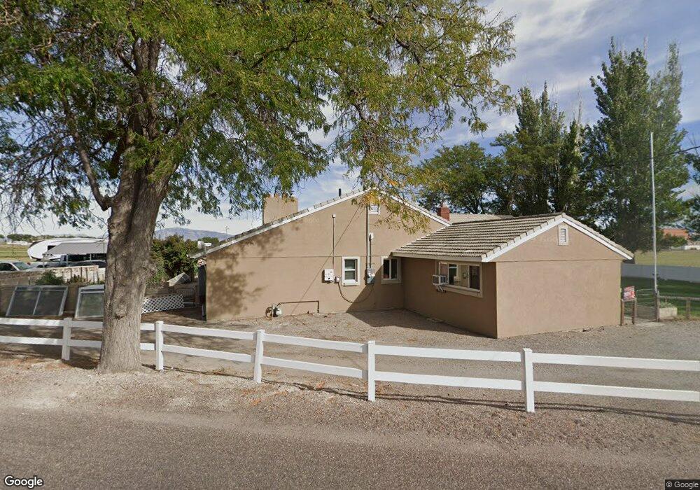
This home is located at 604 N 100 W, Delta, UT 84624 and is currently estimated at $379,998. 604 N 100 W is a home with nearby schools including Cba Center and White River Academy.
Ownership History
Date
Name
Owned For
Owner Type
Purchase Details
Closed on
Mar 27, 2017
Sold by
Sawaya Becky Lee
Bought by
Sawaya Becky Lee
Current Estimated Value
Purchase Details
Closed on
Dec 8, 2010
Sold by
Clark Paul J
Bought by
Clark Paul J and Clark Barbara
Home Financials for this Owner
Home Financials are based on the most recent Mortgage that was taken out on this home.
Original Mortgage
$144,400
Interest Rate
4.17%
Mortgage Type
New Conventional
Purchase Details
Closed on
Dec 7, 2010
Sold by
Tyree Lionel B and Tyree Kimberly L
Bought by
Paul J
Home Financials for this Owner
Home Financials are based on the most recent Mortgage that was taken out on this home.
Original Mortgage
$144,400
Interest Rate
4.17%
Mortgage Type
New Conventional
Purchase Details
Closed on
Mar 17, 2007
Sold by
Shepherd Verna R
Bought by
Tyree Lionel B and Tyree Kimberly L
Home Financials for this Owner
Home Financials are based on the most recent Mortgage that was taken out on this home.
Original Mortgage
$147,250
Interest Rate
6.29%
Mortgage Type
New Conventional
Create a Home Valuation Report for This Property
The Home Valuation Report is an in-depth analysis detailing your home's value as well as a comparison with similar homes in the area
Home Values in the Area
Average Home Value in this Area
Purchase History
| Date | Buyer | Sale Price | Title Company |
|---|---|---|---|
| Sawaya Becky Lee | -- | -- | |
| Clark Paul J | -- | -- | |
| Paul J | -- | -- | |
| Tyree Lionel B | -- | -- |
Source: Public Records
Mortgage History
| Date | Status | Borrower | Loan Amount |
|---|---|---|---|
| Previous Owner | Clark Paul J | $144,400 | |
| Previous Owner | Paul J | $144,400 | |
| Previous Owner | Tyree Lionel B | $147,250 |
Source: Public Records
Tax History Compared to Growth
Tax History
| Year | Tax Paid | Tax Assessment Tax Assessment Total Assessment is a certain percentage of the fair market value that is determined by local assessors to be the total taxable value of land and additions on the property. | Land | Improvement |
|---|---|---|---|---|
| 2025 | $2,271 | $242,955 | $26,251 | $216,704 |
| 2024 | $2,271 | $193,395 | $10,862 | $182,533 |
| 2023 | $2,415 | $193,395 | $10,862 | $182,533 |
| 2022 | $1,858 | $139,770 | $9,874 | $129,896 |
| 2021 | $1,596 | $114,624 | $8,586 | $106,038 |
| 2020 | $1,486 | $106,111 | $7,805 | $98,306 |
| 2019 | $1,419 | $101,359 | $7,017 | $94,342 |
| 2018 | $1,299 | $93,569 | $7,017 | $86,552 |
| 2017 | $1,340 | $92,962 | $6,410 | $86,552 |
| 2016 | $1,299 | $92,962 | $6,410 | $86,552 |
| 2015 | $1,298 | $92,962 | $6,410 | $86,552 |
| 2014 | -- | $85,423 | $6,410 | $79,013 |
| 2013 | -- | $85,423 | $6,410 | $79,013 |
Source: Public Records
Map
Nearby Homes
- 325 N 100 W
- 98 W 1000 N
- 331 W 200 N
- 451 W 300 N
- 0 E Highway 6 Unit LotWP001 16586023
- 7900 E 250 Rd N
- 461 Topaz Blvd Unit 6
- 163 W 100 S
- 901 E 750 Rd N
- 44 E 300 S
- 435 W 100 S
- 628 Sunset St
- 629 E Millard St
- 321 E 200 S
- 242 S 400 W
- 32 E 300 S
- 38 E 300 S
- 294 S 300 W
- 328 S Center St
- Locust Ave Unit LotWP001
- 640 N 100 W
- 615 N 100 W
- 525 N 100 W
- 580 N Sugar Factory Rd
- 550 N 200 W
- 550 N Sugar Factory Rd
- 540 N Sugar Factory Rd
- 620 N Sugar Factory Row Rd W
- 433 N 100 W
- 630 N Sugar Factory Rd W
- 538 N 200 W
- 415 N 100 W
- 140 W 400 N
- 170 W 400 N
- 555 N 200 W
- 496 N Sugar Factory Row Rd
- 440 N 200 W
- 391 N 100 Rd W
- 535 N 200 W
- 141 W 400 N