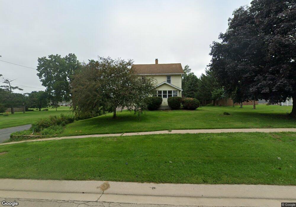
604 N Walnut Ave Forreston, IL 61030
Estimated Value: $178,000 - $208,841
3
Beds
3
Baths
2,421
Sq Ft
$80/Sq Ft
Est. Value
About This Home
This home is located at 604 N Walnut Ave, Forreston, IL 61030 and is currently estimated at $192,710, approximately $79 per square foot. 604 N Walnut Ave is a home located in Ogle County with nearby schools including Forreston High School.
Ownership History
Date
Name
Owned For
Owner Type
Purchase Details
Closed on
Jun 21, 2022
Sold by
Simler Dennis L
Bought by
Simler Trust
Current Estimated Value
Purchase Details
Closed on
Jan 22, 2021
Sold by
Simler Trust
Bought by
Simler Dennis L
Purchase Details
Closed on
May 11, 2010
Sold by
Simler Nancy L
Bought by
Simler Nancy L and The Nancy L Simler Revocable Living Trus
Create a Home Valuation Report for This Property
The Home Valuation Report is an in-depth analysis detailing your home's value as well as a comparison with similar homes in the area
Home Values in the Area
Average Home Value in this Area
Purchase History
| Date | Buyer | Sale Price | Title Company |
|---|---|---|---|
| Simler Trust | -- | None Available | |
| Simler Dennis L | -- | None Available | |
| Simler Nancy L | -- | None Available |
Source: Public Records
Tax History Compared to Growth
Tax History
| Year | Tax Paid | Tax Assessment Tax Assessment Total Assessment is a certain percentage of the fair market value that is determined by local assessors to be the total taxable value of land and additions on the property. | Land | Improvement |
|---|---|---|---|---|
| 2024 | $2,837 | $42,920 | $6,269 | $36,651 |
| 2023 | $2,022 | $40,033 | $5,847 | $34,186 |
| 2022 | $3,350 | $36,630 | $5,350 | $31,280 |
| 2021 | $3,283 | $35,715 | $5,216 | $30,499 |
| 2020 | $2,203 | $35,084 | $5,124 | $29,960 |
| 2019 | $1,970 | $33,654 | $4,915 | $28,739 |
| 2018 | $1,997 | $33,654 | $4,915 | $28,739 |
| 2017 | $2,028 | $33,654 | $4,915 | $28,739 |
| 2016 | $2,163 | $32,855 | $4,798 | $28,057 |
| 2015 | $2,034 | $32,085 | $4,686 | $27,399 |
| 2014 | $2,073 | $32,085 | $4,686 | $27,399 |
| 2013 | $2,262 | $32,884 | $4,803 | $28,081 |
Source: Public Records
Map
Nearby Homes
- 304 Maple Ave
- 406 W Balsam St
- 601 Hewitt St
- 603 Hewitt St
- 603 E Hewitt St
- 613 & 615 Hewitt St
- 617 & 619 Hewitt St
- 609 & 611 Hewitt St
- 605 & 607 Hewitt St
- 702 Hewitt St
- 701 Hewitt St
- 703 Hewitt St
- 706 Hewitt St
- 411 S Walnut Ave
- 404 E Willow St
- 3703 Main St
- 10225 N Brookville Rd
- 31457 Straw School Rd
- 10385 N Rock City Rd
- 5810 W Lightsville Rd
- 101 Magnolia St
- 103 Magnolia St
- 602 N Walnut Ave
- 107 Magnolia St
- 102 Magnolia St
- 98 Magnolia St
- 100 Magnolia St
- 601 N Walnut Ave
- 603 N Walnut Ave
- 103 Phil Pkwy
- 101 Phil Pkwy
- 508 N Walnut Ave
- 602 N Chestnut St
- 602 N Chestnut Ave
- 505 Maple Ave
- 507 N Walnut Ave
- 506 N Walnut Ave
- 104 Phil Pkwy
- 508 Maple Ave
- 501 N Ash Ave