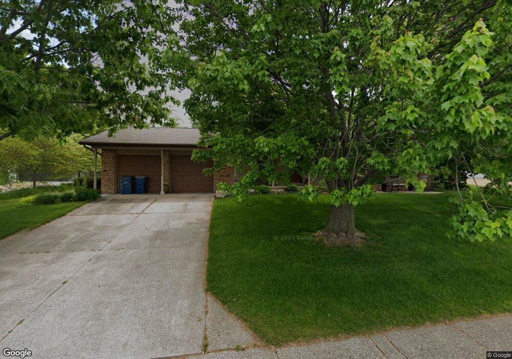
604 S Main St Port Byron, IL 61275
Estimated Value: $275,000 - $335,000
--
Bed
--
Bath
2,336
Sq Ft
$133/Sq Ft
Est. Value
About This Home
This home is located at 604 S Main St, Port Byron, IL 61275 and is currently estimated at $311,712, approximately $133 per square foot. 604 S Main St is a home located in Rock Island County with nearby schools including Riverdale Elementary School, Riverdale Middle School, and Riverdale Senior High School.
Create a Home Valuation Report for This Property
The Home Valuation Report is an in-depth analysis detailing your home's value as well as a comparison with similar homes in the area
Home Values in the Area
Average Home Value in this Area
Tax History Compared to Growth
Tax History
| Year | Tax Paid | Tax Assessment Tax Assessment Total Assessment is a certain percentage of the fair market value that is determined by local assessors to be the total taxable value of land and additions on the property. | Land | Improvement |
|---|---|---|---|---|
| 2024 | $6,726 | $99,670 | $18,357 | $81,313 |
| 2023 | $6,726 | $91,440 | $16,841 | $74,599 |
| 2022 | $5,814 | $84,869 | $16,062 | $68,807 |
| 2021 | $5,639 | $80,445 | $15,225 | $65,220 |
| 2020 | $554 | $79,256 | $15,000 | $64,256 |
| 2019 | $5,559 | $79,256 | $15,000 | $64,256 |
| 2018 | $5,572 | $80,617 | $15,727 | $64,890 |
| 2017 | $5,489 | $80,617 | $15,727 | $64,890 |
| 2016 | $5,428 | $79,504 | $15,510 | $63,994 |
| 2015 | $5,244 | $76,574 | $14,939 | $61,635 |
| 2014 | $1,114 | $75,072 | $14,646 | $60,426 |
| 2013 | $1,114 | $75,072 | $14,646 | $60,426 |
Source: Public Records
Map
Nearby Homes