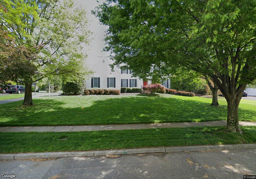
604 Windsock Way Moorestown, NJ 08057
Estimated Value: $983,639 - $1,240,000
Studio
--
Bath
3,061
Sq Ft
$356/Sq Ft
Est. Value
About This Home
This home is located at 604 Windsock Way, Moorestown, NJ 08057 and is currently estimated at $1,088,880, approximately $355 per square foot. 604 Windsock Way is a home located in Burlington County with nearby schools including George C. Baker Elementary School, Moorestown Upper Elementary School, and William Allen Middle School.
Ownership History
Date
Name
Owned For
Owner Type
Purchase Details
Closed on
Sep 14, 1999
Sold by
Bob Meyer Communities Inc
Bought by
Foster Kyler B and Foster Kimberly D
Current Estimated Value
Home Financials for this Owner
Home Financials are based on the most recent Mortgage that was taken out on this home.
Original Mortgage
$203,000
Interest Rate
5.35%
Mortgage Type
Unknown
Purchase Details
Closed on
May 24, 1999
Sold by
Ravikio John B and Ravikio Gail M
Bought by
Bob Meyer Communities Inc
Home Financials for this Owner
Home Financials are based on the most recent Mortgage that was taken out on this home.
Original Mortgage
$140,000
Interest Rate
6.9%
Mortgage Type
Seller Take Back
Create a Home Valuation Report for This Property
The Home Valuation Report is an in-depth analysis detailing your home's value as well as a comparison with similar homes in the area
Home Values in the Area
Average Home Value in this Area
Purchase History
| Date | Buyer | Sale Price | Title Company |
|---|---|---|---|
| Foster Kyler B | $502,000 | Fidelity National Title Ins | |
| Bob Meyer Communities Inc | $160,000 | Congress Title Corp |
Source: Public Records
Mortgage History
| Date | Status | Borrower | Loan Amount |
|---|---|---|---|
| Closed | Foster Kyler B | $203,000 | |
| Open | Foster Kyler B | $390,000 | |
| Previous Owner | Bob Meyer Communities Inc | $140,000 |
Source: Public Records
Tax History
| Year | Tax Paid | Tax Assessment Tax Assessment Total Assessment is a certain percentage of the fair market value that is determined by local assessors to be the total taxable value of land and additions on the property. | Land | Improvement |
|---|---|---|---|---|
| 2025 | $16,338 | $575,900 | $250,100 | $325,800 |
| 2024 | $15,843 | $575,900 | $250,100 | $325,800 |
| 2023 | $15,843 | $575,900 | $250,100 | $325,800 |
| 2022 | $15,682 | $575,900 | $250,100 | $325,800 |
| 2021 | $15,474 | $575,900 | $250,100 | $325,800 |
| 2020 | $15,377 | $575,900 | $250,100 | $325,800 |
| 2019 | $15,106 | $575,900 | $250,100 | $325,800 |
| 2018 | $14,697 | $575,900 | $250,100 | $325,800 |
| 2017 | $14,824 | $575,900 | $250,100 | $325,800 |
| 2016 | $14,772 | $575,900 | $250,100 | $325,800 |
| 2015 | $14,593 | $575,900 | $250,100 | $325,800 |
| 2014 | $13,856 | $575,900 | $250,100 | $325,800 |
Source: Public Records
Map
Nearby Homes
- 628 Windsock Way
- 807 Westfield Rd
- 331 Bridgeboro Rd
- 744 Signal Light Rd
- 106 Ashley Ct
- 745 N Stanwick Rd
- 863 Golf View Rd
- 697 Garwood Rd
- 347 Tom Brown Rd
- 119 Linda Ave
- 408 N Stanwick Rd
- 343 Tom Brown Rd
- 740 Garwood Rd
- 114 Windmoor Rd
- 134 Jacqueline Ave
- 109 Congressional Ct
- 101 Congressional Ct
- 115 Congressional Ct
- 315 Linden St
- 117 Randle Ct
- 608 Windsock Way
- 2 Tyndale Ct
- 600 Windsock Way
- 559 Sentinel Rd
- 551 Sentinel Rd
- 1 Tyndale Ct
- 3 Tyndale Ct
- 563 Sentinel Rd
- 547 Sentinel Rd
- 4 Tyndale Ct
- 607 Windsock Way
- 554 Sentinel Rd
- 5 Tyndale Ct
- 558 Sentinel Rd
- 565 Sentinel Rd
- 1 Deer Rest Rd
- 5 Hayfield Ct
- 2 Hayfield Ct
- 550 Sentinel Rd
- 3 Hayfield Ct
Your Personal Tour Guide
Ask me questions while you tour the home.