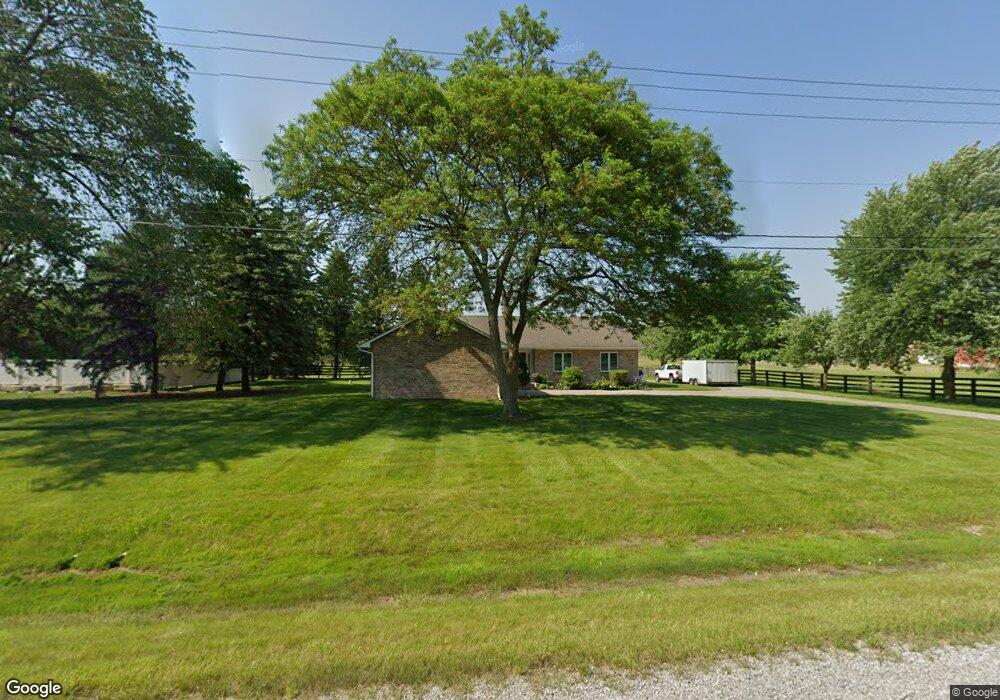
6041 E Baldwin Rd Grand Blanc, MI 48439
Estimated Value: $333,000 - $429,000
3
Beds
2
Baths
1,692
Sq Ft
$231/Sq Ft
Est. Value
About This Home
This home is located at 6041 E Baldwin Rd, Grand Blanc, MI 48439 and is currently estimated at $390,502, approximately $230 per square foot. 6041 E Baldwin Rd is a home located in Genesee County with nearby schools including Cook Elementary School, Mason Elementary School, and Grand Blanc East Middle School.
Ownership History
Date
Name
Owned For
Owner Type
Purchase Details
Closed on
Oct 20, 2023
Sold by
Sobczak Keith
Bought by
Mersin Frederick Adam and Mobbs-Mersino Sheila Arlene
Current Estimated Value
Purchase Details
Closed on
Apr 24, 2018
Sold by
Flint Thomas and Estate Of Keith Paul Flint
Bought by
Sobczak Keith W
Home Financials for this Owner
Home Financials are based on the most recent Mortgage that was taken out on this home.
Original Mortgage
$152,750
Interest Rate
4.44%
Mortgage Type
New Conventional
Purchase Details
Closed on
Jul 30, 2011
Sold by
Flint Thomas
Bought by
Sobczak Keith
Home Financials for this Owner
Home Financials are based on the most recent Mortgage that was taken out on this home.
Original Mortgage
$168,000
Interest Rate
6%
Mortgage Type
Seller Take Back
Purchase Details
Closed on
Feb 1, 2008
Sold by
Flint Keith Paul
Bought by
Flint Keith Paul and Flint Timothy
Create a Home Valuation Report for This Property
The Home Valuation Report is an in-depth analysis detailing your home's value as well as a comparison with similar homes in the area
Home Values in the Area
Average Home Value in this Area
Purchase History
| Date | Buyer | Sale Price | Title Company |
|---|---|---|---|
| Mersin Frederick Adam | $375,000 | Homeland Title | |
| Sobczak Keith W | $180,000 | None Available | |
| Sobczak Keith | $180,000 | None Available | |
| Flint Keith Paul | -- | None Available |
Source: Public Records
Mortgage History
| Date | Status | Borrower | Loan Amount |
|---|---|---|---|
| Previous Owner | Sobczak Keith W | $152,750 | |
| Previous Owner | Sobczak Keith | $168,000 |
Source: Public Records
Tax History Compared to Growth
Tax History
| Year | Tax Paid | Tax Assessment Tax Assessment Total Assessment is a certain percentage of the fair market value that is determined by local assessors to be the total taxable value of land and additions on the property. | Land | Improvement |
|---|---|---|---|---|
| 2025 | $7,030 | $184,500 | $0 | $0 |
| 2024 | $4,277 | $170,400 | $0 | $0 |
| 2023 | $3,433 | $160,100 | $0 | $0 |
| 2022 | $5,335 | $139,800 | $0 | $0 |
| 2021 | $5,201 | $136,000 | $0 | $0 |
| 2020 | $3,165 | $135,100 | $0 | $0 |
| 2019 | $3,118 | $123,200 | $0 | $0 |
| 2018 | $4,948 | $133,300 | $0 | $0 |
| 2017 | $4,693 | $138,100 | $0 | $0 |
| 2016 | $5,047 | $138,800 | $0 | $0 |
| 2015 | $4,991 | $123,100 | $0 | $0 |
| 2012 | -- | $113,800 | $113,800 | $0 |
Source: Public Records
Map
Nearby Homes
- 9818 Burning Tree Dr
- 9705 Burning Tree Dr
- 6264 Muirfield Dr Unit 14
- 6286 Merion Ln Unit 75
- 6320 Knob Bend Dr
- 6326 Knob Bend Dr
- 6016 Plantation Dr
- 6263 Knob Bend Dr
- 9310 Fairway Trail
- 10195 Golfside Dr
- 5239 E Baldwin Rd
- 74 Westwood Dr
- 75 Westwood Dr
- 5270 Fairway Trail
- 76 Westwood Dr
- 77 Westwood Dr
- 0 Westwood Dr Unit 20240007181
- 5378 Warwick Trail Unit 16
- 5215 Sunlyn Dr
- 78 Westwood Dr
- 6023 E Baldwin Rd
- 6009 E Baldwin Rd
- 6081 E Baldwin Rd
- 9801 Burning Tree Dr
- 9811 Burning Tree Dr
- 9787 Burning Tree Dr
- 9823 Burning Tree Dr
- 5520 Broadmoor Ct
- 9777 Burning Tree Dr
- 9767 Burning Tree Dr
- 5510 Broadmoor Ct
- 9837 Burning Tree Dr
- 6109 E Baldwin Rd
- 9802 Burning Tree Dr
- 6059 Caitlin Landing
- 9757 Burning Tree Dr
- 6045 Green Bank Dr
- 9786 Burning Tree Dr
- 6063 Caitlin Landing
- 6025 Green Bank Dr