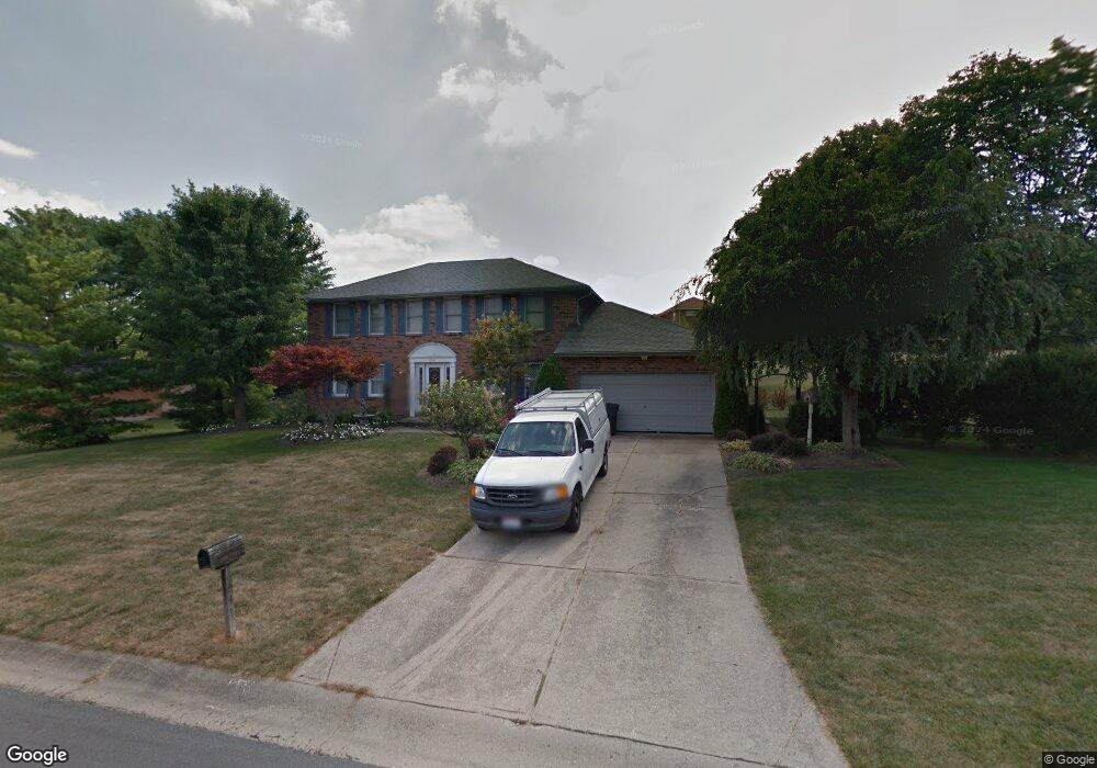
6041 Hillsdale Ln West Chester, OH 45069
West Chester Township NeighborhoodEstimated Value: $445,364 - $494,000
4
Beds
3
Baths
2,436
Sq Ft
$190/Sq Ft
Est. Value
About This Home
This home is located at 6041 Hillsdale Ln, West Chester, OH 45069 and is currently estimated at $463,841, approximately $190 per square foot. 6041 Hillsdale Ln is a home located in Butler County with nearby schools including Freedom Elementary School, Lakota Ridge Junior School, and Lakota West High School.
Ownership History
Date
Name
Owned For
Owner Type
Purchase Details
Closed on
Aug 17, 2001
Sold by
Roberts David J and Roberts Elizabeth C
Bought by
Holder Kevin and Holder Melinda
Current Estimated Value
Home Financials for this Owner
Home Financials are based on the most recent Mortgage that was taken out on this home.
Original Mortgage
$185,250
Outstanding Balance
$72,054
Interest Rate
7.11%
Mortgage Type
Purchase Money Mortgage
Estimated Equity
$391,787
Purchase Details
Closed on
Oct 1, 1991
Create a Home Valuation Report for This Property
The Home Valuation Report is an in-depth analysis detailing your home's value as well as a comparison with similar homes in the area
Home Values in the Area
Average Home Value in this Area
Purchase History
| Date | Buyer | Sale Price | Title Company |
|---|---|---|---|
| Holder Kevin | $195,000 | -- | |
| -- | $144,500 | -- |
Source: Public Records
Mortgage History
| Date | Status | Borrower | Loan Amount |
|---|---|---|---|
| Open | Holder Kevin | $185,250 |
Source: Public Records
Tax History Compared to Growth
Tax History
| Year | Tax Paid | Tax Assessment Tax Assessment Total Assessment is a certain percentage of the fair market value that is determined by local assessors to be the total taxable value of land and additions on the property. | Land | Improvement |
|---|---|---|---|---|
| 2024 | $4,785 | $115,900 | $19,430 | $96,470 |
| 2023 | $4,751 | $120,990 | $19,430 | $101,560 |
| 2022 | $5,087 | $91,470 | $19,430 | $72,040 |
| 2021 | $4,644 | $88,040 | $19,430 | $68,610 |
| 2020 | $4,754 | $88,040 | $19,430 | $68,610 |
| 2019 | $6,787 | $70,820 | $17,370 | $53,450 |
| 2018 | $4,012 | $70,820 | $17,370 | $53,450 |
| 2017 | $4,083 | $70,820 | $17,370 | $53,450 |
| 2016 | $4,174 | $68,170 | $17,370 | $50,800 |
| 2015 | $4,167 | $68,170 | $17,370 | $50,800 |
| 2014 | $4,115 | $68,170 | $17,370 | $50,800 |
| 2013 | $4,115 | $65,410 | $17,370 | $48,040 |
Source: Public Records
Map
Nearby Homes
- 8222 Lindfield Dr
- 6036 Bardean Dr
- 5911 Hazeltine Ct
- 6241 Skyline Dr
- 8164 Foxdale Ct
- 7948 Bayer Dr
- 8062 Kennesaw Dr
- 5648 Eagle Nest Ct
- 7886 Lesourdsville West Chester Rd
- 5769 Forge Bridge Dr
- 8583 Kates Way
- 7856 Chantilly Dr
- 6210 Cardington Place
- 7947 Kennesaw Dr
- 6084 Tylersville Rd
- 8672 Rupp Farm Dr
- 6387 Coachlight Way
- 7913 Merryman Way
- 5602 Plowshare Way
- 8831 Eagleview Dr
- 6053 Hillsdale Ln
- 8286 Lindfield Dr
- 8296 Lindfield Dr
- 8268 Lindfield Dr
- 8273 Westberry Ct
- 8261 Westberry Ct
- 8306 Lindfield Dr
- 6038 Hillsdale Ln
- 6048 Hillsdale Ln
- 8283 Westberry Ct
- 6032 Hillsdale Ln
- 6058 Hillsdale Ln
- 8236 Lindfield Dr
- 8310 Lindfield Dr
- 98 Hillsdale Ln
- 99 Hillsdale Ln
- 6068 Hillsdale Ln
- 8293 Westberry Ct
- 8295 Lindfield Dr
- 8305 Lindfield Dr