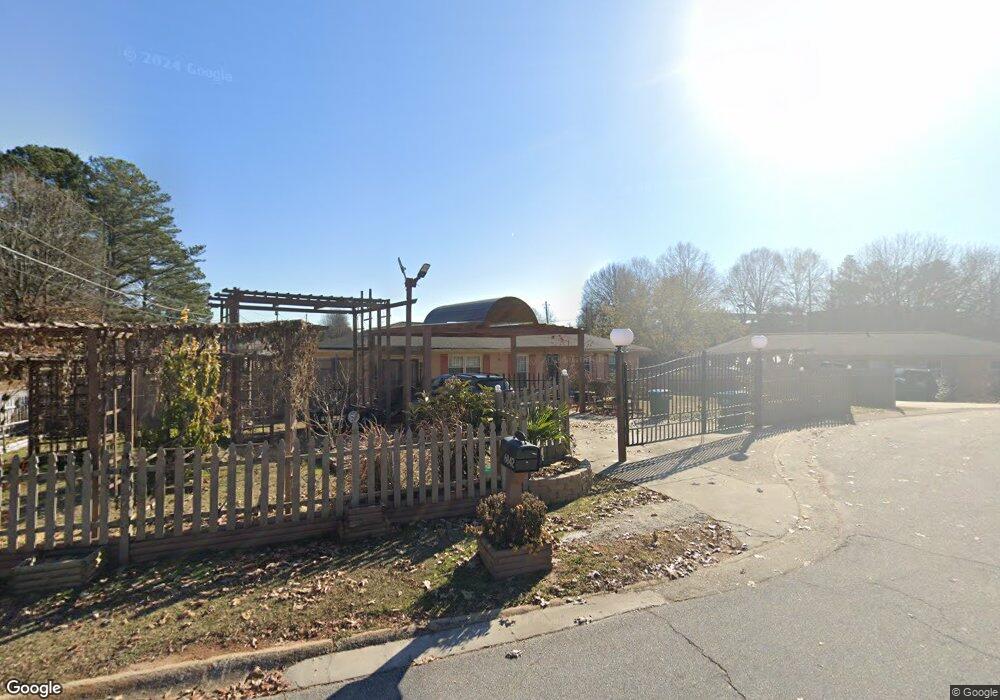
6042 Kay Dr Unit 3 Norcross, GA 30093
Estimated Value: $278,000 - $322,000
3
Beds
2
Baths
1,625
Sq Ft
$184/Sq Ft
Est. Value
About This Home
This home is located at 6042 Kay Dr Unit 3, Norcross, GA 30093 and is currently estimated at $298,836, approximately $183 per square foot. 6042 Kay Dr Unit 3 is a home located in Gwinnett County with nearby schools including Meadowcreek Elementary School, Louise Radloff Middle School, and Meadowcreek High School.
Ownership History
Date
Name
Owned For
Owner Type
Purchase Details
Closed on
Mar 31, 2016
Sold by
Tran Michael Sang
Bought by
Le Viet
Current Estimated Value
Home Financials for this Owner
Home Financials are based on the most recent Mortgage that was taken out on this home.
Original Mortgage
$40,000
Interest Rate
3.64%
Mortgage Type
New Conventional
Purchase Details
Closed on
Mar 2, 2005
Sold by
Alsabrook Jimmy R
Bought by
Branch Bkng & Trust Co
Purchase Details
Closed on
Dec 12, 2003
Sold by
Cleveland Farms Inc
Bought by
Alsabrook Jimmy R
Create a Home Valuation Report for This Property
The Home Valuation Report is an in-depth analysis detailing your home's value as well as a comparison with similar homes in the area
Home Values in the Area
Average Home Value in this Area
Purchase History
| Date | Buyer | Sale Price | Title Company |
|---|---|---|---|
| Le Viet | $127,000 | -- | |
| Branch Bkng & Trust Co | $106,577 | -- | |
| Alsabrook Jimmy R | -- | -- |
Source: Public Records
Mortgage History
| Date | Status | Borrower | Loan Amount |
|---|---|---|---|
| Closed | Le Viet | $40,000 |
Source: Public Records
Tax History Compared to Growth
Tax History
| Year | Tax Paid | Tax Assessment Tax Assessment Total Assessment is a certain percentage of the fair market value that is determined by local assessors to be the total taxable value of land and additions on the property. | Land | Improvement |
|---|---|---|---|---|
| 2025 | $3,255 | $109,800 | $21,120 | $88,680 |
| 2024 | $3,247 | $103,840 | $21,120 | $82,720 |
| 2023 | $3,247 | $102,240 | $24,800 | $77,440 |
| 2022 | $2,882 | $88,440 | $22,400 | $66,040 |
| 2021 | $2,406 | $64,120 | $16,000 | $48,120 |
| 2020 | $2,642 | $64,120 | $16,000 | $48,120 |
| 2019 | $2,119 | $52,520 | $13,600 | $38,920 |
| 2018 | $2,116 | $52,520 | $13,600 | $38,920 |
| 2016 | $1,600 | $37,280 | $10,400 | $26,880 |
| 2015 | $1,382 | $30,600 | $8,000 | $22,600 |
| 2014 | -- | $30,600 | $8,000 | $22,600 |
Source: Public Records
Map
Nearby Homes
- 1665 Oakbrook Lake Dr
- 1368 Breezy Cir
- 1561 Danbury Dr
- 1281 Rockfield Cir
- 1415 Commercial Ct
- 1576 Village Dr
- 1596 Village Dr
- 5719 Singlebriar Ct
- 1002 Rockbridge Rd
- 1353 Harbins Ridge Dr Unit 36
- 6419 Danbury Ln
- 5590 Stonewood Ct
- 5952 Robin Hood Ln
- 6575 Story Cir
- 5775 Dekalb Ln
- 903 Redwood Dr
- 5665 Terremont Cir
- 3321 S Norcross Tucker Rd
- 1258 Roman Point Dr
- 1034 Redwood Dr
- 6022 Kay Dr
- 6031 Kay Dr
- 6041 Kay Dr Unit 3
- 6052 Kay Dr Unit 3
- 6060 Kay Dr
- 6021 Kay Dr Unit 12
- 6021 Kay Dr
- 6012 Kay Dr Unit 3
- 6051 Kay Dr
- 6035 Singleton Rd Unit 5
- 6035 Singleton Rd
- 6011 Kay Dr Unit 3
- 6045 Singleton Rd
- 6025 Singleton Rd
- 6002 Kay Dr
- 6015 Singleton Rd
- 6001 Kay Dr Unit 3
- 5992 Kay Dr Unit 3
- 6005 Singleton Rd
- 5992 Kay Dr NW