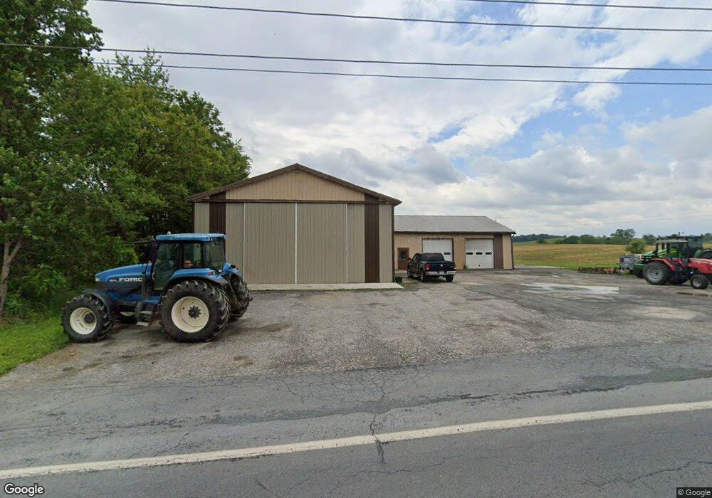
6042 Manheim Rd Waynesboro, PA 17268
--
Bed
--
Bath
--
Sq Ft
1.91
Acres
About This Home
This home is located at 6042 Manheim Rd, Waynesboro, PA 17268. 6042 Manheim Rd is a home located in Franklin County with nearby schools including Waynesboro Area Senior High School and Providence School - Pigeon Hill Building.
Ownership History
Date
Name
Owned For
Owner Type
Purchase Details
Closed on
Oct 25, 2019
Sold by
Branch Banking And Trust
Bought by
Martin David J and Martin Dannette L
Purchase Details
Closed on
Mar 19, 2019
Sold by
Benedict Kevin L and Benedict Darlene P
Bought by
Branch Banking And Trusts and Susquehanna Bank
Purchase Details
Closed on
Dec 5, 2007
Sold by
Benedict Philip L and Benedict Wilma J
Bought by
Benedict Kevin L and Benedict Darlene P
Home Financials for this Owner
Home Financials are based on the most recent Mortgage that was taken out on this home.
Original Mortgage
$195,000
Interest Rate
6.37%
Mortgage Type
Commercial
Create a Home Valuation Report for This Property
The Home Valuation Report is an in-depth analysis detailing your home's value as well as a comparison with similar homes in the area
Home Values in the Area
Average Home Value in this Area
Purchase History
| Date | Buyer | Sale Price | Title Company |
|---|---|---|---|
| Martin David J | $200,000 | Community Settlement | |
| Branch Banking And Trusts | $736 | None Available | |
| Benedict Kevin L | -- | None Available |
Source: Public Records
Mortgage History
| Date | Status | Borrower | Loan Amount |
|---|---|---|---|
| Previous Owner | Benedict Kevin L | $195,000 |
Source: Public Records
Tax History Compared to Growth
Tax History
| Year | Tax Paid | Tax Assessment Tax Assessment Total Assessment is a certain percentage of the fair market value that is determined by local assessors to be the total taxable value of land and additions on the property. | Land | Improvement |
|---|---|---|---|---|
| 2025 | $5,253 | $36,000 | $3,370 | $32,630 |
| 2024 | $5,091 | $36,000 | $3,370 | $32,630 |
| 2023 | $6,037 | $43,900 | $3,370 | $40,530 |
| 2022 | $5,861 | $43,900 | $3,370 | $40,530 |
| 2021 | $5,572 | $43,020 | $3,370 | $39,650 |
| 2020 | $5,572 | $43,020 | $3,370 | $39,650 |
| 2019 | $3,895 | $30,790 | $3,370 | $27,420 |
| 2018 | $3,765 | $30,790 | $3,370 | $27,420 |
| 2017 | $3,680 | $30,790 | $3,370 | $27,420 |
| 2016 | $874 | $30,500 | $3,370 | $27,130 |
| 2015 | $814 | $30,500 | $3,370 | $27,130 |
| 2014 | $814 | $30,500 | $3,370 | $27,130 |
Source: Public Records
Map
Nearby Homes
- 7468 Anthony Hwy
- 5434 Manheim Rd
- 6159 Orphanage Rd
- 286 Verdier St
- 8620 Monns Gap Rd
- 207 University Dr
- 6 S Main St
- 111 Poplar St
- 8652 Mormon Church Rd
- 6456 Wayne Hwy
- 8655 Wayne Hwy
- 7205 Fairway Dr S
- 6158 Merion Dr
- 7130 St Annes Dr
- 6337 Medina Ridge Dr
- 7136 Sandwich Ln
- 7059 Duck Hook Ln
- 7060 Duck Hook Ln
- 7121 Sandwich Ln
- 3891 Alfalfa Ln
- 7330 Anthony Hwy
- 6440 Slabtown Rd
- 6000 Manheim Rd
- 7204 Anthony Hwy
- 7202 Anthony Hwy
- 6472 Slabtown Rd
- 5933 Mount Zion Rd
- 7338 Anthony Hwy
- 7184 Anthony Hwy
- 7170 Anthony Hwy
- 0 Anthony Hwy Unit FL9840816
- 0 Anthony Hwy Unit 1004910798
- 7508 Anthony Hwy
- 7244 Anthony Hwy
- 6501 Slabtown Rd
- 6080 Mount Zion Rd
- 7522 Anthony Hwy
- 7432 Anthony Hwy
- 6200 Mount Zion Rd
- 5915 Manheim Rd