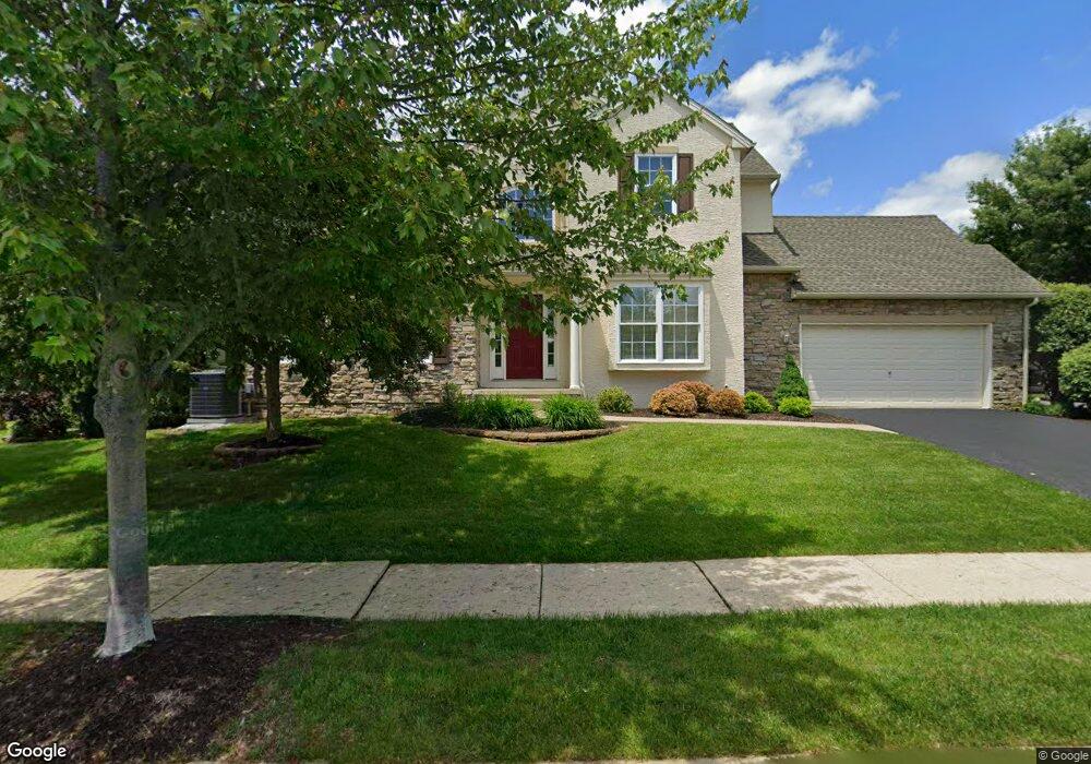
6044 Eli Cir Macungie, PA 18062
Lower Macungie Township East NeighborhoodEstimated Value: $446,000 - $485,000
3
Beds
3
Baths
2,184
Sq Ft
$211/Sq Ft
Est. Value
About This Home
This home is located at 6044 Eli Cir, Macungie, PA 18062 and is currently estimated at $460,177, approximately $210 per square foot. 6044 Eli Cir is a home located in Lehigh County with nearby schools including Willow Lane Elementary School, Eyer Middle School, and Emmaus High School.
Ownership History
Date
Name
Owned For
Owner Type
Purchase Details
Closed on
Aug 23, 2007
Sold by
Krissinger Michele C
Bought by
Rostow Steven
Current Estimated Value
Home Financials for this Owner
Home Financials are based on the most recent Mortgage that was taken out on this home.
Original Mortgage
$85,000
Outstanding Balance
$54,037
Interest Rate
6.74%
Mortgage Type
New Conventional
Estimated Equity
$406,140
Purchase Details
Closed on
Jun 16, 2005
Sold by
Penns Chase Inc
Bought by
Krissinger Michele C
Home Financials for this Owner
Home Financials are based on the most recent Mortgage that was taken out on this home.
Original Mortgage
$182,750
Interest Rate
5.25%
Mortgage Type
Fannie Mae Freddie Mac
Create a Home Valuation Report for This Property
The Home Valuation Report is an in-depth analysis detailing your home's value as well as a comparison with similar homes in the area
Home Values in the Area
Average Home Value in this Area
Purchase History
| Date | Buyer | Sale Price | Title Company |
|---|---|---|---|
| Rostow Steven | $335,000 | -- | |
| Krissinger Michele C | $302,764 | -- |
Source: Public Records
Mortgage History
| Date | Status | Borrower | Loan Amount |
|---|---|---|---|
| Open | Rostow Steven | $85,000 | |
| Previous Owner | Krissinger Michele C | $182,750 |
Source: Public Records
Tax History Compared to Growth
Tax History
| Year | Tax Paid | Tax Assessment Tax Assessment Total Assessment is a certain percentage of the fair market value that is determined by local assessors to be the total taxable value of land and additions on the property. | Land | Improvement |
|---|---|---|---|---|
| 2025 | $5,734 | $224,600 | $8,500 | $216,100 |
| 2024 | $5,548 | $224,600 | $8,500 | $216,100 |
| 2023 | $5,437 | $224,600 | $8,500 | $216,100 |
| 2022 | $5,308 | $224,600 | $216,100 | $8,500 |
| 2021 | $5,195 | $224,600 | $8,500 | $216,100 |
| 2020 | $5,146 | $224,600 | $8,500 | $216,100 |
| 2019 | $5,058 | $224,600 | $8,500 | $216,100 |
| 2018 | $4,992 | $224,600 | $8,500 | $216,100 |
| 2017 | $4,905 | $224,600 | $8,500 | $216,100 |
| 2016 | -- | $224,600 | $8,500 | $216,100 |
| 2015 | -- | $224,600 | $8,500 | $216,100 |
| 2014 | -- | $224,600 | $8,500 | $216,100 |
Source: Public Records
Map
Nearby Homes
- 6022 Eli Cir
- 2611 Fieldview Dr
- 5804 Burning Tree Ln
- 2362 S Pewter Dr
- 2593 Old Wagon Ct
- 2771 Rolling Green Place Unit C419
- 5706 Whitemarsh Dr
- 5691 Merion Ln
- 2834 Springhaven Place
- 2756 Springhaven Place
- 2796 Springhaven Place
- 5289 Princeton Rd
- 5640 Merion Ln
- 2878 Whitemarsh Place
- 2154 Gorton Rd
- 2969 Aronimink Place
- Rushford B Plan at The Fields at Brookside
- Torrey D - Modern Farmhouse Plan at The Fields at Brookside
- Mayfair II - BR Plan at The Fields at Brookside
- Stratton C Plan at The Fields at Brookside