Estimated Value: $199,507 - $218,000
3
Beds
2
Baths
1,524
Sq Ft
$138/Sq Ft
Est. Value
About This Home
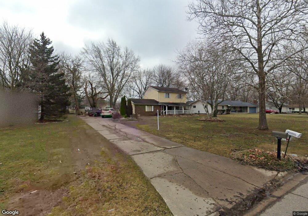
This home is located at 6045 Lancaster Dr, Flint, MI 48532 and is currently estimated at $210,627, approximately $138 per square foot. 6045 Lancaster Dr is a home located in Genesee County with nearby schools including Carman-Ainsworth High School, Genesee STEM Academy, and First Flint Seventh-day Adventist Christian School.
Ownership History
Date
Name
Owned For
Owner Type
Purchase Details
Closed on
Apr 30, 2025
Sold by
Valentine Sherwin M and Valentine Sherwin
Bought by
Valentine Sherwin M and Valentine Pamela E
Current Estimated Value
Purchase Details
Closed on
Jan 2, 2018
Sold by
Brown Lorne and Cole Brown Carolyn
Bought by
Valentine Sherwin
Home Financials for this Owner
Home Financials are based on the most recent Mortgage that was taken out on this home.
Original Mortgage
$80,000
Interest Rate
3.94%
Mortgage Type
New Conventional
Purchase Details
Closed on
Jan 2, 2015
Sold by
Brown Lorne and Cole Brown Carolyn
Bought by
Valentine Sherwin
Purchase Details
Closed on
Mar 12, 2012
Sold by
Fletcher Lee A and Fletcher Lorna J
Bought by
Brown Lorne and Cole Brown Carolyn
Create a Home Valuation Report for This Property
The Home Valuation Report is an in-depth analysis detailing your home's value as well as a comparison with similar homes in the area
Home Values in the Area
Average Home Value in this Area
Purchase History
| Date | Buyer | Sale Price | Title Company |
|---|---|---|---|
| Valentine Sherwin M | -- | None Listed On Document | |
| Valentine Sherwin | $36,000 | None Available | |
| Valentine Sherwin | -- | Liberty Title | |
| Brown Lorne | -- | None Available |
Source: Public Records
Mortgage History
| Date | Status | Borrower | Loan Amount |
|---|---|---|---|
| Previous Owner | Valentine Sherwin | $80,000 |
Source: Public Records
Tax History Compared to Growth
Tax History
| Year | Tax Paid | Tax Assessment Tax Assessment Total Assessment is a certain percentage of the fair market value that is determined by local assessors to be the total taxable value of land and additions on the property. | Land | Improvement |
|---|---|---|---|---|
| 2025 | $1,981 | $83,600 | $0 | $0 |
| 2024 | $1,024 | $82,200 | $0 | $0 |
| 2023 | $977 | $69,600 | $0 | $0 |
| 2022 | $873 | $63,600 | $0 | $0 |
| 2021 | $1,771 | $57,800 | $0 | $0 |
| 2020 | $878 | $48,800 | $0 | $0 |
| 2019 | $865 | $42,800 | $0 | $0 |
| 2018 | $1,618 | $38,400 | $0 | $0 |
| 2017 | $1,578 | $38,400 | $0 | $0 |
| 2016 | $1,619 | $36,800 | $0 | $0 |
| 2015 | $1,335 | $34,500 | $0 | $0 |
| 2014 | $1,390 | $33,200 | $0 | $0 |
| 2012 | -- | $39,300 | $39,300 | $0 |
Source: Public Records
Map
Nearby Homes
- 6090 Lancaster Dr
- 1442 Mintola Ave
- 6172 W Court St
- 1417 Grassmere Ave
- 6098 Corunna Rd
- 6007 Corunna Rd
- 000 Corunna Rd
- oo Walnut Creek Dr
- 1192 Citation Dr
- 1184 Citation Dr
- 00 Graham St
- 00 Corunna Rd
- 5406 Litchfield Dr
- 5345 Birchtree Ct
- 0 Country Ridge Trail
- 0000 Reuben Reuben St
- 5503 Westchester Dr
- 1460 S Dye Rd
- Integrity 1880 Plan at Country Ridge of Flint
- 6142 Noel Dr
- 6035 Lancaster Dr
- 6055 Lancaster Dr
- 6044 W Court St
- 6065 Lancaster Dr
- 6034 W Court St Unit Bldg-Unit
- 6034 W Court St
- 6054 W Court St
- 6040 Lancaster Dr
- 6050 Lancaster Dr
- 6024 W Court St
- 6064 W Court St
- 6075 Lancaster Dr
- 6060 Lancaster Dr
- 6028 Lancaster Dr
- 6021 Lancaster Dr
- 6074 W Court St
- 6070 Lancaster Dr
- 6012 W Court St
- 6017 Lancaster Dr
- 6080 Lancaster Dr