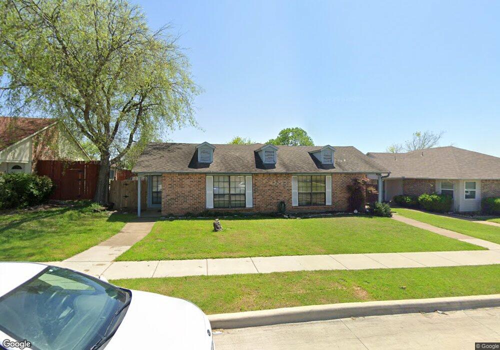
6045 Mcafee Dr the Colony, TX 75056
Estimated Value: $212,081 - $271,000
2
Beds
1
Bath
998
Sq Ft
$241/Sq Ft
Est. Value
About This Home
This home is located at 6045 Mcafee Dr, the Colony, TX 75056 and is currently estimated at $240,770, approximately $241 per square foot. 6045 Mcafee Dr is a home located in Denton County with nearby schools including B B Owen Elementary School, Griffin Middle School, and The Colony High School.
Ownership History
Date
Name
Owned For
Owner Type
Purchase Details
Closed on
Oct 9, 2015
Sold by
Virani Nadir and Virani Shanila
Bought by
Nnms Ventures Series B Llc
Current Estimated Value
Purchase Details
Closed on
May 23, 2013
Sold by
Williams Naomi Denise and Williams Frederick C
Bought by
Virani Nadir and Virani Shanila
Home Financials for this Owner
Home Financials are based on the most recent Mortgage that was taken out on this home.
Original Mortgage
$97,400
Interest Rate
3.43%
Mortgage Type
New Conventional
Create a Home Valuation Report for This Property
The Home Valuation Report is an in-depth analysis detailing your home's value as well as a comparison with similar homes in the area
Home Values in the Area
Average Home Value in this Area
Purchase History
| Date | Buyer | Sale Price | Title Company |
|---|---|---|---|
| Nnms Ventures Series B Llc | -- | None Available | |
| Virani Nadir | -- | None Available |
Source: Public Records
Mortgage History
| Date | Status | Borrower | Loan Amount |
|---|---|---|---|
| Previous Owner | Virani Nadir | $97,400 |
Source: Public Records
Tax History Compared to Growth
Tax History
| Year | Tax Paid | Tax Assessment Tax Assessment Total Assessment is a certain percentage of the fair market value that is determined by local assessors to be the total taxable value of land and additions on the property. | Land | Improvement |
|---|---|---|---|---|
| 2025 | $3,222 | $166,000 | $47,373 | $118,627 |
| 2024 | $3,222 | $166,000 | $47,373 | $118,627 |
| 2023 | $3,331 | $170,000 | $40,605 | $129,395 |
| 2022 | $2,729 | $130,000 | $40,605 | $89,395 |
| 2021 | $2,771 | $124,432 | $30,318 | $94,114 |
| 2020 | $2,445 | $110,000 | $26,935 | $83,065 |
| 2019 | $2,525 | $110,000 | $26,935 | $83,065 |
| 2018 | $2,079 | $90,000 | $26,935 | $63,065 |
| 2017 | $1,752 | $75,000 | $26,935 | $48,065 |
| 2016 | $1,733 | $70,000 | $12,885 | $57,115 |
| 2015 | $1,530 | $68,000 | $12,885 | $55,115 |
| 2013 | -- | $57,027 | $12,885 | $44,142 |
Source: Public Records
Map
Nearby Homes
- 6076 Dooley Dr
- 6082 Dooley Dr
- 5687 Southern Hills Dr
- 3581 Senate Ln
- 3459 United Ln
- 3325 Nutmeg Cir
- 3336 Columbus Dr
- 3487 Pilgrim Dr
- 4592 Biltmoore Dr
- 3908 Banner Dr
- 3399 Columbus Dr
- 4613 Shadow Ridge Dr
- 4489 Mira Vista Dr
- 4198 Peace Dr
- 4601 Firestone Dr
- 3882 W Crescent Way
- 3925 Victory Dr
- 3856 Truman Dr
- 6 Savannah Ridge Dr
- 4765 Mariner Dr