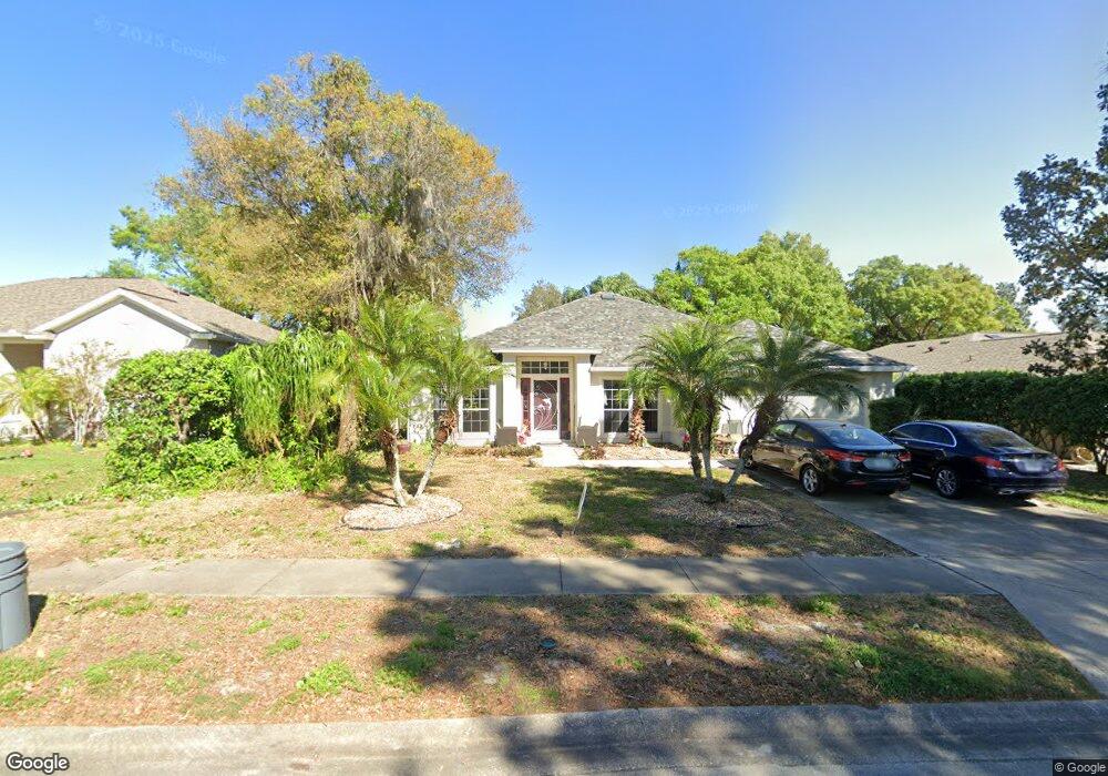
6046 Spruce Point Cir Port Orange, FL 32128
Port Orange West NeighborhoodEstimated Value: $382,411 - $483,000
3
Beds
2
Baths
1,881
Sq Ft
$227/Sq Ft
Est. Value
About This Home
This home is located at 6046 Spruce Point Cir, Port Orange, FL 32128 and is currently estimated at $426,353, approximately $226 per square foot. 6046 Spruce Point Cir is a home located in Volusia County with nearby schools including Sweetwater Elementary School, Creekside Middle School, and Spruce Creek High School.
Ownership History
Date
Name
Owned For
Owner Type
Purchase Details
Closed on
Aug 18, 2011
Sold by
Vansplunder William H and Van Splunder Charlotte S
Bought by
Lunn Laura
Current Estimated Value
Home Financials for this Owner
Home Financials are based on the most recent Mortgage that was taken out on this home.
Original Mortgage
$35,000
Interest Rate
8%
Mortgage Type
Balloon
Purchase Details
Closed on
Sep 29, 2003
Sold by
Inc-Jacksonville D R Horton
Bought by
Vansplunder William H and Vansplunder Charlotte S
Home Financials for this Owner
Home Financials are based on the most recent Mortgage that was taken out on this home.
Original Mortgage
$80,000
Interest Rate
6.28%
Mortgage Type
Purchase Money Mortgage
Create a Home Valuation Report for This Property
The Home Valuation Report is an in-depth analysis detailing your home's value as well as a comparison with similar homes in the area
Home Values in the Area
Average Home Value in this Area
Purchase History
| Date | Buyer | Sale Price | Title Company |
|---|---|---|---|
| Lunn Laura | $165,000 | Columbia Title Research Corp | |
| Vansplunder William H | $180,100 | -- |
Source: Public Records
Mortgage History
| Date | Status | Borrower | Loan Amount |
|---|---|---|---|
| Closed | Lunn Laura | $35,000 | |
| Previous Owner | Vansplunder William H | $80,000 |
Source: Public Records
Tax History Compared to Growth
Tax History
| Year | Tax Paid | Tax Assessment Tax Assessment Total Assessment is a certain percentage of the fair market value that is determined by local assessors to be the total taxable value of land and additions on the property. | Land | Improvement |
|---|---|---|---|---|
| 2025 | $2,469 | $186,396 | -- | -- |
| 2024 | $2,469 | $181,143 | -- | -- |
| 2023 | $2,469 | $175,867 | $0 | $0 |
| 2022 | $2,378 | $170,745 | $0 | $0 |
| 2021 | $2,425 | $165,772 | $0 | $0 |
| 2020 | $2,361 | $163,483 | $0 | $0 |
| 2019 | $2,280 | $159,807 | $0 | $0 |
| 2018 | $2,277 | $156,827 | $0 | $0 |
| 2017 | $2,282 | $153,601 | $0 | $0 |
| 2016 | $2,285 | $150,442 | $0 | $0 |
| 2015 | $2,353 | $149,396 | $0 | $0 |
| 2014 | $2,360 | $148,210 | $0 | $0 |
Source: Public Records
Map
Nearby Homes
- 1781 Taylor Rd
- 6037 Whispering Trees Ln
- 6065 Spruce Point Cir
- 141 Crooked Pine Rd
- 128 Crooked Pine Rd
- 125 Crooked Pine Rd
- 120 Crooked Pine Rd
- 102 Underbrush Trail
- 2610 Spruce Creek Blvd
- 112 Underbrush Trail
- 109 Crooked Pine Rd
- 89 Crooked Pine Rd
- 6012 Sawgrass Point Dr
- 79 Cypress Pond Rd
- 71 Crooked Pine Rd
- 6103 Oxbow Bend Ln
- 62 Cypress Pond Rd
- 2540 Taxiway Echo
- 130 Cypress Pond Rd
- 1340 Osprey Nest Ln
- 6044 Spruce Point Cir
- 6048 Spruce Point Cir
- 1322 Shadow Path Dr
- 1320 Shadow Path Dr
- 6042 Spruce Point Cir
- 6050 Spruce Point Cir
- 6045 Spruce Point Cir
- 6047 Spruce Point Cir
- 1324 Shadow Path Dr
- 6043 Spruce Point Cir
- 1318 Shadow Path Dr
- 6040 Spruce Point Cir
- 6041 Spruce Point Cir
- 6054 Spruce Point Cir
- 6051 Spruce Point Cir
- 1321 Shadow Path Dr
- 1331 Shadow Path Dr
- 1319 Shadow Path Dr
- 6058 Spruce Point Cir
- 1314 Shadow Path Dr