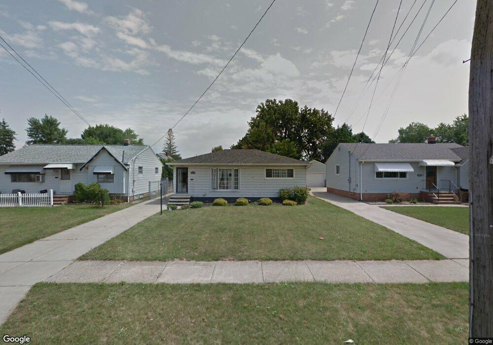
6047 Smith Rd Brookpark, OH 44142
Estimated Value: $173,846 - $216,000
3
Beds
1
Bath
988
Sq Ft
$198/Sq Ft
Est. Value
About This Home
This home is located at 6047 Smith Rd, Brookpark, OH 44142 and is currently estimated at $195,462, approximately $197 per square foot. 6047 Smith Rd is a home located in Cuyahoga County with nearby schools including Berea-Midpark Middle School, Berea-Midpark High School, and Huber Heights Preparatory Academy Parma Academy.
Ownership History
Date
Name
Owned For
Owner Type
Purchase Details
Closed on
Jun 17, 2008
Sold by
The Secretary Of Veterans Affairs
Bought by
Kutsick Michael and Ciero Anthony
Current Estimated Value
Home Financials for this Owner
Home Financials are based on the most recent Mortgage that was taken out on this home.
Original Mortgage
$58,500
Interest Rate
5.73%
Mortgage Type
VA
Purchase Details
Closed on
Jan 22, 2007
Sold by
Hall Thomas G and Hall Michelle K
Bought by
Va
Purchase Details
Closed on
Mar 2, 2000
Sold by
Eichenmiller Michele
Bought by
Hall Thomas G
Home Financials for this Owner
Home Financials are based on the most recent Mortgage that was taken out on this home.
Original Mortgage
$105,978
Interest Rate
8.26%
Mortgage Type
VA
Purchase Details
Closed on
Feb 17, 1984
Sold by
Computaro Sistantonio and Computaro Susie
Bought by
Camputaro Sistantonio
Purchase Details
Closed on
Jan 1, 1975
Bought by
Computaro Sistantonio and Computaro Susie
Create a Home Valuation Report for This Property
The Home Valuation Report is an in-depth analysis detailing your home's value as well as a comparison with similar homes in the area
Home Values in the Area
Average Home Value in this Area
Purchase History
| Date | Buyer | Sale Price | Title Company |
|---|---|---|---|
| Kutsick Michael | -- | Newman Title | |
| Va | $76,667 | Attorney | |
| Hall Thomas G | $103,900 | City Title Company Agency In | |
| Camputaro Sistantonio | -- | -- | |
| Computaro Sistantonio | -- | -- |
Source: Public Records
Mortgage History
| Date | Status | Borrower | Loan Amount |
|---|---|---|---|
| Previous Owner | Kutsick Michael | $58,500 | |
| Previous Owner | Hall Thomas G | $105,978 |
Source: Public Records
Tax History
| Year | Tax Paid | Tax Assessment Tax Assessment Total Assessment is a certain percentage of the fair market value that is determined by local assessors to be the total taxable value of land and additions on the property. | Land | Improvement |
|---|---|---|---|---|
| 2024 | $2,828 | $54,845 | $11,130 | $43,715 |
| 2023 | $2,663 | $42,770 | $9,030 | $33,740 |
| 2022 | $2,645 | $42,770 | $9,030 | $33,740 |
| 2021 | $2,631 | $42,770 | $9,030 | $33,740 |
| 2020 | $2,374 | $33,950 | $7,180 | $26,780 |
| 2019 | $2,304 | $97,000 | $20,500 | $76,500 |
| 2018 | $2,208 | $33,950 | $7,180 | $26,780 |
| 2017 | $2,293 | $31,330 | $6,760 | $24,570 |
| 2016 | $2,274 | $31,330 | $6,760 | $24,570 |
| 2015 | $2,138 | $31,330 | $6,760 | $24,570 |
| 2014 | $2,138 | $31,330 | $6,760 | $24,570 |
Source: Public Records
Map
Nearby Homes
- 15532 Rademaker Dr
- 6095 Stark Dr
- 15424 Holland Rd
- 16117 Hocking Blvd
- 6103 Westbrook Dr
- 16159 Bowfin Blvd
- 6014 Westbrook Dr
- 15497 Hummel Rd
- 5727 Gateway Ln Unit 1203
- 6330 Ledgebrook Dr
- 6386 Sandfield Dr
- 6377 Ledgebrook Dr
- 14396 Park Dr
- 14024 Donald Dr
- 15633 Harrison Dr
- 5889 Westbrook Dr
- 13874 Heatherwood Dr
- 16379 Hummel Rd
- 5757 Defiance Ave
- 14398 Sheldon Rd
Your Personal Tour Guide
Ask me questions while you tour the home.