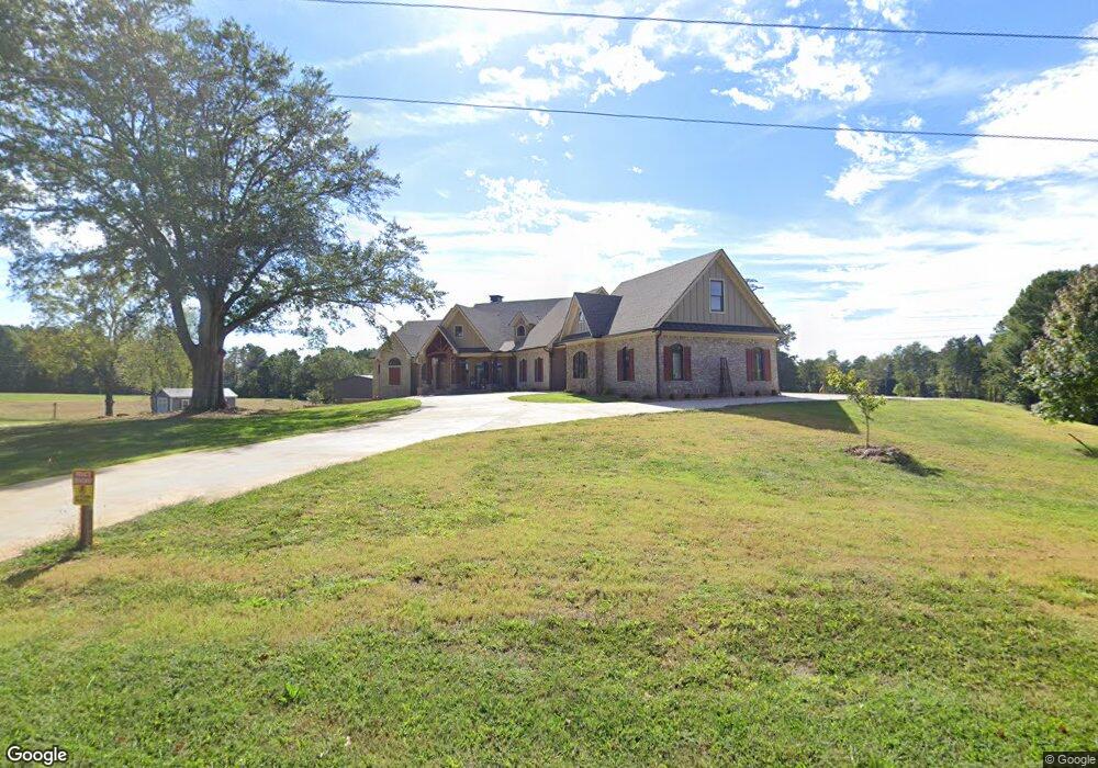
6048 New Bethany Rd Buford, GA 30518
Estimated Value: $978,000 - $1,078,575
3
Beds
4
Baths
4,699
Sq Ft
$219/Sq Ft
Est. Value
About This Home
This home is located at 6048 New Bethany Rd, Buford, GA 30518 and is currently estimated at $1,028,288, approximately $218 per square foot. 6048 New Bethany Rd is a home with nearby schools including Friendship Elementary School, C.W. Davis Middle School, and Flowery Branch High School.
Ownership History
Date
Name
Owned For
Owner Type
Purchase Details
Closed on
Aug 11, 2025
Sold by
Morgan Marianne Pruett
Bought by
Pruett Farms Llc
Current Estimated Value
Purchase Details
Closed on
Nov 28, 2023
Sold by
Marion Elbert Pruett Testamentary Trust
Bought by
Morgan James R and Morgan Marianne Pruett
Purchase Details
Closed on
Jun 20, 2017
Sold by
Pruett Marion Elbert
Bought by
Pruett Robbie B and Pruett Morgan Marianne
Create a Home Valuation Report for This Property
The Home Valuation Report is an in-depth analysis detailing your home's value as well as a comparison with similar homes in the area
Home Values in the Area
Average Home Value in this Area
Purchase History
| Date | Buyer | Sale Price | Title Company |
|---|---|---|---|
| Pruett Farms Llc | $3,276,000 | -- | |
| Morgan James R | -- | -- | |
| Pruett Morgan Marianne | -- | -- | |
| Pruett Robbie B | $515,453 | -- |
Source: Public Records
Tax History Compared to Growth
Tax History
| Year | Tax Paid | Tax Assessment Tax Assessment Total Assessment is a certain percentage of the fair market value that is determined by local assessors to be the total taxable value of land and additions on the property. | Land | Improvement |
|---|---|---|---|---|
| 2024 | $633 | $332,960 | $332,960 | $0 |
| 2023 | $4,114 | $690,240 | $226,880 | $463,360 |
| 2022 | $223 | $229,512 | $226,880 | $2,632 |
| 2021 | $647 | $199,512 | $197,280 | $2,232 |
| 2020 | $853 | $206,733 | $197,280 | $9,453 |
| 2019 | $854 | $206,733 | $197,280 | $9,453 |
| 2018 | $875 | $206,733 | $197,280 | $9,453 |
| 2017 | $859 | $206,181 | $197,280 | $8,901 |
| 2016 | $835 | $21,421 | $12,520 | $8,901 |
| 2015 | $831 | $21,421 | $12,520 | $8,901 |
| 2014 | $831 | $21,421 | $12,520 | $8,901 |
Source: Public Records
Map
Nearby Homes
- 6225 Bridgewood Dr
- 6119 Bethany View Trail
- 6205 Bridgewood Dr
- 2999 S Waterworks Rd
- 2759 S Waterworks Rd
- 0 Peachtree Industrial Blvd Unit 7679534
- 5989 Lanier Islands Pkwy
- 5832 Bay View Dr
- 3180 Lee Dr
- 2610 Buford Dam Rd
- 5862 Bay View Dr
- 5697 Frontier Walk Ln
- 5885 Bay View Dr
- 6132 Hutchins Dr
- 6120 Hutchins Dr
- 403 Thunder Rd
- 450 Thunder Rd
- 6155 New Bethany Rd
- 6165 New Bethany Rd
- 5978 New Bethany Rd
- 5946 New Bethany Rd
- 6172 New Bethany Rd
- 2972 Beards Rd
- 6178 New Bethany Rd
- 0 Beards Rd Unit 8387313
- 0 Beards Rd Unit 8328048
- 0 Beards Rd Unit 8586294
- 0 Beards Rd Unit 8195599
- 0 Beards Rd Unit 7571908
- 0 Beards Rd Unit 7549417
- 0 Beards Rd Unit 8931333
- 2967 Beards Rd
- 6184 New Bethany Rd
- 2796 Buford Dam Rd
- 6134 Bethany View Trail
- 6226 Bridgewood Dr
- 6222 Bridgewood Dr