Estimated Value: $839,000 - $901,000
4
Beds
3
Baths
2,110
Sq Ft
$408/Sq Ft
Est. Value
About This Home
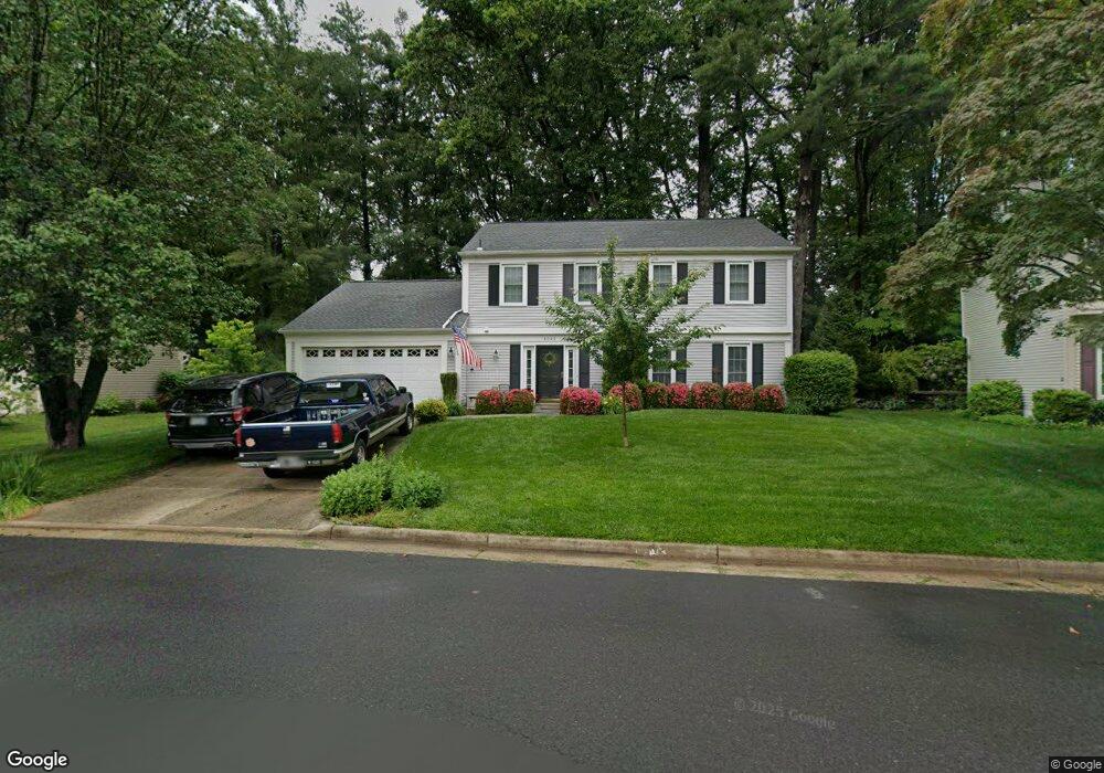
This home is located at 6049 Burnside Landing Dr, Burke, VA 22015 and is currently estimated at $860,846, approximately $407 per square foot. 6049 Burnside Landing Dr is a home located in Fairfax County with nearby schools including Fairview Elementary School, James W Robinson, Jr. Secondary School, and Fairfax Baptist Temple Academy.
Ownership History
Date
Name
Owned For
Owner Type
Purchase Details
Closed on
Jun 20, 2011
Sold by
Heuer Mark A
Bought by
Robinson Steven M
Current Estimated Value
Home Financials for this Owner
Home Financials are based on the most recent Mortgage that was taken out on this home.
Original Mortgage
$495,840
Outstanding Balance
$341,822
Interest Rate
4.63%
Mortgage Type
VA
Estimated Equity
$519,024
Purchase Details
Closed on
May 27, 1994
Sold by
Brophy John C
Bought by
Heuer Mark A
Home Financials for this Owner
Home Financials are based on the most recent Mortgage that was taken out on this home.
Original Mortgage
$203,150
Interest Rate
8.22%
Create a Home Valuation Report for This Property
The Home Valuation Report is an in-depth analysis detailing your home's value as well as a comparison with similar homes in the area
Home Values in the Area
Average Home Value in this Area
Purchase History
| Date | Buyer | Sale Price | Title Company |
|---|---|---|---|
| Robinson Steven M | $480,000 | -- | |
| Heuer Mark A | $214,900 | -- |
Source: Public Records
Mortgage History
| Date | Status | Borrower | Loan Amount |
|---|---|---|---|
| Open | Robinson Steven M | $495,840 | |
| Previous Owner | Heuer Mark A | $203,150 |
Source: Public Records
Tax History Compared to Growth
Tax History
| Year | Tax Paid | Tax Assessment Tax Assessment Total Assessment is a certain percentage of the fair market value that is determined by local assessors to be the total taxable value of land and additions on the property. | Land | Improvement |
|---|---|---|---|---|
| 2025 | $8,258 | $743,820 | $320,000 | $423,820 |
| 2024 | $8,258 | $712,810 | $310,000 | $402,810 |
| 2023 | $8,127 | $720,140 | $310,000 | $410,140 |
| 2022 | $7,683 | $671,890 | $310,000 | $361,890 |
| 2021 | $6,979 | $594,730 | $255,000 | $339,730 |
| 2020 | $6,725 | $568,220 | $250,000 | $318,220 |
| 2019 | $6,420 | $542,460 | $245,000 | $297,460 |
| 2018 | $6,171 | $536,630 | $245,000 | $291,630 |
| 2017 | $5,906 | $508,740 | $220,000 | $288,740 |
| 2016 | $5,908 | $510,000 | $220,000 | $290,000 |
| 2015 | $5,692 | $531,490 | $220,000 | $311,490 |
| 2014 | $5,697 | $511,660 | $215,000 | $296,660 |
Source: Public Records
Map
Nearby Homes
- 6115 Martins Landing Ct
- 10411 Todman Landing Ct
- 6154 Martins Landing Ct
- 10205 Quiet Pond Terrace
- 6105 Heron Pond Ct
- 5932 Cove Landing Rd Unit 101
- 5924 Cove Landing Rd Unit 301
- 6108 Pond Lily Ct
- 5918 Cove Landing Rd Unit 204
- 5837 Cove Landing Rd Unit 101
- 5976 Annaberg Place Unit 168
- 5811 Cove Landing Rd Unit 301
- 10330 Luria Commons Ct Unit 1B
- 12210 Wye Oak Commons Cir
- 5806 Cove Landing Rd Unit 304
- 5806 Cove Landing Rd Unit 101
- 12287 Wye Oak Commons Cir
- 10114 Marshall Pond Rd
- 6220 Winslow Ct
- 5816 Oak Leather Dr
- 6047 Burnside Landing Dr
- 6057 Meyers Landing Ct
- 6056 Meyers Landing Ct
- 6055 Meyers Landing Ct
- 6054 Meyers Landing Ct
- 6053 Meyers Landing Ct
- 6052 Meyers Landing Ct
- 6046 Burnside Landing Dr
- 6045 Burnside Landing Dr
- 6054 Burnside Landing Dr
- 6057 Burnside Landing Dr
- 6051 Meyers Landing Ct
- 6050 Meyers Landing Ct
- 6049 Meyers Landing Ct
- 6130 Poburn Landing Ct
- 6048 Meyers Landing Ct
- 6044 Burnside Landing Dr
- 6056 Burnside Landing Dr
- 6125 Martins Landing Ct
- 6128 Poburn Landing Ct