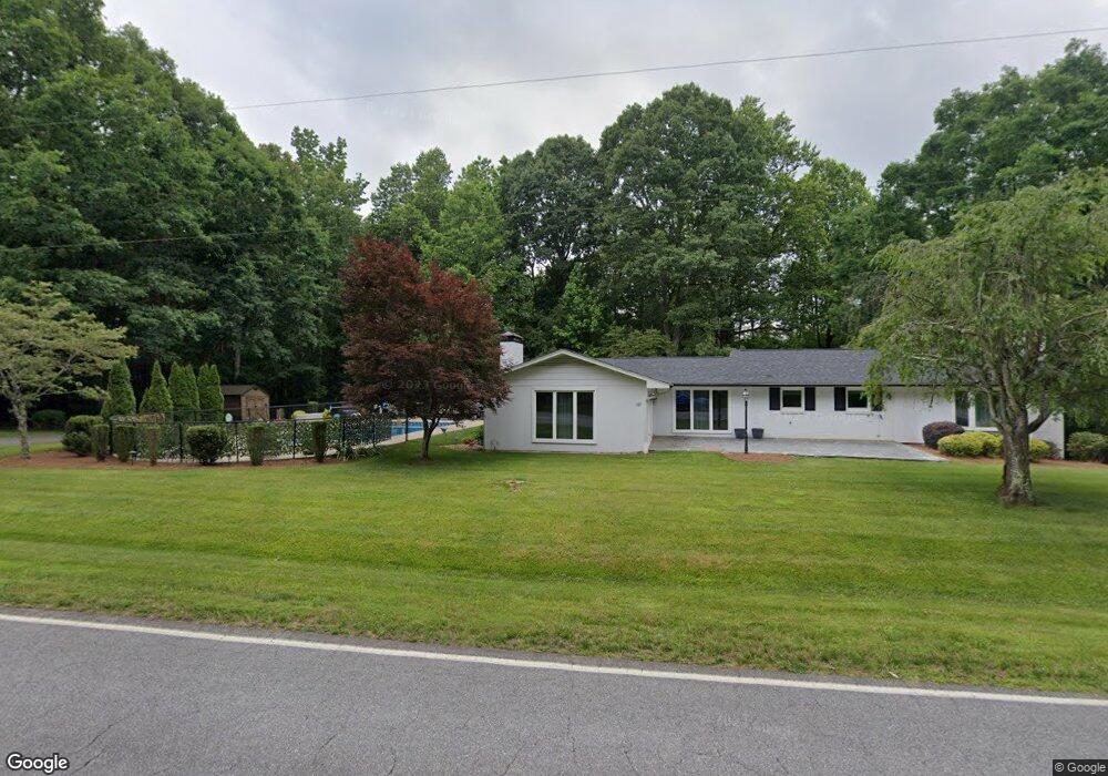
605 Bumgarner Industrial Dr SW Conover, NC 28613
Estimated Value: $254,000 - $273,772
--
Bed
--
Bath
2,580
Sq Ft
$102/Sq Ft
Est. Value
About This Home
This home is located at 605 Bumgarner Industrial Dr SW, Conover, NC 28613 and is currently estimated at $264,193, approximately $102 per square foot. 605 Bumgarner Industrial Dr SW is a home with nearby schools including Shuford Elementary School, Newton-Conover Middle School, and Newton-Conover High School.
Ownership History
Date
Name
Owned For
Owner Type
Purchase Details
Closed on
Nov 4, 2021
Sold by
Perkins Allan W
Bought by
Baumgardner Shawn and Baumgardner Juliette
Current Estimated Value
Home Financials for this Owner
Home Financials are based on the most recent Mortgage that was taken out on this home.
Original Mortgage
$333,841
Outstanding Balance
$305,437
Interest Rate
2.88%
Mortgage Type
FHA
Estimated Equity
-$41,244
Purchase Details
Closed on
Jul 5, 2012
Sold by
Bumgarner Donald E and Bumgarner Nancy S
Bought by
Perkins Allan W
Home Financials for this Owner
Home Financials are based on the most recent Mortgage that was taken out on this home.
Original Mortgage
$137,755
Interest Rate
3.7%
Mortgage Type
New Conventional
Create a Home Valuation Report for This Property
The Home Valuation Report is an in-depth analysis detailing your home's value as well as a comparison with similar homes in the area
Home Values in the Area
Average Home Value in this Area
Purchase History
| Date | Buyer | Sale Price | Title Company |
|---|---|---|---|
| Baumgardner Shawn | $340,000 | Robert A Mullinax Pllc | |
| Perkins Allan W | $135,000 | None Available |
Source: Public Records
Mortgage History
| Date | Status | Borrower | Loan Amount |
|---|---|---|---|
| Open | Baumgardner Shawn | $333,841 | |
| Previous Owner | Perkins Allan W | $137,755 |
Source: Public Records
Tax History Compared to Growth
Tax History
| Year | Tax Paid | Tax Assessment Tax Assessment Total Assessment is a certain percentage of the fair market value that is determined by local assessors to be the total taxable value of land and additions on the property. | Land | Improvement |
|---|---|---|---|---|
| 2025 | $1,546 | $194,800 | $34,800 | $160,000 |
| 2024 | $1,546 | $194,800 | $34,800 | $160,000 |
| 2023 | $1,546 | $153,100 | $34,800 | $118,300 |
| 2022 | $1,646 | $153,100 | $34,800 | $118,300 |
| 2021 | $1,646 | $153,100 | $34,800 | $118,300 |
| 2020 | $1,646 | $153,100 | $34,800 | $118,300 |
| 2019 | $1,646 | $153,100 | $0 | $0 |
| 2018 | $1,494 | $139,000 | $34,800 | $104,200 |
| 2017 | $1,453 | $0 | $0 | $0 |
| 2016 | $1,453 | $0 | $0 | $0 |
| 2015 | $1,437 | $139,000 | $34,800 | $104,200 |
| 2014 | $1,437 | $165,500 | $41,800 | $123,700 |
Source: Public Records
Map
Nearby Homes
- 1221 Fedex Dr SW Unit 2
- 1015 8th Ave SW
- 902 & 904 8th Ave SW
- 605 8th Ave SW Unit B5
- 605 8th Ave SW Unit C-1
- 3362 15th Avenue Blvd SE
- 210 7th Ave SW
- 0000 Section House Rd
- 1351 33rd St SE
- 603 2nd Street Place SW
- Lot 1, 701 2nd Street Place SW
- Lot 2, 701 2nd Street Place SW
- 1275 32nd St SE
- 0 St Pauls Church Rd Unit CAR4299390
- 319 7th Street Place SW Unit B1
- 1510 31st Street Ct SE
- 814 2nd Ave SW
- 2661 N Ashe Ave
- 227 W 27th St
- 2901 N Shipp Ave
- 625 Sunset Dr SW
- 1401 4th St SW
- 1403 4th St SW
- 1405 4th St SW
- 1280 4th St SW
- 1304 4th St SW
- 1305 4th St SW
- 720 Bumgarner Industrial Dr
- 1307 4th St SW
- 549 Sunset Dr SW
- 1224 4th St SW
- 1311 Elk Dr SW
- 1313 Elk Dr SW
- 1315 Elk Dr SW
- 1312 Elk Dr SW
- 1206 4th St SW
- 1316 Elk Dr SW
- 1205 4th St SW
- 521 4th St SW
- 1124 4th St SW