Estimated Value: $561,000 - $698,000
3
Beds
3
Baths
2,706
Sq Ft
$228/Sq Ft
Est. Value
About This Home
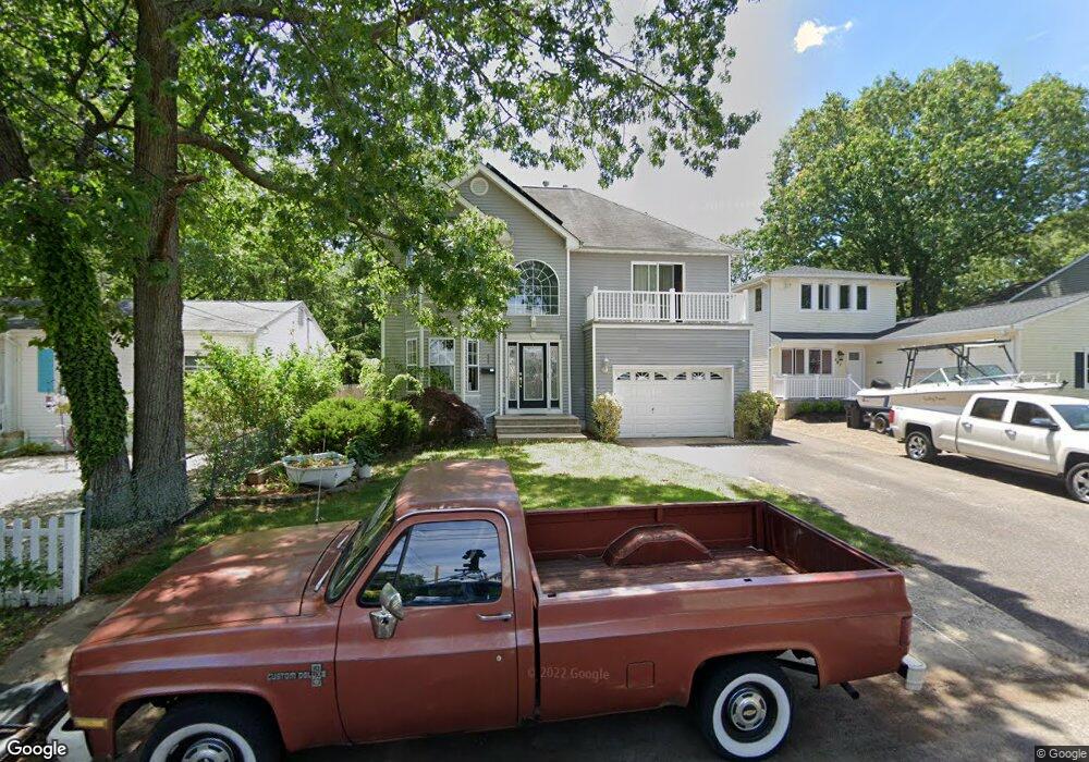
This home is located at 605 Burtis St, Brick, NJ 08723 and is currently estimated at $617,732, approximately $228 per square foot. 605 Burtis St is a home located in Ocean County with nearby schools including Emma Havens Young Elementary School, Lake Riviera Middle School, and Brick Township High School.
Ownership History
Date
Name
Owned For
Owner Type
Purchase Details
Closed on
May 29, 2003
Sold by
Cuccinello Anthony
Bought by
Anderson James H and Murphy Jennifer
Current Estimated Value
Home Financials for this Owner
Home Financials are based on the most recent Mortgage that was taken out on this home.
Original Mortgage
$238,000
Outstanding Balance
$104,180
Interest Rate
5.77%
Estimated Equity
$513,552
Purchase Details
Closed on
Aug 14, 1998
Sold by
Gwaldo Charles and Gwaldo Helen
Bought by
Cuccinello Anthony and Cuccinello Tracy
Create a Home Valuation Report for This Property
The Home Valuation Report is an in-depth analysis detailing your home's value as well as a comparison with similar homes in the area
Home Values in the Area
Average Home Value in this Area
Purchase History
| Date | Buyer | Sale Price | Title Company |
|---|---|---|---|
| Anderson James H | $384,000 | -- | |
| Cuccinello Anthony | $123,000 | -- |
Source: Public Records
Mortgage History
| Date | Status | Borrower | Loan Amount |
|---|---|---|---|
| Open | Anderson James H | $238,000 |
Source: Public Records
Tax History
| Year | Tax Paid | Tax Assessment Tax Assessment Total Assessment is a certain percentage of the fair market value that is determined by local assessors to be the total taxable value of land and additions on the property. | Land | Improvement |
|---|---|---|---|---|
| 2025 | $7,914 | $306,400 | $116,700 | $189,700 |
| 2024 | $7,522 | $306,400 | $116,700 | $189,700 |
| 2023 | $7,424 | $306,400 | $116,700 | $189,700 |
| 2022 | $7,424 | $306,400 | $116,700 | $189,700 |
| 2021 | $7,268 | $306,400 | $116,700 | $189,700 |
| 2020 | $7,176 | $306,400 | $116,700 | $189,700 |
| 2019 | $7,056 | $306,400 | $116,700 | $189,700 |
| 2018 | $6,894 | $306,400 | $116,700 | $189,700 |
| 2017 | $6,707 | $306,400 | $116,700 | $189,700 |
| 2016 | $6,673 | $306,400 | $116,700 | $189,700 |
| 2015 | $6,499 | $306,400 | $116,700 | $189,700 |
| 2014 | $6,447 | $306,400 | $116,700 | $189,700 |
Source: Public Records
Map
Nearby Homes
- 35 Hampton Rd
- 592 Kingfisher Cir
- 580 Kingfisher Cir
- 578 Kingfisher Cir
- 9 Bayberry Ave
- 683 Mantoloking Rd
- 4 Mayfair Ct
- 19 Moholo Ct Unit 19
- 307 Drum Point Rd
- 11 Cedar Rd
- 10 Riverside Dr W
- 299 Huppert Dr
- 23 Island Dr
- 0 Island Ct
- 24 Unity Dr
- 458 E End Ave
- 3 Metedeconk Rd
- 230 Drum Point Rd
- 56 Tall Timber Dr
- 0 Mantoloking Rd Unit 11584872
Your Personal Tour Guide
Ask me questions while you tour the home.