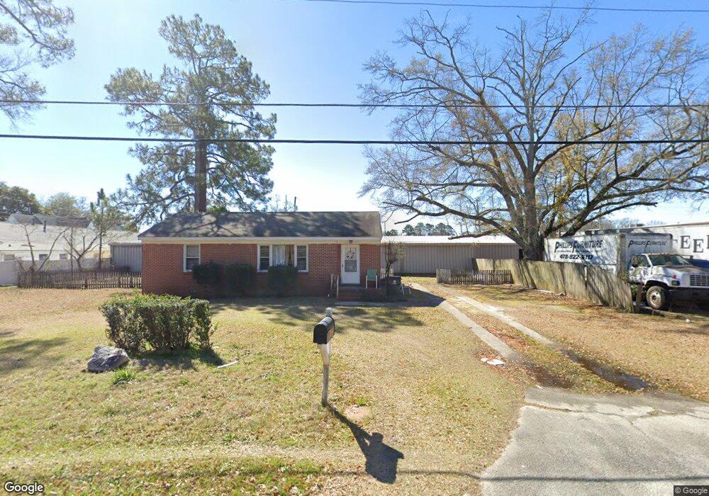
605 Cherokee Dr Warner Robins, GA 31093
Estimated Value: $164,000 - $388,569
Studio
--
Bath
1,024
Sq Ft
$237/Sq Ft
Est. Value
About This Home
This home is located at 605 Cherokee Dr, Warner Robins, GA 31093 and is currently estimated at $243,190, approximately $237 per square foot. 605 Cherokee Dr is a home located in Houston County with nearby schools including Westside Elementary School, Northside Middle School, and Northside High School.
Ownership History
Date
Name
Owned For
Owner Type
Purchase Details
Closed on
Nov 25, 2025
Sold by
Herbert H Phillips Credit Shelter Testam and Phillips Mark K
Bought by
Phillips Bros Of Houston County Llc
Current Estimated Value
Purchase Details
Closed on
Jul 15, 2022
Sold by
Conner Susan P
Bought by
Herbert H Phillips Credit Shelter Testamentar
Purchase Details
Closed on
May 13, 2004
Sold by
Gore Mary Ann Burke
Bought by
Phillips Herbert
Purchase Details
Closed on
Apr 1, 1995
Sold by
Gore Mary A and Burke Mary Lucil
Bought by
Gore Mary Ann Burke
Purchase Details
Closed on
Dec 12, 1990
Sold by
Gore Mary Ann Burke
Bought by
Gore Mary A and Burke Mary Lucille S
Purchase Details
Closed on
Jun 25, 1990
Sold by
Burke Olan A
Bought by
Gore Mary Ann Burke
Purchase Details
Closed on
Sep 12, 1972
Sold by
Wysowski C J
Bought by
Burke Olan A
Purchase Details
Closed on
Jul 31, 1958
Bought by
Wysowski C J
Create a Home Valuation Report for This Property
The Home Valuation Report is an in-depth analysis detailing your home's value as well as a comparison with similar homes in the area
Home Values in the Area
Average Home Value in this Area
Purchase History
| Date | Buyer | Sale Price | Title Company |
|---|---|---|---|
| Phillips Bros Of Houston County Llc | -- | None Listed On Document | |
| Herbert H Phillips Credit Shelter Testamentar | -- | Walker Hulbert Gray & Moore Ll | |
| Phillips Herbert | $300,400 | -- | |
| Gore Mary Ann Burke | -- | -- | |
| Gore Mary A | -- | -- | |
| Gore Mary Ann Burke | -- | -- | |
| Burke Olan A | $25,000 | -- | |
| Wysowski C J | -- | -- |
Source: Public Records
Tax History
| Year | Tax Paid | Tax Assessment Tax Assessment Total Assessment is a certain percentage of the fair market value that is determined by local assessors to be the total taxable value of land and additions on the property. | Land | Improvement |
|---|---|---|---|---|
| 2025 | $5,886 | $202,120 | $34,960 | $167,160 |
| 2024 | $5,740 | $175,400 | $36,000 | $139,400 |
| 2023 | $5,592 | $169,600 | $36,000 | $133,600 |
| 2022 | $2,788 | $121,240 | $36,000 | $85,240 |
| 2021 | $2,728 | $118,000 | $36,000 | $82,000 |
| 2020 | $2,468 | $106,240 | $42,000 | $64,240 |
| 2019 | $2,458 | $105,800 | $36,000 | $69,800 |
| 2018 | $2,458 | $105,800 | $36,000 | $69,800 |
| 2017 | $2,460 | $105,800 | $36,000 | $69,800 |
| 2016 | $2,464 | $105,800 | $36,000 | $69,800 |
| 2015 | -- | $105,800 | $36,000 | $69,800 |
| 2014 | -- | $105,800 | $36,000 | $69,800 |
| 2013 | -- | $105,800 | $36,000 | $69,800 |
Source: Public Records
Map
Nearby Homes
- 110 Springdale Dr
- 118 Briardale Ave
- 112 Briardale Ave
- 110 Briardale Ave
- 203 Springdale Dr
- 133 Briardale Ave
- 119 Woodlawn Ave
- 207 Kingsway Dr
- 213 Briarcliff Rd
- 306 Woodlawn Ave
- 306 Kingsbury Cir
- 402 & 404 Green St
- 118 Meadowcliff Cir
- 94 Ravenwood Way
- 214 Kingsbury Cir
- 103 Spring St
- 113 Pearce Dr
- 216 Randall Dr
- 110 Merlin St
- 104 Sherry Dr
- 606 Cherokee Dr
- 604 Cherokee Dr
- 107 Holly St
- 1738 Watson Blvd
- 602 Cherokee Dr
- 608 Cherokee Dr
- 1740 Watson Blvd
- 105 Holly St
- 105 Holly Dr
- 603 Bernard Dr
- 605 Bernard Dr
- 1744 Watson Blvd
- 109 Holly St
- 610 Cherokee Dr
- 1746 Watson Blvd Unit 174
- 1746 Watson Blvd
- 607 Bernard Dr
- 601 Bernard Dr
- 1748 Watson Blvd
- 1752 Watson Blvd
Your Personal Tour Guide
Ask me questions while you tour the home.