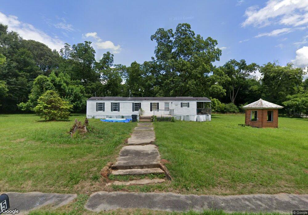
605 Crawfordville Rd Union Point, GA 30669
Estimated Value: $55,412 - $121,000
--
Bed
--
Bath
960
Sq Ft
$87/Sq Ft
Est. Value
About This Home
This home is located at 605 Crawfordville Rd, Union Point, GA 30669 and is currently estimated at $83,137, approximately $86 per square foot. 605 Crawfordville Rd is a home located in Greene County with nearby schools including Greene County High School.
Ownership History
Date
Name
Owned For
Owner Type
Purchase Details
Closed on
Feb 24, 2005
Sold by
Ohalloran Kevin
Bought by
Luna Properties Llc
Current Estimated Value
Purchase Details
Closed on
Feb 23, 2005
Sold by
Stewart Family Investments Lp
Bought by
Luna Properties Llc
Purchase Details
Closed on
Mar 3, 2003
Sold by
Stewart John B
Bought by
Stewart Family Investments Lp
Purchase Details
Closed on
Oct 6, 2000
Sold by
Mercure Keith E
Bought by
Stewart John B
Purchase Details
Closed on
Dec 3, 1996
Sold by
Wheelus J H Mrs
Bought by
Mercure Keith E
Purchase Details
Closed on
Jan 1, 1966
Sold by
Wheelus J H
Bought by
Wheelus J H Mrs
Create a Home Valuation Report for This Property
The Home Valuation Report is an in-depth analysis detailing your home's value as well as a comparison with similar homes in the area
Home Values in the Area
Average Home Value in this Area
Purchase History
| Date | Buyer | Sale Price | Title Company |
|---|---|---|---|
| Luna Properties Llc | $271,000 | -- | |
| Luna Properties Llc | $271,000 | -- | |
| Stewart Family Investments Lp | -- | -- | |
| Stewart John B | $32,000 | -- | |
| Mercure Keith E | $16,000 | -- | |
| Wheelus J H Mrs | -- | -- |
Source: Public Records
Tax History Compared to Growth
Tax History
| Year | Tax Paid | Tax Assessment Tax Assessment Total Assessment is a certain percentage of the fair market value that is determined by local assessors to be the total taxable value of land and additions on the property. | Land | Improvement |
|---|---|---|---|---|
| 2024 | $196 | $7,960 | $7,854 | $106 |
| 2023 | $111 | $5,840 | $5,763 | $77 |
| 2022 | $122 | $5,840 | $5,760 | $80 |
| 2021 | $182 | $10,280 | $10,200 | $80 |
| 2020 | $155 | $6,560 | $6,480 | $80 |
| 2019 | $164 | $6,560 | $6,480 | $80 |
| 2018 | $164 | $6,560 | $6,480 | $80 |
| 2017 | $152 | $6,560 | $6,480 | $80 |
| 2016 | $155 | $6,560 | $6,480 | $80 |
| 2015 | -- | $6,560 | $6,480 | $80 |
| 2014 | -- | $6,560 | $6,480 | $80 |
Source: Public Records
Map
Nearby Homes
- 504 Crawfordville Rd
- 606 Bryan Ave
- 324 N Rhodes St
- 0 Woodland Ct Unit 1027434
- 0 Woodland Ct Unit 10543600
- 202 Veazey St
- 215 Hunter St
- 1010 Orear Rd
- 0 S Rhodes St Unit 10618488
- 0 Washington Hwy Unit 7276060
- 1180 Moody St
- 1041 Hillcrest Dr
- 1241 Old Siloam Rd
- 1860 Washington Hwy
- 0 Buffalo Lick Rd Unit 10551328
- 1201 Buffalo Lick Rd
- 0 Buffalo Lick Rd Unit 10551325
- 0 Buffalo Lick Rd Unit 10551234
- 1251 Adams Rd
- 0 Old Union Point Rd Unit 1 10557753
- 415 Thornton St
- 609 Crawfordville Rd
- 400 Veazey St
- 711 Crawfordville Rd
- 402 Veazey St
- 715 Crawfordville Rd
- 306 Veazey St
- 1271 N Rhodes St
- 507 Crawfordville Rd
- 718 Crawford Rd
- 416 Thornton St
- 404 Veazey St
- 405 Thornton St
- 718 Crawfordville Rd
- 401 Veazey St
- 506 Crawfordville Rd
- 304 Veazey St
- 405 N Rhodes St
- 603 Woodland Ct
- 601 Woodland Ct